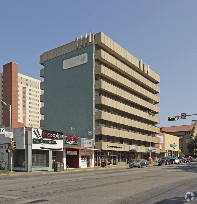
Property Record
2100 Guadalupe St, Austin, TX 78705

NEARBY LISTINGS FOR SALE OR LEASE
Property Detail
2100 Guadalupe St
Austin-Round Rock, TX
Horsts Louis Subd
203722
LOT 33 OLT 22-1/2 DIV D HORSTS LOUIS SUBD
Vacantlandnec
Travis
X
Texas
48453C0465K
33
2024
0.19 AC
2025
The Drag
000608
Austin
5,640 SF
DEMOGRAPHICS near 2100 Guadalupe St
1 Mile
3 Mile
5 Mile
2024 Total Population
37,815
180,775
384,110
2029 Population
40,555
197,547
419,749
Pop Growth 2024-2029
+ 7.25%
+ 9.28%
+ 9.28%
Average Age
26
36
36
2024 Total Households
13,263
86,630
177,094
HH Growth 2024-2029
+ 9.51%
+ 10.49%
+ 10.23%
Median Household Inc
$18,854
$87,148
$78,590
Avg Household Size
2.00
1.90
2.00
2024 Avg HH Vehicles
1.00
1.00
2.00
Median Home Value
$757,987
$802,130
$698,935
Median Year Built
1994
2000
1988
Nearby Places
Map Layers
Map Styles
 Street
 Aerial
- Restaurants
- Banks
- Shops
- Fitness
- Groceries
PUBLIC TRANSPORTATION
COMMUTER RAIL
Downtown Station (Capital MetroRail - Capital Metropolitan Transportation Authority Rail (MetroRail))
DRIVE
WALK
Distance
Downtown Station (Capital MetroRail - Capital Metropolitan Transportation Authority Rail (MetroRail))
5 min
1.8 mi
Plaza Saltillo Station (Capital MetroRail - Capital Metropolitan Transportation Authority Rail (MetroRail))
DRIVE
WALK
Distance
Plaza Saltillo Station (Capital MetroRail - Capital Metropolitan Transportation Authority Rail (MetroRail))
6 min
2.4 mi
AIRPORT
Austin-Bergstrom International
DRIVE
WALK
Distance
Austin-Bergstrom International
26 min
12.5 mi
Freight Ports
Calhoun Port
DRIVE
WALK
Distance
Calhoun Port
212 min
156.0 mi
Nearby Properties
Address
Land Use
TOTAL SIZE
Lot Size
Zoning
Address
Land Use
TOTAL SIZE
Lot Size
Zoning
1,008,789 SF
17.50 AC
Address
Land Use
TOTAL SIZE
Lot Size
Zoning
20,550 SF
14.15 AC
Address
Land Use
TOTAL SIZE
Lot Size
Zoning
262 SF
65.06 AC
Address
Land Use
TOTAL SIZE
Lot Size
Zoning
29,594 SF
155.62 AC
Address
Land Use
TOTAL SIZE
Lot Size
Zoning
28.39 AC
Address
Land Use
TOTAL SIZE
Lot Size
Zoning
Address
Land Use
TOTAL SIZE
Lot Size
Zoning
28.62 AC
Address
Land Use
TOTAL SIZE
Lot Size
Zoning
1,156,135 SF
1.74 AC
Address
Land Use
TOTAL SIZE
Lot Size
Zoning
1,003,475 SF
1.84 AC
Address
Land Use
TOTAL SIZE
Lot Size
Zoning
27.17 AC
Address
Land Use
TOTAL SIZE
Lot Size
Zoning
136,900 SF
19.32 AC
Address
Land Use
TOTAL SIZE
Lot Size
Zoning
786,600 SF
1.27 AC
Address
Land Use
TOTAL SIZE
Lot Size
Zoning
24.50 AC
Address
Land Use
TOTAL SIZE
Lot Size
Zoning
9,034 SF
28.69 AC
Address
Land Use
TOTAL SIZE
Lot Size
Zoning
30.96 AC
Address
Land Use
TOTAL SIZE
Lot Size
Zoning
709,300 SF
0.94 AC
Address
Land Use
TOTAL SIZE
Lot Size
Zoning
498,684 SF
61.86 AC
Address
Land Use
TOTAL SIZE
Lot Size
Zoning
18.52 AC
Address
Land Use
TOTAL SIZE
Lot Size
Zoning
74.69 AC
Address
Land Use
TOTAL SIZE
Lot Size
Zoning
47.20 AC
Address
Land Use
TOTAL SIZE
Lot Size
Zoning
1,400,000 SF
3.07 AC
Address
Land Use
TOTAL SIZE
Lot Size
Zoning
789,220 SF
14.34 AC
Address
Land Use
TOTAL SIZE
Lot Size
Zoning
548,399 SF
23.82 AC
Address
Land Use
TOTAL SIZE
Lot Size
Zoning
35,041 SF
28.65 AC
Address
Land Use
TOTAL SIZE
Lot Size
Zoning
623,000 SF
11.78 AC
Address
Land Use
TOTAL SIZE
Lot Size
Zoning
21 AC
Address
Land Use
TOTAL SIZE
Lot Size
Zoning
614,532 SF
66.07 AC
Address
Land Use
TOTAL SIZE
Lot Size
Zoning
513,567 SF
1.78 AC
Address
Land Use
TOTAL SIZE
Lot Size
Zoning
500,511 SF
0.82 AC
The World's #1 Commercial Real Estate Marketplace
Connect with us
© 2025 CoStar Group
The information above has been obtained from sources believed reliable. While we do not doubt its accuracy we have not verified it and make no guarantee, warranty or representation about it. It is your responsibility to independently confirm its accuracy and completeness. Any projections, opinions, assumptions, or estimates used are for example only and do not represent the current or future performance of the property. The value of this transaction to you depends on tax and other factors which should be evaluated by your tax, financial, and legal advisors. You and your advisors should conduct a careful, independent investigation of the property to determine to your satisfaction the suitability of the property for your needs.