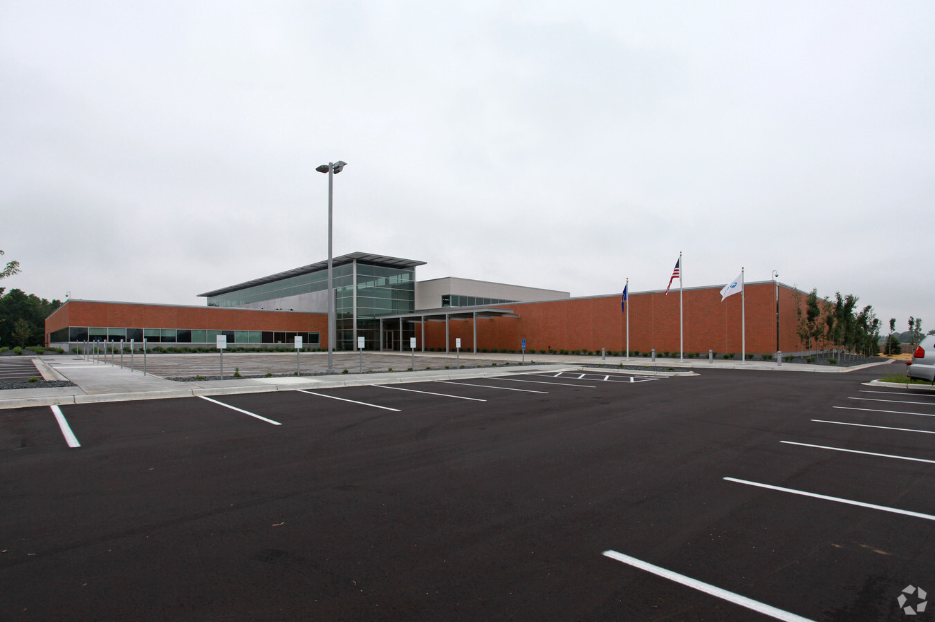
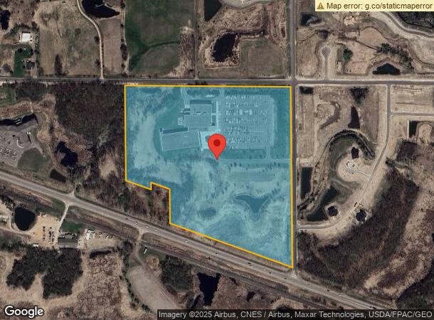
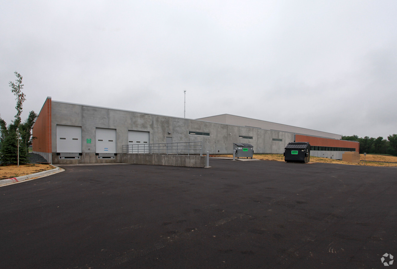
Property Record
2100 Highway 55, Hamel, MN 55340
NEARBY LISTINGS FOR SALE OR LEASE
Property Detail
2100 Highway 55
Minneapolis-St. Paul-Bloomington, MN-WI
Unplatted 03 118 23
03-118-23-31-0001
UNPLATTED 03 118 23 BEG AT THE NW COR OF E 1/2 OF SW 1/4 TH S ALONG THE W LINE THOF TO A PT DIST 208.72 FT N FROM ITS INTERSEC WITH THE NLY LINE OF T IRREGULAR
Industrialgeneral
Hennepin
A
Minnesota
27053C0165F
33.02 AC
2024
Southwest
2023
Minneapolis/St Paul
0271011044
DEMOGRAPHICS near 2100 Highway 55
1 Mile
3 Mile
5 Mile
2024 Total Population
1,030
13,066
64,183
2029 Population
1,002
13,054
63,498
Pop Growth 2024-2029
(2.72%)
(0.09%)
(1.07%)
Average Age
35
37
38
2024 Total Households
299
4,179
21,540
HH Growth 2024-2029
(3.01%)
(0.38%)
(1.26%)
Median Household Inc
$254,854
$189,366
$166,020
Avg Household Size
3.30
3.10
2.90
2024 Avg HH Vehicles
2.00
2.00
2.00
Median Home Value
$754,999
$657,392
$525,345
Median Year Built
2005
2005
1998
Nearby Places
- Restaurants
- Banks
- Shops
- Fitness
- Groceries
PUBLIC TRANSPORTATION
AIRPORT
Minneapolis-St Paul International/Wold-Chamberlain
DRIVE
WALK
Distance
Minneapolis-St Paul International/Wold-Chamberlain
44 min
29.4 mi
Freight Ports
Port Milwaukee
DRIVE
WALK
Distance
Port Milwaukee
404 min
357.1 mi
Nearby Properties
Address
Land Use
TOTAL SIZE
Lot Size
Zoning
Address
Land Use
TOTAL SIZE
Lot Size
Zoning
21.09 AC
Address
Land Use
TOTAL SIZE
Lot Size
Zoning
Address
Land Use
TOTAL SIZE
Lot Size
Zoning
25.53 AC
Address
Land Use
TOTAL SIZE
Lot Size
Zoning
32.70 AC
Address
Land Use
TOTAL SIZE
Lot Size
Zoning
25.11 AC
Address
Land Use
TOTAL SIZE
Lot Size
Zoning
42.53 AC
Address
Land Use
TOTAL SIZE
Lot Size
Zoning
10.70 AC
Address
Land Use
TOTAL SIZE
Lot Size
Zoning
11.52 AC
Address
Land Use
TOTAL SIZE
Lot Size
Zoning
10.79 AC
Address
Land Use
TOTAL SIZE
Lot Size
Zoning
9.82 AC
Address
Land Use
TOTAL SIZE
Lot Size
Zoning
3.85 AC
Address
Land Use
TOTAL SIZE
Lot Size
Zoning
Address
Land Use
TOTAL SIZE
Lot Size
Zoning
16.62 AC
Address
Land Use
TOTAL SIZE
Lot Size
Zoning
2.01 AC
Address
Land Use
TOTAL SIZE
Lot Size
Zoning
3.04 AC
Address
Land Use
TOTAL SIZE
Lot Size
Zoning
1.99 AC
Address
Land Use
TOTAL SIZE
Lot Size
Zoning
3.35 AC
Address
Land Use
TOTAL SIZE
Lot Size
Zoning
5.06 AC
Address
Land Use
TOTAL SIZE
Lot Size
Zoning
1.23 AC
Address
Land Use
TOTAL SIZE
Lot Size
Zoning
4.87 AC
Address
Land Use
TOTAL SIZE
Lot Size
Zoning
1.27 AC
Address
Land Use
TOTAL SIZE
Lot Size
Zoning
15.21 AC
Address
Land Use
TOTAL SIZE
Lot Size
Zoning
10.01 AC
Address
Land Use
TOTAL SIZE
Lot Size
Zoning
2.12 AC
Address
Land Use
TOTAL SIZE
Lot Size
Zoning
1.06 AC
Address
Land Use
TOTAL SIZE
Lot Size
Zoning
8.67 AC
Address
Land Use
TOTAL SIZE
Lot Size
Zoning
2.23 AC
Address
Land Use
TOTAL SIZE
Lot Size
Zoning
17.93 AC
Address
Land Use
TOTAL SIZE
Lot Size
Zoning
1.02 AC
The World's #1 Commercial Real Estate Marketplace
Connect with us
© 2025 CoStar Group
The information above has been obtained from sources believed reliable. While we do not doubt its accuracy we have not verified it and make no guarantee, warranty or representation about it. It is your responsibility to independently confirm its accuracy and completeness. Any projections, opinions, assumptions, or estimates used are for example only and do not represent the current or future performance of the property. The value of this transaction to you depends on tax and other factors which should be evaluated by your tax, financial, and legal advisors. You and your advisors should conduct a careful, independent investigation of the property to determine to your satisfaction the suitability of the property for your needs.