Property Record
2100 Mack Blvd, Allentown, PA 18103


NEARBY LISTINGS FOR SALE OR LEASE
Property Detail
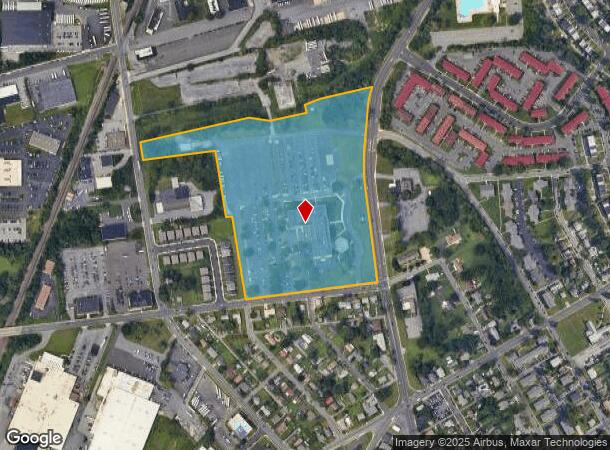
2100 Mack Blvd
Allentown-Bethlehem-Easton, PA-NJ
Alta Acsm Land Title Survey Prepared For
640610029093-1
LOTS: 005
Warehouse
Lehigh
AE
Pennsylvania
42077C0253F
5
2024
22.31 AC
2024
Lehigh Valley
001501
Philadelphia
7,200 SF
DEMOGRAPHICS near 2100 Mack Blvd
1 Mile
3 Mile
5 Mile
2024 Total Population
12,496
125,072
227,994
2029 Population
12,651
126,010
229,705
Pop Growth 2024-2029
+ 1.24%
+ 0.75%
+ 0.75%
Average Age
36
37
39
2024 Total Households
4,698
45,940
85,931
HH Growth 2024-2029
+ 1.21%
+ 0.85%
+ 0.80%
Median Household Inc
$58,791
$50,120
$58,853
Avg Household Size
2.60
2.50
2.50
2024 Avg HH Vehicles
2.00
1.00
2.00
Median Home Value
$161,386
$175,046
$223,078
Median Year Built
1958
1953
1960
Nearby Places
- Restaurants
- Banks
- Shops
- Fitness
- Groceries
PUBLIC TRANSPORTATION
AIRPORT
Lehigh Valley International
DRIVE
WALK
Distance
Lehigh Valley International
16 min
8.3 mi
Freight Ports
Port of Philadelphia
DRIVE
WALK
Distance
Port of Philadelphia
83 min
51.1 mi
Nearby Properties
Address
Land Use
TOTAL SIZE
Lot Size
Zoning
Address
Land Use
TOTAL SIZE
Lot Size
Zoning
504,141 SF
44.47 AC
R2
Address
Land Use
TOTAL SIZE
Lot Size
Zoning
302,304 SF
5.15 AC
B-2
Address
Land Use
TOTAL SIZE
Lot Size
Zoning
187,337 SF
2.11 AC
I-G
Address
Land Use
TOTAL SIZE
Lot Size
Zoning
285,048 SF
4.34 AC
I-G
Address
Land Use
TOTAL SIZE
Lot Size
Zoning
356,283 SF
2 AC
I-G
Address
Land Use
TOTAL SIZE
Lot Size
Zoning
300,783 SF
0.64 AC
B-2
Address
Land Use
TOTAL SIZE
Lot Size
Zoning
229,379 SF
1.16 AC
I-G
Address
Land Use
TOTAL SIZE
Lot Size
Zoning
135,668 SF
5 AC
R3
Address
Land Use
TOTAL SIZE
Lot Size
Zoning
314,421 SF
2.22 AC
I-G
Address
Land Use
TOTAL SIZE
Lot Size
Zoning
112,456 SF
5 AC
R3
Address
Land Use
TOTAL SIZE
Lot Size
Zoning
113,608 SF
6.43 AC
I-G
Address
Land Use
TOTAL SIZE
Lot Size
Zoning
155,344 SF
B-2
Address
Land Use
TOTAL SIZE
Lot Size
Zoning
335,939 SF
54 AC
E
Address
Land Use
TOTAL SIZE
Lot Size
Zoning
266,354 SF
2.56 AC
R-H
Address
Land Use
TOTAL SIZE
Lot Size
Zoning
165,557 SF
0.48 AC
B-2
Address
Land Use
TOTAL SIZE
Lot Size
Zoning
139,462 SF
1.30 AC
B-2
Address
Land Use
TOTAL SIZE
Lot Size
Zoning
113,162 SF
3.02 AC
B/LI
Address
Land Use
TOTAL SIZE
Lot Size
Zoning
85,440 SF
2.10 AC
I-G
Address
Land Use
TOTAL SIZE
Lot Size
Zoning
139,812 SF
0.14 AC
B-2
Address
Land Use
TOTAL SIZE
Lot Size
Zoning
208,086 SF
3.13 AC
R-H
Address
Land Use
TOTAL SIZE
Lot Size
Zoning
42,250 SF
3.33 AC
I-G
Address
Land Use
TOTAL SIZE
Lot Size
Zoning
48,816 SF
197.98 AC
I-2
Address
Land Use
TOTAL SIZE
Lot Size
Zoning
71,838 SF
0.47 AC
I-G
Address
Land Use
TOTAL SIZE
Lot Size
Zoning
19,850 SF
15.01 AC
R3
Address
Land Use
TOTAL SIZE
Lot Size
Zoning
1.76 AC
B-2
Address
Land Use
TOTAL SIZE
Lot Size
Zoning
166,219 SF
5.16 AC
R-M
Address
Land Use
TOTAL SIZE
Lot Size
Zoning
219,048 SF
1.48 AC
B-2
Address
Land Use
TOTAL SIZE
Lot Size
Zoning
128,106 SF
10.14 AC
C1
Address
Land Use
TOTAL SIZE
Lot Size
Zoning
19,581 SF
15.99 AC
R-MP
Address
Land Use
TOTAL SIZE
Lot Size
Zoning
48.49 AC
P
The World's #1 Commercial Real Estate Marketplace
Connect with us
© 2025 CoStar Group
The information above has been obtained from sources believed reliable. While we do not doubt its accuracy we have not verified it and make no guarantee, warranty or representation about it. It is your responsibility to independently confirm its accuracy and completeness. Any projections, opinions, assumptions, or estimates used are for example only and do not represent the current or future performance of the property. The value of this transaction to you depends on tax and other factors which should be evaluated by your tax, financial, and legal advisors. You and your advisors should conduct a careful, independent investigation of the property to determine to your satisfaction the suitability of the property for your needs.