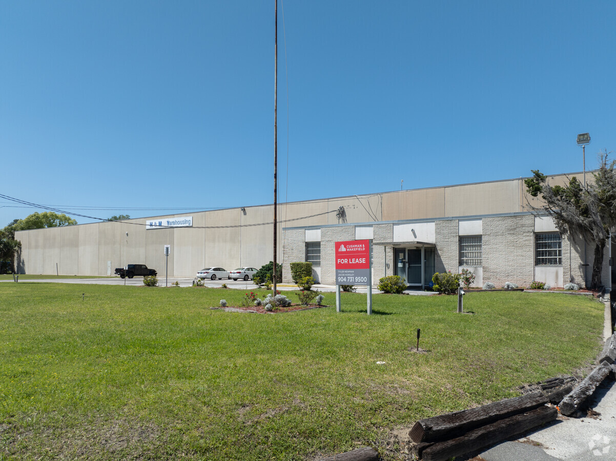
Property Record
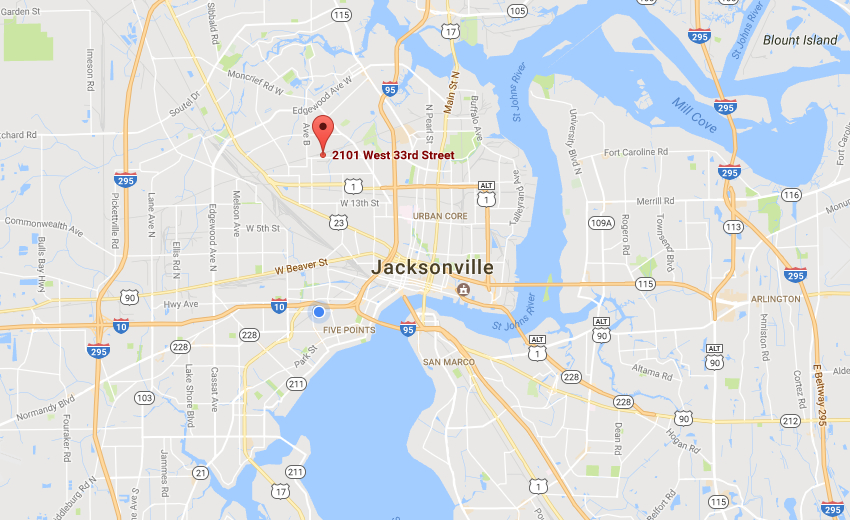
2101 W 33Rd St, Jacksonville, FL 32209

NEARBY LISTINGS FOR SALE OR LEASE
Property Detail
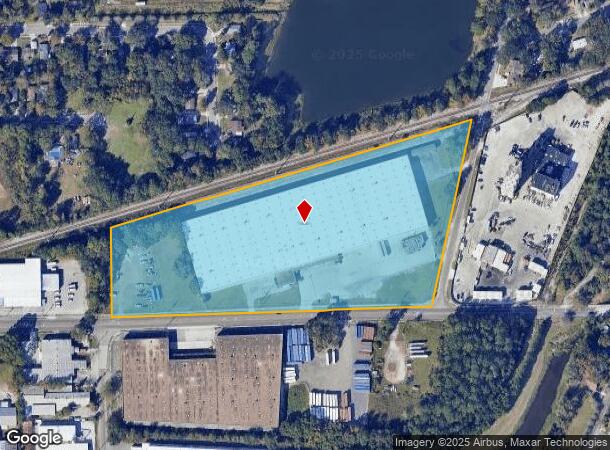
2101 W 33Rd St
029896-0000
Section Land
Warehouse
55-2S-26E 12.17 PT SIBBALD GRANT,PT SEC 55-2S-26E RECD O/R 19952-2085
X
Duval
12031C0352H
Florida
2023
11.99 AC
2024
North Side
002801
Jacksonville (Florida)
220,152 SF
Jacksonville, FL
DEMOGRAPHICS near 2101 W 33Rd St
1 Mile
3 Mile
5 Mile
2024 Total Population
13,453
89,262
177,350
2029 Population
14,305
94,601
187,990
Pop Growth 2024-2029
+ 6.33%
+ 5.98%
+ 6.00%
Average Age
38
38
39
2024 Total Households
5,259
35,022
73,205
HH Growth 2024-2029
+ 6.47%
+ 6.12%
+ 6.25%
Median Household Inc
$29,552
$30,472
$37,948
Avg Household Size
2.50
2.40
2.30
2024 Avg HH Vehicles
1.00
1.00
1.00
Median Home Value
$72,053
$92,616
$149,725
Median Year Built
1964
1960
1961
Nearby Places
- Restaurants
- Banks
- Shops
- Fitness
- Groceries
PUBLIC TRANSPORTATION
COMMUTER RAIL
Jacksonville (Silver Meteor - Amtrak, Silver Star - Amtrak)
DRIVE
WALK
Distance
Jacksonville (Silver Meteor - Amtrak, Silver Star - Amtrak)
6 min
2.7 mi
AIRPORT
Jacksonville International
DRIVE
WALK
Distance
Jacksonville International
22 min
13.4 mi
Freight Ports
Jacksonville Port
DRIVE
WALK
Distance
Jacksonville Port
10 min
4.8 mi
SALE & LEASE HISTORY
LISTING DATE
SALE/LEASE

Oct 13, 2023
For Lease
Feb 09, 2017
For Sale
Nearby Properties
Address
Land Use
TOTAL SIZE
Lot Size
Zoning
Address
Land Use
TOTAL SIZE
Lot Size
Zoning
705,940 SF
25.12 AC
PBF-1
Address
Land Use
TOTAL SIZE
Lot Size
Zoning
313,472 SF
35.44 AC
CCBD
Address
Land Use
TOTAL SIZE
Lot Size
Zoning
299,055 SF
18.80 AC
CCBD
Address
Land Use
TOTAL SIZE
Lot Size
Zoning
163,471 SF
7.84 AC
PBF-2
Address
Land Use
TOTAL SIZE
Lot Size
Zoning
352,439 SF
3.40 AC
CCBD
Address
Land Use
TOTAL SIZE
Lot Size
Zoning
144,400 SF
10.32 AC
PBF-2
Address
Land Use
TOTAL SIZE
Lot Size
Zoning
311,068 SF
18.91 AC
PBF-1
Address
Land Use
TOTAL SIZE
Lot Size
Zoning
186,773 SF
9.76 AC
CCG-2
Address
Land Use
TOTAL SIZE
Lot Size
Zoning
40,984 SF
2.33 AC
CCBD
Address
Land Use
TOTAL SIZE
Lot Size
Zoning
117,227 SF
14.32 AC
CCG-2
Address
Land Use
TOTAL SIZE
Lot Size
Zoning
317,474 SF
17.74 AC
IL
Address
Land Use
TOTAL SIZE
Lot Size
Zoning
323,592 SF
32.35 AC
PUD
Address
Land Use
TOTAL SIZE
Lot Size
Zoning
77,356 SF
2.15 AC
PBF-2
Address
Land Use
TOTAL SIZE
Lot Size
Zoning
679,901 SF
18.30 AC
PBF-1
Address
Land Use
TOTAL SIZE
Lot Size
Zoning
110,290 SF
3.72 AC
PBF-1
Address
Land Use
TOTAL SIZE
Lot Size
Zoning
323,045 SF
56.62 AC
IL
Address
Land Use
TOTAL SIZE
Lot Size
Zoning
571,166 SF
16.73 AC
IL
Address
Land Use
TOTAL SIZE
Lot Size
Zoning
154,437 SF
29.28 AC
IL
Address
Land Use
TOTAL SIZE
Lot Size
Zoning
138,076 SF
20.68 AC
RLD-60
Address
Land Use
TOTAL SIZE
Lot Size
Zoning
175,436 SF
10.62 AC
RMD-D
Address
Land Use
TOTAL SIZE
Lot Size
Zoning
118,375 SF
4.52 AC
PUD
Address
Land Use
TOTAL SIZE
Lot Size
Zoning
392,885 SF
61.13 AC
PBF-1
Address
Land Use
TOTAL SIZE
Lot Size
Zoning
184,283 SF
13.09 AC
RMD-D
Address
Land Use
TOTAL SIZE
Lot Size
Zoning
192,086 SF
14.62 AC
RMD-D
Address
Land Use
TOTAL SIZE
Lot Size
Zoning
267,290 SF
11.81 AC
IL
Address
Land Use
TOTAL SIZE
Lot Size
Zoning
165,626 SF
10.12 AC
PUD
Address
Land Use
TOTAL SIZE
Lot Size
Zoning
27,722 SF
1.61 AC
PBF-1
Address
Land Use
TOTAL SIZE
Lot Size
Zoning
106,133 SF
10.58 AC
PBF-2
Address
Land Use
TOTAL SIZE
Lot Size
Zoning
7,483 SF
12.70 AC
CCBD
Address
Land Use
TOTAL SIZE
Lot Size
Zoning
120,586 SF
36.53 AC
IL
The World's #1 Commercial Real Estate Marketplace
Connect with us
© 2025 CoStar Group
The information above has been obtained from sources believed reliable. While we do not doubt its accuracy we have not verified it and make no guarantee, warranty or representation about it. It is your responsibility to independently confirm its accuracy and completeness. Any projections, opinions, assumptions, or estimates used are for example only and do not represent the current or future performance of the property. The value of this transaction to you depends on tax and other factors which should be evaluated by your tax, financial, and legal advisors. You and your advisors should conduct a careful, independent investigation of the property to determine to your satisfaction the suitability of the property for your needs.