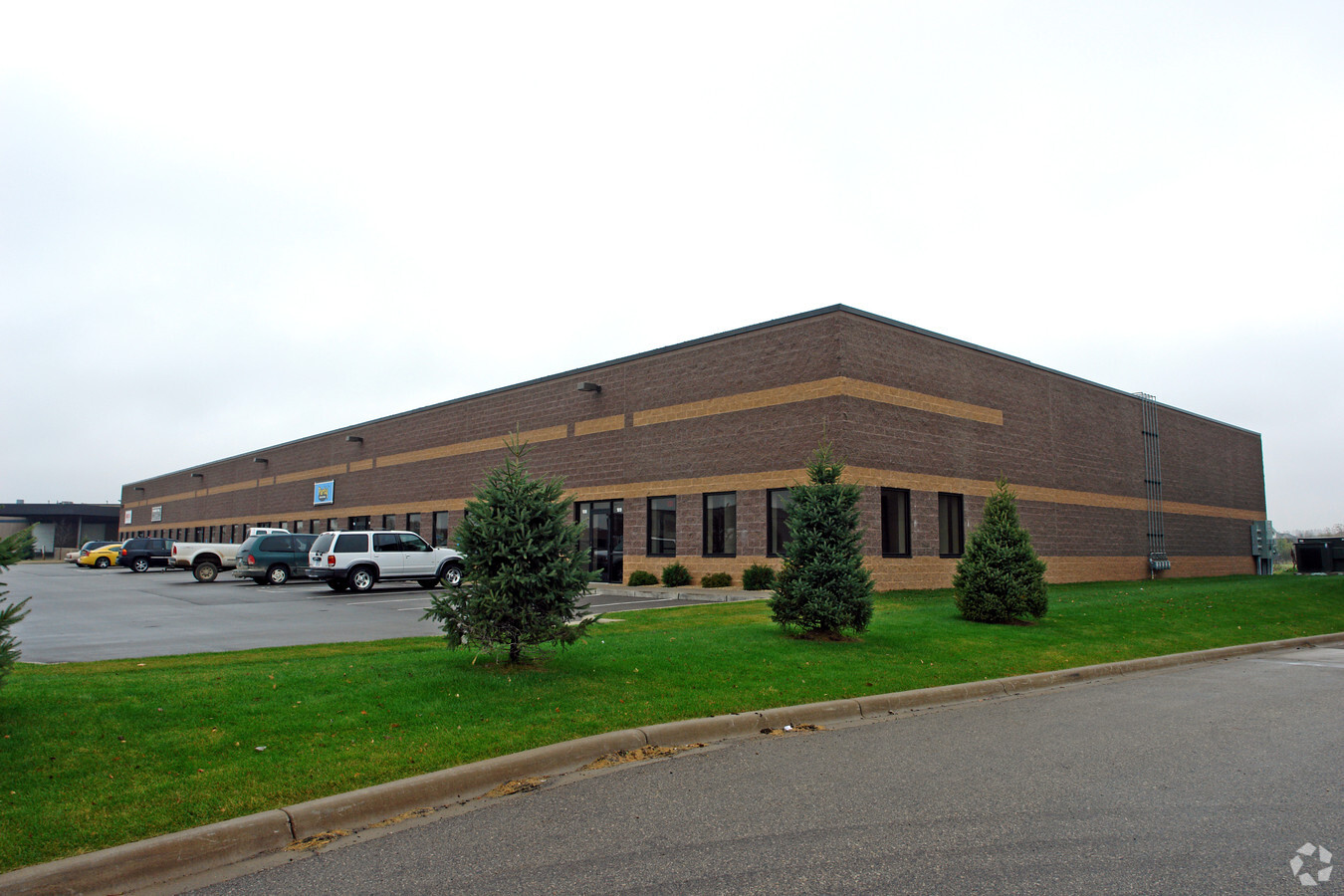
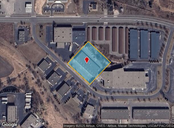
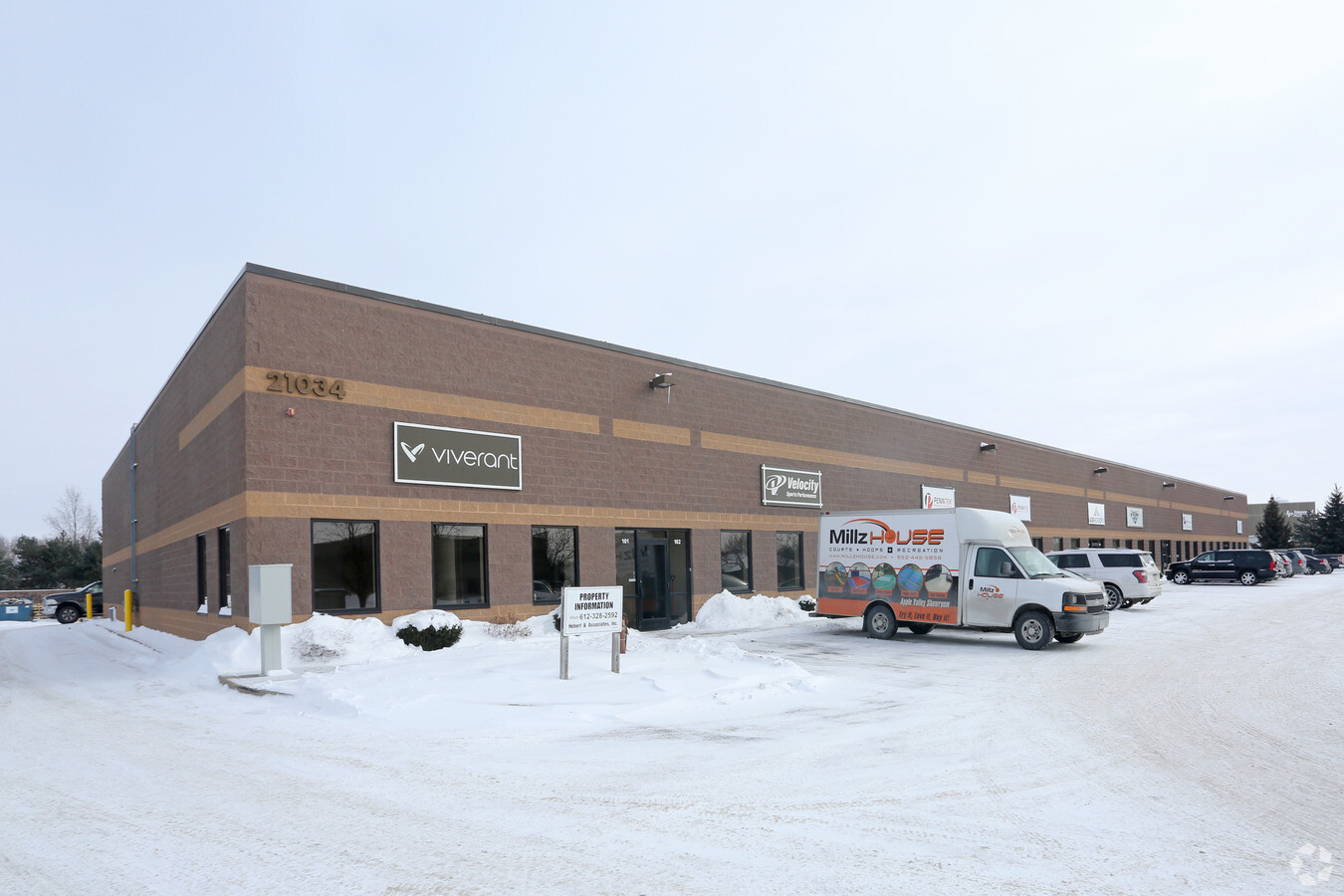
Property Record
21034 Heron Way, Lakeville, MN 55044
NEARBY LISTINGS FOR SALE OR LEASE
-
-
View all Lakeville listings for lease on LoopNet.com
Property Detail
21034 Heron Way
Minneapolis-St. Paul-Bloomington, MN-WI
Airlake Development 4Th Addition
22-11053-01-031
AIRLAKE DEVELOPMENT 4TH ADDITION 3 1 LOTS 2 &
Industrialgeneral
Dakota
X
Minnesota
27037C0213E
2
2024
2.04 AC
2023
South Central
060836
Minneapolis/St Paul
26,985 SF
DEMOGRAPHICS near 21034 Heron Way
1 Mile
3 Mile
5 Mile
2024 Total Population
6,883
26,298
86,511
2029 Population
7,156
27,296
89,045
Pop Growth 2024-2029
+ 3.97%
+ 3.79%
+ 2.93%
Average Age
36
36
37
2024 Total Households
2,398
8,755
28,966
HH Growth 2024-2029
+ 3.75%
+ 3.84%
+ 3.02%
Median Household Inc
$88,239
$121,586
$119,102
Avg Household Size
2.80
3.00
2.90
2024 Avg HH Vehicles
2.00
2.00
2.00
Median Home Value
$363,980
$407,534
$373,132
Median Year Built
1997
2003
1997
Nearby Places
- Restaurants
- Banks
- Shops
- Fitness
- Groceries
PUBLIC TRANSPORTATION
AIRPORT
Minneapolis-St Paul International/Wold-Chamberlain
DRIVE
WALK
Distance
Minneapolis-St Paul International/Wold-Chamberlain
31 min
18.9 mi
Freight Ports
Port Milwaukee
DRIVE
WALK
Distance
Port Milwaukee
382 min
342.5 mi
SALE & LEASE HISTORY
LISTING DATE
SALE/LEASE

Sep 25, 2016
For Lease
Nov 26, 2024
For Lease
Mar 20, 2017
For Lease
Aug 28, 2019
For Lease
Nearby Properties
Address
Land Use
TOTAL SIZE
Lot Size
Zoning
Address
Land Use
TOTAL SIZE
Lot Size
Zoning
749,550 SF
71.74 AC
Address
Land Use
TOTAL SIZE
Lot Size
Zoning
179,859 SF
43.48 AC
Address
Land Use
TOTAL SIZE
Lot Size
Zoning
282,100 SF
18.86 AC
Address
Land Use
TOTAL SIZE
Lot Size
Zoning
359,914 SF
18.86 AC
Address
Land Use
TOTAL SIZE
Lot Size
Zoning
374,622 SF
18.74 AC
Address
Land Use
TOTAL SIZE
Lot Size
Zoning
187,993 SF
21.88 AC
Address
Land Use
TOTAL SIZE
Lot Size
Zoning
121,600 SF
27.55 AC
Address
Land Use
TOTAL SIZE
Lot Size
Zoning
275,666 SF
23.58 AC
Address
Land Use
TOTAL SIZE
Lot Size
Zoning
151,200 SF
17.20 AC
Address
Land Use
TOTAL SIZE
Lot Size
Zoning
94,592 SF
14.30 AC
Address
Land Use
TOTAL SIZE
Lot Size
Zoning
276,560 SF
20.11 AC
Address
Land Use
TOTAL SIZE
Lot Size
Zoning
12.51 AC
Address
Land Use
TOTAL SIZE
Lot Size
Zoning
93,883 SF
4.17 AC
Address
Land Use
TOTAL SIZE
Lot Size
Zoning
53,022 SF
11.89 AC
Address
Land Use
TOTAL SIZE
Lot Size
Zoning
56,950 SF
27.71 AC
Address
Land Use
TOTAL SIZE
Lot Size
Zoning
130,180 SF
9.01 AC
Address
Land Use
TOTAL SIZE
Lot Size
Zoning
78,220 SF
5.96 AC
Address
Land Use
TOTAL SIZE
Lot Size
Zoning
158,698 SF
8.59 AC
Address
Land Use
TOTAL SIZE
Lot Size
Zoning
109,440 SF
8.92 AC
Address
Land Use
TOTAL SIZE
Lot Size
Zoning
118,065 SF
7.63 AC
Address
Land Use
TOTAL SIZE
Lot Size
Zoning
102,664 SF
3.82 AC
Address
Land Use
TOTAL SIZE
Lot Size
Zoning
112,730 SF
5.73 AC
Address
Land Use
TOTAL SIZE
Lot Size
Zoning
131,634 SF
10.76 AC
Address
Land Use
TOTAL SIZE
Lot Size
Zoning
49,460 SF
14.65 AC
Address
Land Use
TOTAL SIZE
Lot Size
Zoning
84,582 SF
14.20 AC
Address
Land Use
TOTAL SIZE
Lot Size
Zoning
54,378 SF
6.48 AC
Address
Land Use
TOTAL SIZE
Lot Size
Zoning
75,411 SF
1.12 AC
Address
Land Use
TOTAL SIZE
Lot Size
Zoning
61,674 SF
10.30 AC
Address
Land Use
TOTAL SIZE
Lot Size
Zoning
137,542 SF
11.85 AC
The World's #1 Commercial Real Estate Marketplace
Connect with us
© 2025 CoStar Group
The information above has been obtained from sources believed reliable. While we do not doubt its accuracy we have not verified it and make no guarantee, warranty or representation about it. It is your responsibility to independently confirm its accuracy and completeness. Any projections, opinions, assumptions, or estimates used are for example only and do not represent the current or future performance of the property. The value of this transaction to you depends on tax and other factors which should be evaluated by your tax, financial, and legal advisors. You and your advisors should conduct a careful, independent investigation of the property to determine to your satisfaction the suitability of the property for your needs.