Property Record
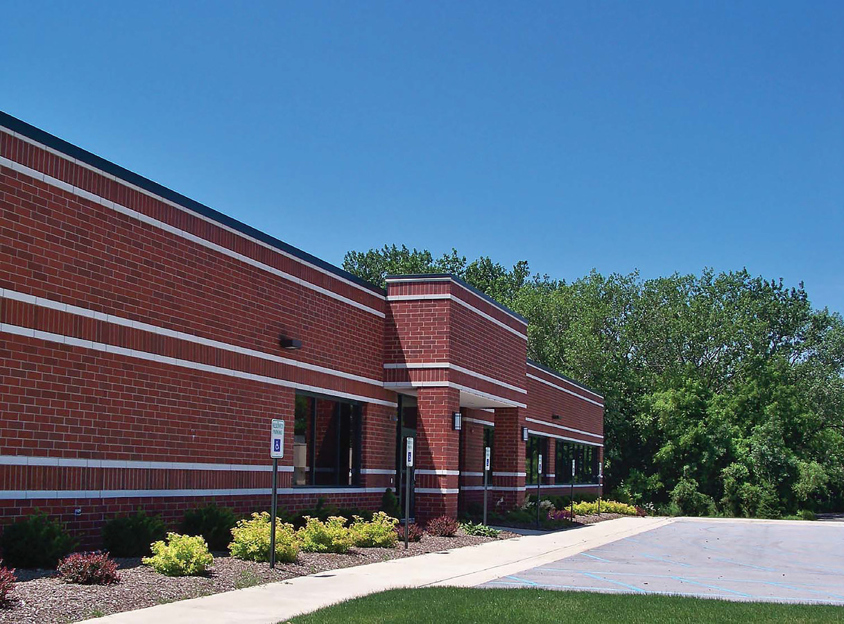
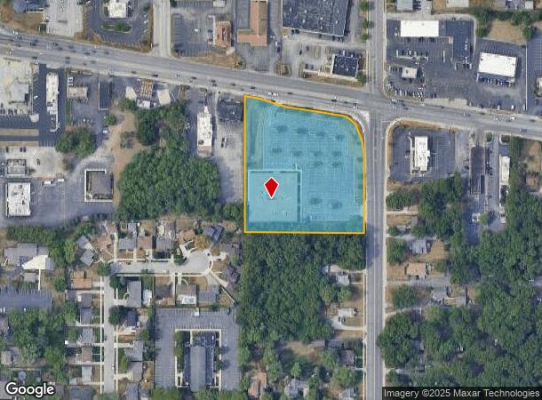
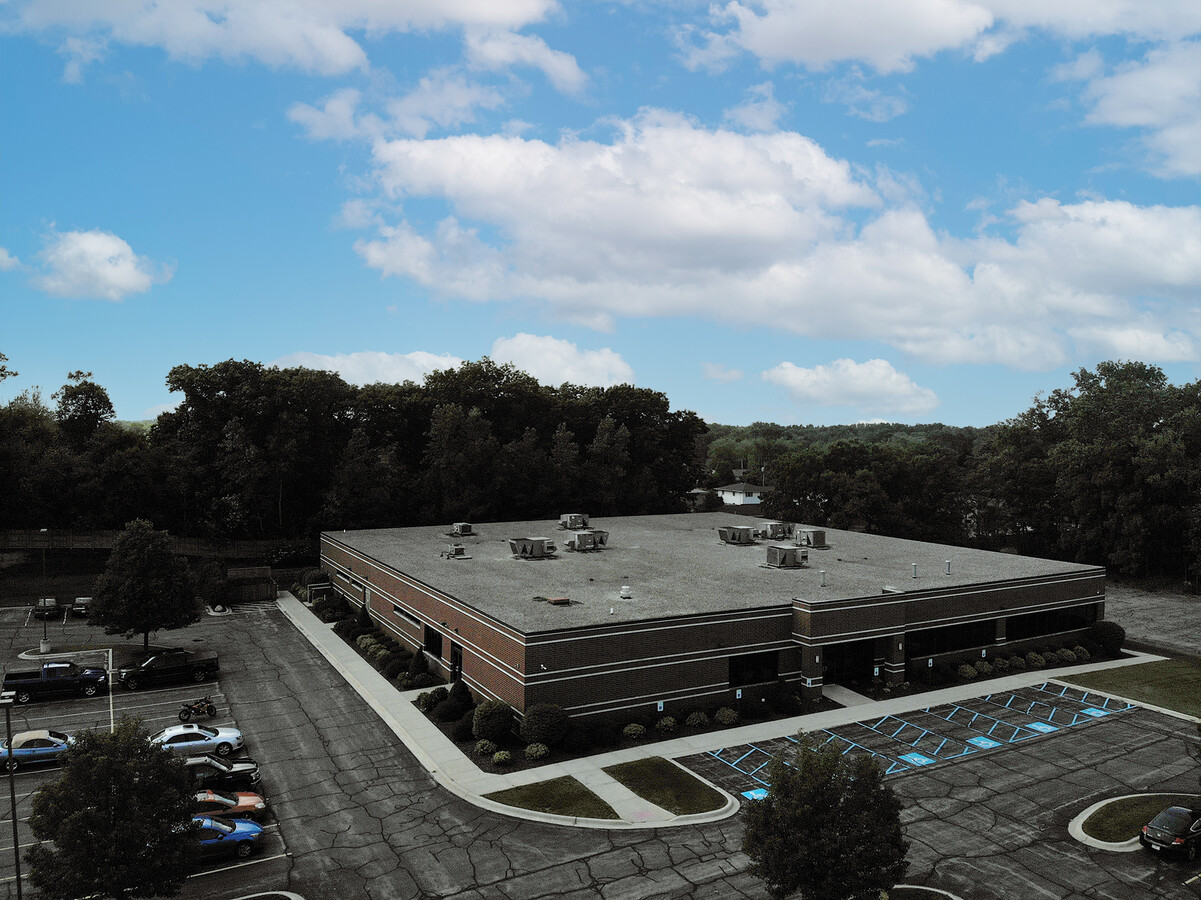
211 W Ridge Rd, Griffith, IN 46319


Current Lease Availabilities
NEARBY LISTINGS FOR SALE OR LEASE
Property Detail
211 W Ridge Rd
Chicago-Naperville-Elgin, IL-IN-WI
Fcl Griffith Sub
45-07-26-102-037.000-006
FCL GRIFFITH SUB LOT 1
Officebuilding
Lake
X
Indiana
18089C0141F
1
2023
3.72 AC
2024
Indiana
041001
Chicago
24,964 SF
DEMOGRAPHICS near 211 W Ridge Rd
1 Mile
3 Mile
5 Mile
2024 Total Population
10,714
60,129
173,650
2029 Population
10,625
59,971
174,418
Pop Growth 2024-2029
(0.83%)
(0.26%)
+ 0.44%
Average Age
39
40
41
2024 Total Households
4,431
24,694
69,740
HH Growth 2024-2029
(0.93%)
(0.34%)
+ 0.40%
Median Household Inc
$63,947
$62,280
$59,118
Avg Household Size
2.40
2.40
2.40
2024 Avg HH Vehicles
2.00
2.00
2.00
Median Home Value
$185,741
$180,049
$181,397
Median Year Built
1966
1964
1963
Nearby Places
- Restaurants
- Banks
- Shops
- Fitness
- Groceries
PUBLIC TRANSPORTATION
COMMUTER RAIL
Clark Road (Gary) Station (South Shore Line - Northern Indiana Commuter Transportation District (South Shore Line))
DRIVE
WALK
Distance
Clark Road (Gary) Station (South Shore Line - Northern Indiana Commuter Transportation District (South Shore Line))
10 min
6.1 mi
AIRPORT
Chicago Midway International
DRIVE
WALK
Distance
Chicago Midway International
46 min
31.2 mi
Freight Ports
Port Milwaukee
DRIVE
WALK
Distance
Port Milwaukee
147 min
115.3 mi
Nearby Properties
Address
Land Use
TOTAL SIZE
Lot Size
Zoning
Address
Land Use
TOTAL SIZE
Lot Size
Zoning
233,023 SF
37.73 AC
Address
Land Use
TOTAL SIZE
Lot Size
Zoning
233,767 SF
37.03 AC
Address
Land Use
TOTAL SIZE
Lot Size
Zoning
168,766 SF
19.16 AC
Address
Land Use
TOTAL SIZE
Lot Size
Zoning
394,442 SF
16.83 AC
Address
Land Use
TOTAL SIZE
Lot Size
Zoning
214,752 SF
10.41 AC
R3
Address
Land Use
TOTAL SIZE
Lot Size
Zoning
153,073 SF
4.88 AC
Address
Land Use
TOTAL SIZE
Lot Size
Zoning
80,444 SF
13.41 AC
R3
Address
Land Use
TOTAL SIZE
Lot Size
Zoning
77,091 SF
2.08 AC
Address
Land Use
TOTAL SIZE
Lot Size
Zoning
79,169 SF
2.76 AC
Address
Land Use
TOTAL SIZE
Lot Size
Zoning
233,769 SF
29.04 AC
R3
Address
Land Use
TOTAL SIZE
Lot Size
Zoning
217,104 SF
10.45 AC
Address
Land Use
TOTAL SIZE
Lot Size
Zoning
64,971 SF
6.98 AC
Address
Land Use
TOTAL SIZE
Lot Size
Zoning
34,116 SF
73.40 AC
Address
Land Use
TOTAL SIZE
Lot Size
Zoning
100,000 SF
7.29 AC
R3
Address
Land Use
TOTAL SIZE
Lot Size
Zoning
167,108 SF
10.18 AC
Address
Land Use
TOTAL SIZE
Lot Size
Zoning
105,600 SF
2.90 AC
Address
Land Use
TOTAL SIZE
Lot Size
Zoning
53,096 SF
8.64 AC
R3
Address
Land Use
TOTAL SIZE
Lot Size
Zoning
60,234 SF
9.01 AC
Address
Land Use
TOTAL SIZE
Lot Size
Zoning
69,576 SF
2.55 AC
Address
Land Use
TOTAL SIZE
Lot Size
Zoning
33,920 SF
83.34 AC
Address
Land Use
TOTAL SIZE
Lot Size
Zoning
55,656 SF
1.99 AC
R3
Address
Land Use
TOTAL SIZE
Lot Size
Zoning
112,758 SF
8.02 AC
Address
Land Use
TOTAL SIZE
Lot Size
Zoning
121,900 SF
8.79 AC
R3
Address
Land Use
TOTAL SIZE
Lot Size
Zoning
79,059 SF
7.07 AC
R3
Address
Land Use
TOTAL SIZE
Lot Size
Zoning
28,138 SF
2.33 AC
R33
Address
Land Use
TOTAL SIZE
Lot Size
Zoning
61,425 SF
3.29 AC
Address
Land Use
TOTAL SIZE
Lot Size
Zoning
47,260 SF
1.61 AC
R3
Address
Land Use
TOTAL SIZE
Lot Size
Zoning
79,835 SF
10.04 AC
Address
Land Use
TOTAL SIZE
Lot Size
Zoning
111,363 SF
9.60 AC
Address
Land Use
TOTAL SIZE
Lot Size
Zoning
18,052 SF
2.43 AC
The World's #1 Commercial Real Estate Marketplace
Connect with us
© 2025 CoStar Group
The information above has been obtained from sources believed reliable. While we do not doubt its accuracy we have not verified it and make no guarantee, warranty or representation about it. It is your responsibility to independently confirm its accuracy and completeness. Any projections, opinions, assumptions, or estimates used are for example only and do not represent the current or future performance of the property. The value of this transaction to you depends on tax and other factors which should be evaluated by your tax, financial, and legal advisors. You and your advisors should conduct a careful, independent investigation of the property to determine to your satisfaction the suitability of the property for your needs.