Property Record
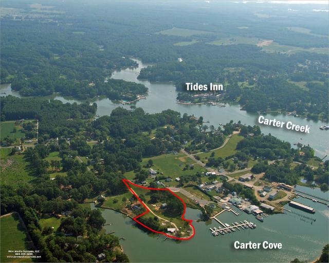
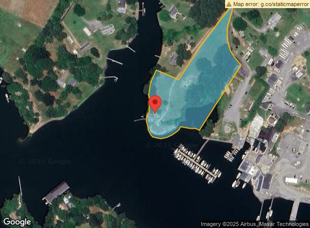
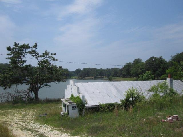
212 Carters Cove Dr, Weems, VA 22576
NEARBY LISTINGS FOR SALE OR LEASE
-
-
View all Weems listings for sale on LoopNet.com
Property Detail
212 Carters Cove Dr
33-164
JOHN NECK 4.892 AC POND .245 AC INCLU LR22/1033
Realpropertynec
Lancaster
AE
Virginia
51119C0150D
4.89 AC
0
Virginia Regional
2024
Other Market Areas
030302
DEMOGRAPHICS near 212 Carters Cove Dr
1 Mile
3 Mile
5 Mile
2024 Total Population
591
2,681
6,987
2029 Population
567
2,591
6,884
Pop Growth 2024-2029
(4.06%)
(3.36%)
(1.47%)
Average Age
54
54
52
2024 Total Households
298
1,324
3,361
HH Growth 2024-2029
(4.03%)
(3.47%)
(1.61%)
Median Household Inc
$48,676
$56,376
$58,818
Avg Household Size
2.00
1.90
2.00
2024 Avg HH Vehicles
2.00
2.00
2.00
Median Home Value
$327,272
$322,477
$317,134
Median Year Built
1977
1980
1981
Nearby Places
- Restaurants
- Banks
- Shops
- Fitness
- Groceries
Nearby Properties
Address
Land Use
TOTAL SIZE
Lot Size
Zoning
Address
Land Use
TOTAL SIZE
Lot Size
Zoning
70,576 SF
23.66 AC
R1
Address
Land Use
TOTAL SIZE
Lot Size
Zoning
27,502 SF
22.65 AC
C1
Address
Land Use
TOTAL SIZE
Lot Size
Zoning
15,592 SF
6 AC
R1
Address
Land Use
TOTAL SIZE
Lot Size
Zoning
7,868 SF
340.46 AC
R2
Address
Land Use
TOTAL SIZE
Lot Size
Zoning
22,775 SF
6.62 AC
C1
Address
Land Use
TOTAL SIZE
Lot Size
Zoning
5,866 SF
1.16 AC
R1
Address
Land Use
TOTAL SIZE
Lot Size
Zoning
4,652 SF
5.76 AC
R1
Address
Land Use
TOTAL SIZE
Lot Size
Zoning
6,322 SF
1.20 AC
R1
Address
Land Use
TOTAL SIZE
Lot Size
Zoning
8,050 SF
4.69 AC
R1
Address
Land Use
TOTAL SIZE
Lot Size
Zoning
12,356 SF
2.17 AC
R1
Address
Land Use
TOTAL SIZE
Lot Size
Zoning
15,820 SF
2.06 AC
M1
Address
Land Use
TOTAL SIZE
Lot Size
Zoning
2,964 SF
1.20 AC
R1
Address
Land Use
TOTAL SIZE
Lot Size
Zoning
9,068 SF
0.99 AC
C1
Address
Land Use
TOTAL SIZE
Lot Size
Zoning
10,306 SF
3.84 AC
C1
Address
Land Use
TOTAL SIZE
Lot Size
Zoning
3,088 SF
1.55 AC
R1
Address
Land Use
TOTAL SIZE
Lot Size
Zoning
1,964 SF
12.54 AC
R1
Address
Land Use
TOTAL SIZE
Lot Size
Zoning
2,984 SF
2.88 AC
R1
Address
Land Use
TOTAL SIZE
Lot Size
Zoning
7,354 SF
3.72 AC
A2
Address
Land Use
TOTAL SIZE
Lot Size
Zoning
12,000 SF
1.40 AC
R1
Address
Land Use
TOTAL SIZE
Lot Size
Zoning
9,156 SF
11.57 AC
A2
Address
Land Use
TOTAL SIZE
Lot Size
Zoning
2,736 SF
0.98 AC
C1
Address
Land Use
TOTAL SIZE
Lot Size
Zoning
1,920 SF
0.67 AC
R1
Address
Land Use
TOTAL SIZE
Lot Size
Zoning
3,904 SF
4.12 AC
R1
Address
Land Use
TOTAL SIZE
Lot Size
Zoning
2,217 SF
4.24 AC
R1
Address
Land Use
TOTAL SIZE
Lot Size
Zoning
8,963 SF
2.88 AC
C1
Address
Land Use
TOTAL SIZE
Lot Size
Zoning
4,868 SF
1.96 AC
H1
Address
Land Use
TOTAL SIZE
Lot Size
Zoning
7.84 AC
M1
Address
Land Use
TOTAL SIZE
Lot Size
Zoning
3,418 SF
2.30 AC
R1
Address
Land Use
TOTAL SIZE
Lot Size
Zoning
2,368 SF
2.84 AC
C1
Address
Land Use
TOTAL SIZE
Lot Size
Zoning
3,746 SF
0.58 AC
R1
The World's #1 Commercial Real Estate Marketplace
Connect with us
© 2025 CoStar Group
The information above has been obtained from sources believed reliable. While we do not doubt its accuracy we have not verified it and make no guarantee, warranty or representation about it. It is your responsibility to independently confirm its accuracy and completeness. Any projections, opinions, assumptions, or estimates used are for example only and do not represent the current or future performance of the property. The value of this transaction to you depends on tax and other factors which should be evaluated by your tax, financial, and legal advisors. You and your advisors should conduct a careful, independent investigation of the property to determine to your satisfaction the suitability of the property for your needs.