Property Record
2121 Noble Rd, Raleigh, NC 27608


Property Detail
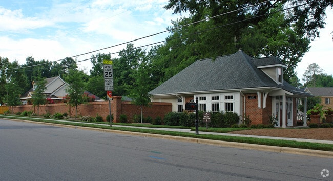
2121 Noble Rd
1705.20-80-2221-000
LO94 OPEN SPACE WHITAKER PARK PH1 BM2007
Nightclub
WAKE
R-10
North Carolina
B and X Area of moderate flood hazard, usually the area between the limits of the 100-year and 500-year floods.
94
0
1.15 AC
2025
Five Points
051800
Raleigh/Durham
1,074 SF
Raleigh-Cary, NC
NEARBY LISTINGS FOR SALE OR LEASE
DEMOGRAPHICS near 2121 Noble Rd
1 mile
3 mile
5 mile
2025 Total Population
10,061
111,760
269,367
2030 Population
10,847
120,794
290,618
Pop Growth 2025-2030
+ 7.81%
+ 8.08%
+ 7.89%
Average Age
40
38
38
2025 Total Households
4,457
49,507
115,546
HH Growth 2025-2030
+ 8.30%
+ 9.05%
+ 8.63%
Median Household Inc
$169,259
$97,753
$79,770
Avg Household Size
2.20
2.00
2.20
2025 Avg HH Vehicles
2.00
2.00
2.00
Median Home Value
$890,220
$703,087
$474,965
Median Year Built
1976
1987
1988
Nearby Places
Map Layers
Map Styles
 Street
 Aerial
Layers
 Traffic
 Biking
Places
Listings with unknown addresses are not visible on the map
- Restaurants
- Banks
- Shops
- Fitness
- Groceries
PUBLIC TRANSPORTATION
COMMUTER RAIL
Raleigh Union Station (Piedmont - North Carolina by Train (NC Train))
Drive
Walk
Distance
Raleigh Union Station (Piedmont - North Carolina by Train (NC Train))
7 min
2.8 mi
AIRPORT
Raleigh-Durham International
Drive
Walk
Distance
Raleigh-Durham International
24 min
13.5 mi
Nearby Properties
Address
Land Use
TOTAL SIZE
Lot Size
Zoning
Address
Land Use
TOTAL SIZE
Lot Size
Zoning
5,616,802 SF
507.97 AC
OX-12
Address
Land Use
TOTAL SIZE
Lot Size
Zoning
972,279 SF
4.05 AC
DX-20
Address
Land Use
TOTAL SIZE
Lot Size
Zoning
1,597,789 SF
13.35 AC
DX-20
Address
Land Use
TOTAL SIZE
Lot Size
Zoning
458,830 SF
3.98 AC
DX-20
Address
Land Use
TOTAL SIZE
Lot Size
Zoning
706,810 SF
40.78 AC
IH
Address
Land Use
TOTAL SIZE
Lot Size
Zoning
1,085,654 SF
16.87 AC
OX-5
Address
Land Use
TOTAL SIZE
Lot Size
Zoning
675,817 SF
3.56 AC
DX-12
Address
Land Use
TOTAL SIZE
Lot Size
Zoning
372,222 SF
9.64 AC
DX-12
Address
Land Use
TOTAL SIZE
Lot Size
Zoning
250,448 SF
25.28 AC
OX-3
Address
Land Use
TOTAL SIZE
Lot Size
Zoning
517,826 SF
2.52 AC
DX-7
Address
Land Use
TOTAL SIZE
Lot Size
Zoning
179,565 SF
1.10 AC
DX-7
Address
Land Use
TOTAL SIZE
Lot Size
Zoning
524,391 SF
4.13 AC
NX-5
Address
Land Use
TOTAL SIZE
Lot Size
Zoning
344,814 SF
1.95 AC
DX-40
Address
Land Use
TOTAL SIZE
Lot Size
Zoning
658,580 SF
3.30 AC
PD
Address
Land Use
TOTAL SIZE
Lot Size
Zoning
654,148 SF
1.21 AC
DX-40
Address
Land Use
TOTAL SIZE
Lot Size
Zoning
747,658 SF
11.12 AC
CX-12
Address
Land Use
TOTAL SIZE
Lot Size
Zoning
465,052 SF
2.65 AC
PD
Address
Land Use
TOTAL SIZE
Lot Size
Zoning
462,217 SF
1.01 AC
DX-20
Address
Land Use
TOTAL SIZE
Lot Size
Zoning
364,025 SF
2.19 AC
PD
Address
Land Use
TOTAL SIZE
Lot Size
Zoning
834,950 SF
3.91 AC
OX-12
Address
Land Use
TOTAL SIZE
Lot Size
Zoning
561,966 SF
3.81 AC
IX-7
Address
Land Use
TOTAL SIZE
Lot Size
Zoning
426,539 SF
2.90 AC
NX-5
Address
Land Use
TOTAL SIZE
Lot Size
Zoning
765,252 SF
1.72 AC
DX-20
Address
Land Use
TOTAL SIZE
Lot Size
Zoning
159,921 SF
4.99 AC
DX-5
Address
Land Use
TOTAL SIZE
Lot Size
Zoning
40,024 SF
6.19 AC
DX-3
Address
Land Use
TOTAL SIZE
Lot Size
Zoning
613,248 SF
2.20 AC
IND-2
Address
Land Use
TOTAL SIZE
Lot Size
Zoning
539,902 SF
1.28 AC
O&I-1
Address
Land Use
TOTAL SIZE
Lot Size
Zoning
580,268 SF
9.02 AC
PD
Address
Land Use
TOTAL SIZE
Lot Size
Zoning
197,029 SF
6.27 AC
DX-5
Address
Land Use
TOTAL SIZE
Lot Size
Zoning
201,558 SF
4.05 AC
DX-12
The World's #1 Commercial Real Estate Marketplace
Connect with us
© 2026 CoStar Group
The information above has been obtained from sources believed reliable. While we do not doubt its accuracy we have not verified it and make no guarantee, warranty or representation about it. It is your responsibility to independently confirm its accuracy and completeness. Any projections, opinions, assumptions, or estimates used are for example only and do not represent the current or future performance of the property. The value of this transaction to you depends on tax and other factors which should be evaluated by your tax, financial, and legal advisors. You and your advisors should conduct a careful, independent investigation of the property to determine to your satisfaction the suitability of the property for your needs.