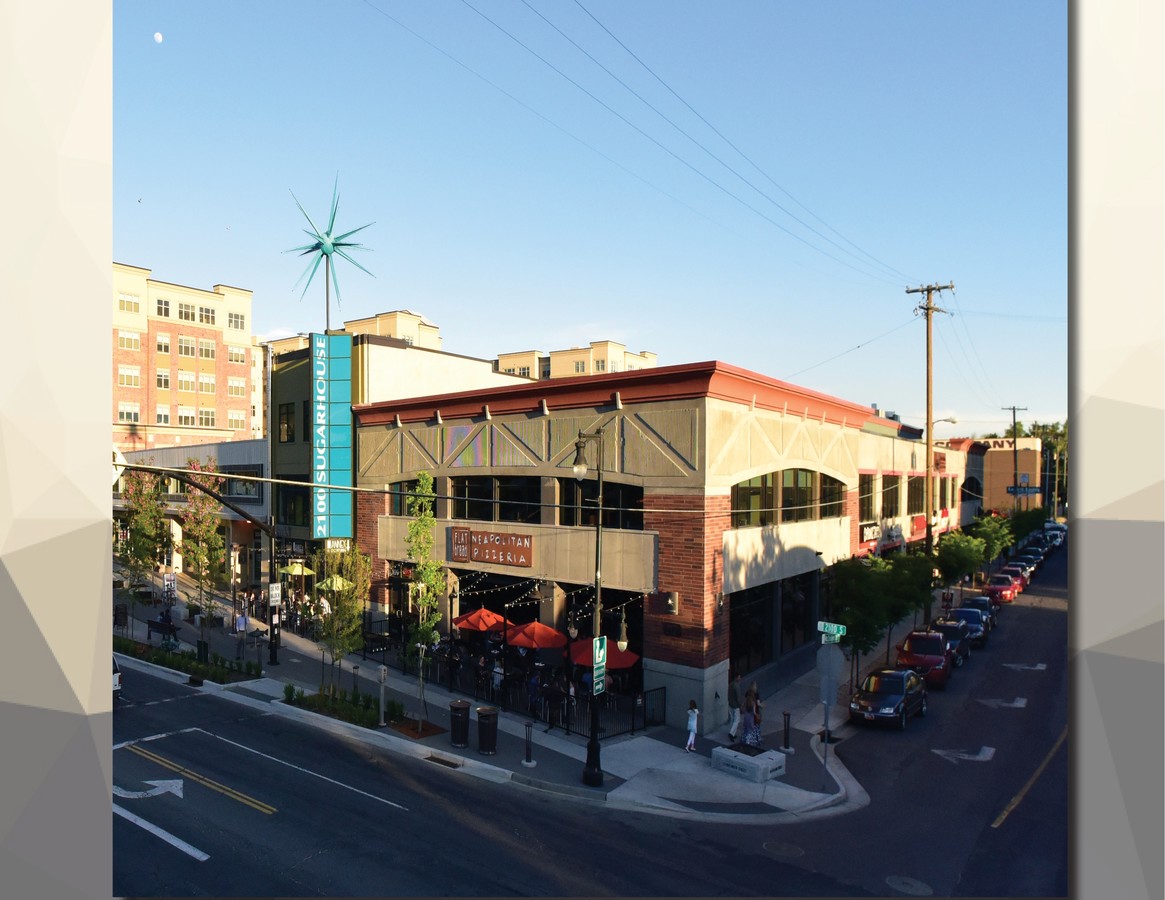
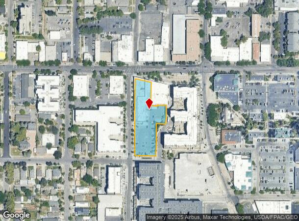
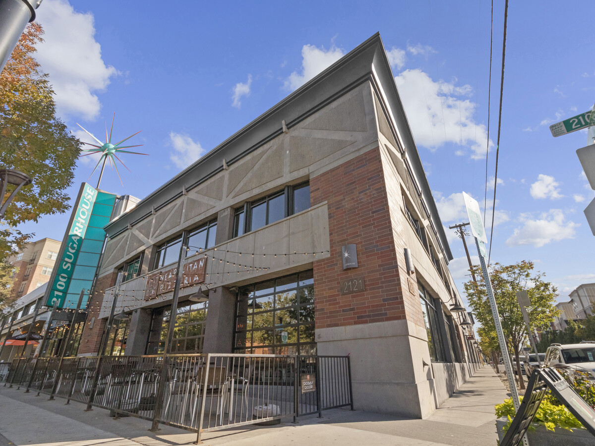
Property Record
2121 S Mcclelland St, Salt Lake City, UT 84106

Current Lease Availabilities
General Retail LEASE
$30.00 - $33.00 SF/YR
1,883 - 13,666 SF
NEARBY LISTINGS FOR SALE OR LEASE
Property Detail
2121 S Mcclelland St
Salt Lake City, UT
Fairmount Springs Add
16-20-206-041-0000
BEG S 02110 W 2 FT FR NE COR OF LOT 13, BLK 5, FAIRMOUNT SPRINGS ADD; N 892835 W 130 FT; N 02110 E 469.68 FT; S774030 E 99.19 FT; S 04437 W 132.39 FT; S 02110 W 10.90 FT; S 892835 E 33.71 FT; S 02110 E 4.10 FT; S 892835 E 6.70 FT; N 02110 E 7.41 FT;
Stripcommercialcenter
Salt Lake
X
Utah
49035C0301H
13
2023
1.37 AC
2023
Sugarhouse
114100
Salt Lake City
84,490 SF
DEMOGRAPHICS near 2121 S Mcclelland St
1 Mile
3 Mile
5 Mile
2024 Total Population
21,022
154,945
330,380
2029 Population
21,255
156,991
334,873
Pop Growth 2024-2029
+ 1.11%
+ 1.32%
+ 1.36%
Average Age
38
37
37
2024 Total Households
9,822
68,276
138,741
HH Growth 2024-2029
+ 1.36%
+ 1.52%
+ 1.66%
Median Household Inc
$79,313
$68,124
$66,963
Avg Household Size
2.00
2.20
2.20
2024 Avg HH Vehicles
2.00
2.00
2.00
Median Home Value
$489,115
$532,163
$497,405
Median Year Built
1955
1963
1971
Nearby Places
- Restaurants
- Banks
- Shops
- Fitness
- Groceries
PUBLIC TRANSPORTATION
TRANSIT/SUBWAY
Fairmont Station (S-Line - Utah Transit Authority (UTA))
DRIVE
WALK
Distance
Fairmont Station (S-Line - Utah Transit Authority (UTA))
1 min
3 min
0.2 mi
Sugarmont Station (S-Line - Utah Transit Authority (UTA))
DRIVE
WALK
Distance
Sugarmont Station (S-Line - Utah Transit Authority (UTA))
1 min
6 min
0.3 mi
700 East Station (S-Line - Utah Transit Authority (UTA))
DRIVE
WALK
Distance
700 East Station (S-Line - Utah Transit Authority (UTA))
3 min
14 min
0.8 mi
500 East Station (S-Line - Utah Transit Authority (UTA))
DRIVE
WALK
Distance
500 East Station (S-Line - Utah Transit Authority (UTA))
4 min
20 min
1.0 mi
COMMUTER RAIL
North Temple Station (FrontRunner - Utah Transit Authority (UTA))
DRIVE
WALK
Distance
North Temple Station (FrontRunner - Utah Transit Authority (UTA))
12 min
6.9 mi
Warm Springs Relief Point (FrontRunner - Utah Transit Authority (UTA))
DRIVE
WALK
Distance
Warm Springs Relief Point (FrontRunner - Utah Transit Authority (UTA))
14 min
8.3 mi
AIRPORT
Salt Lake City International
DRIVE
WALK
Distance
Salt Lake City International
16 min
10.9 mi
Freight Ports
Port of Stockton
DRIVE
WALK
Distance
Port of Stockton
717 min
701.3 mi
Nearby Properties
Address
Land Use
TOTAL SIZE
Lot Size
Zoning
Address
Land Use
TOTAL SIZE
Lot Size
Zoning
1,259,285 SF
59.07 AC
I
Address
Land Use
TOTAL SIZE
Lot Size
Zoning
629,582 SF
80.77 AC
I
Address
Land Use
TOTAL SIZE
Lot Size
Zoning
457,024 SF
127 AC
RP
Address
Land Use
TOTAL SIZE
Lot Size
Zoning
296,978 SF
27.30 AC
I
Address
Land Use
TOTAL SIZE
Lot Size
Zoning
87,933 SF
4.90 AC
D-1
Address
Land Use
TOTAL SIZE
Lot Size
Zoning
440,898 SF
0.01 AC
RP
Address
Land Use
TOTAL SIZE
Lot Size
Zoning
308,431 SF
38 AC
I
Address
Land Use
TOTAL SIZE
Lot Size
Zoning
163,932 SF
14.65 AC
PL
Address
Land Use
TOTAL SIZE
Lot Size
Zoning
82,851 SF
9.76 AC
PL2
Address
Land Use
TOTAL SIZE
Lot Size
Zoning
2,566,335 SF
10.01 AC
D-1
Address
Land Use
TOTAL SIZE
Lot Size
Zoning
16,933 SF
34.68 AC
1205
Address
Land Use
TOTAL SIZE
Lot Size
Zoning
497,018 SF
13.11 AC
1205
Address
Land Use
TOTAL SIZE
Lot Size
Zoning
166,938 SF
51.07 AC
I
Address
Land Use
TOTAL SIZE
Lot Size
Zoning
183,600 SF
10.70 AC
RMF-35
Address
Land Use
TOTAL SIZE
Lot Size
Zoning
691,463 SF
17.80 AC
RM
Address
Land Use
TOTAL SIZE
Lot Size
Zoning
19,640 SF
100 AC
OS
Address
Land Use
TOTAL SIZE
Lot Size
Zoning
128,997 SF
3.04 AC
ESN
Address
Land Use
TOTAL SIZE
Lot Size
Zoning
37,536 SF
10 AC
2000
Address
Land Use
TOTAL SIZE
Lot Size
Zoning
549,074 SF
3.45 AC
D-1
Address
Land Use
TOTAL SIZE
Lot Size
Zoning
680,751 SF
1.45 AC
TSA-UC
Address
Land Use
TOTAL SIZE
Lot Size
Zoning
426,600 SF
1.61 AC
CSHBD1
Address
Land Use
TOTAL SIZE
Lot Size
Zoning
139,558 SF
3.65 AC
R-MU
Address
Land Use
TOTAL SIZE
Lot Size
Zoning
232,984 SF
52.19 AC
RP
Address
Land Use
TOTAL SIZE
Lot Size
Zoning
434,481 SF
10 AC
D-1
Address
Land Use
TOTAL SIZE
Lot Size
Zoning
275,908 SF
1.85 AC
2000
Address
Land Use
TOTAL SIZE
Lot Size
Zoning
296,854 SF
10.97 AC
1205
Address
Land Use
TOTAL SIZE
Lot Size
Zoning
903,167 SF
1.90 AC
CSHBD1
Address
Land Use
TOTAL SIZE
Lot Size
Zoning
95,854 SF
15.42 AC
CC
Address
Land Use
TOTAL SIZE
Lot Size
Zoning
297,476 SF
1.74 AC
Address
Land Use
TOTAL SIZE
Lot Size
Zoning
538,682 SF
4.11 AC
E ST C
The World's #1 Commercial Real Estate Marketplace
Connect with us
© 2025 CoStar Group
The information above has been obtained from sources believed reliable. While we do not doubt its accuracy we have not verified it and make no guarantee, warranty or representation about it. It is your responsibility to independently confirm its accuracy and completeness. Any projections, opinions, assumptions, or estimates used are for example only and do not represent the current or future performance of the property. The value of this transaction to you depends on tax and other factors which should be evaluated by your tax, financial, and legal advisors. You and your advisors should conduct a careful, independent investigation of the property to determine to your satisfaction the suitability of the property for your needs.