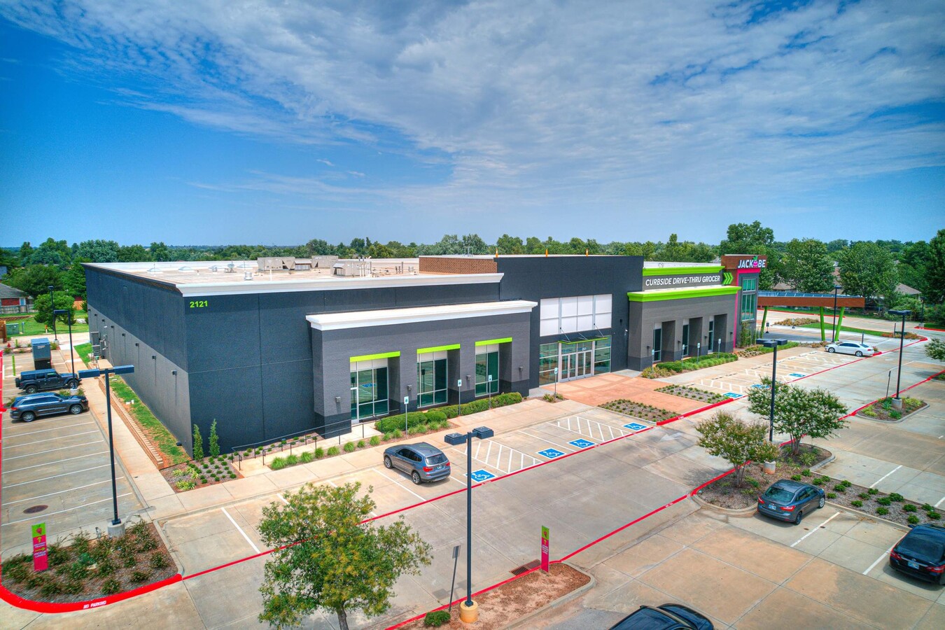
Property Record
2121 W Danforth Rd, Edmond, OK 73003
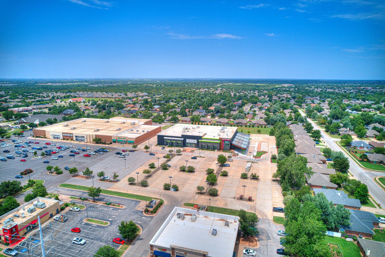
NEARBY LISTINGS FOR SALE OR LEASE
Property Detail
2121 W Danforth Rd
212691000
Danforth Village E Ed
Supermarket
TACO MAYO 00A 000
X
Oklahoma
40083C0500F
Oklahoma
2023
6.33 AC
2024
North Outlying
108229
Oklahoma City
37,195 SF
Oklahoma City, OK
DEMOGRAPHICS near 2121 W Danforth Rd
1 Mile
3 Mile
5 Mile
2024 Total Population
9,557
73,288
149,159
2029 Population
9,664
74,603
152,712
Pop Growth 2024-2029
+ 1.12%
+ 1.79%
+ 2.38%
Average Age
38
37
37
2024 Total Households
3,553
27,541
57,158
HH Growth 2024-2029
+ 1.18%
+ 1.84%
+ 2.44%
Median Household Inc
$93,894
$85,286
$89,570
Avg Household Size
2.70
2.60
2.50
2024 Avg HH Vehicles
2.00
2.00
2.00
Median Home Value
$231,187
$245,421
$268,720
Median Year Built
1994
1996
1997
Nearby Places
- Restaurants
- Banks
- Shops
- Fitness
- Groceries
PUBLIC TRANSPORTATION
AIRPORT
Will Rogers World
DRIVE
WALK
Distance
Will Rogers World
40 min
25.0 mi
Freight Ports
Tulsa Port Of Catoosa
DRIVE
WALK
Distance
Tulsa Port Of Catoosa
136 min
122.1 mi
SALE & LEASE HISTORY
LISTING DATE
SALE/LEASE

Nov 01, 2021
For Lease
Jul 25, 2023
For Lease
Aug 10, 2022
For Lease
Nearby Properties
Address
Land Use
TOTAL SIZE
Lot Size
Zoning
Address
Land Use
TOTAL SIZE
Lot Size
Zoning
304,750 SF
21.76 AC
Address
Land Use
TOTAL SIZE
Lot Size
Zoning
242,429 SF
26.01 AC
Address
Land Use
TOTAL SIZE
Lot Size
Zoning
82,162 SF
6.12 AC
Address
Land Use
TOTAL SIZE
Lot Size
Zoning
151,156 SF
13.71 AC
Address
Land Use
TOTAL SIZE
Lot Size
Zoning
173,384 SF
5.51 AC
Address
Land Use
TOTAL SIZE
Lot Size
Zoning
164,940 SF
27.04 AC
Address
Land Use
TOTAL SIZE
Lot Size
Zoning
210,018 SF
23.72 AC
Address
Land Use
TOTAL SIZE
Lot Size
Zoning
140,434 SF
18.14 AC
Address
Land Use
TOTAL SIZE
Lot Size
Zoning
176,307 SF
14.76 AC
Address
Land Use
TOTAL SIZE
Lot Size
Zoning
6,600 SF
1.04 AC
Address
Land Use
TOTAL SIZE
Lot Size
Zoning
154,244 SF
6.44 AC
Address
Land Use
TOTAL SIZE
Lot Size
Zoning
8,920 SF
7.83 AC
Address
Land Use
TOTAL SIZE
Lot Size
Zoning
140,000 SF
11.94 AC
Address
Land Use
TOTAL SIZE
Lot Size
Zoning
140,928 SF
9.60 AC
Address
Land Use
TOTAL SIZE
Lot Size
Zoning
159,232 SF
14.06 AC
Address
Land Use
TOTAL SIZE
Lot Size
Zoning
71,902 SF
6.68 AC
Address
Land Use
TOTAL SIZE
Lot Size
Zoning
75,308 SF
4.03 AC
Address
Land Use
TOTAL SIZE
Lot Size
Zoning
81,518 SF
4.80 AC
Address
Land Use
TOTAL SIZE
Lot Size
Zoning
20,810 SF
4.44 AC
Address
Land Use
TOTAL SIZE
Lot Size
Zoning
140,144 SF
15.74 AC
Address
Land Use
TOTAL SIZE
Lot Size
Zoning
106,508 SF
2.65 AC
Address
Land Use
TOTAL SIZE
Lot Size
Zoning
121,875 SF
17.45 AC
Address
Land Use
TOTAL SIZE
Lot Size
Zoning
154,332 SF
8.77 AC
Address
Land Use
TOTAL SIZE
Lot Size
Zoning
103,292 SF
10 AC
Address
Land Use
TOTAL SIZE
Lot Size
Zoning
100,147 SF
3.05 AC
Address
Land Use
TOTAL SIZE
Lot Size
Zoning
41,272 SF
2.91 AC
Address
Land Use
TOTAL SIZE
Lot Size
Zoning
2,389 SF
1.63 AC
Address
Land Use
TOTAL SIZE
Lot Size
Zoning
17,243 SF
1.74 AC
Address
Land Use
TOTAL SIZE
Lot Size
Zoning
74,682 SF
17.68 AC
Address
Land Use
TOTAL SIZE
Lot Size
Zoning
4,413 SF
5.86 AC
The World's #1 Commercial Real Estate Marketplace
Connect with us
© 2025 CoStar Group
The information above has been obtained from sources believed reliable. While we do not doubt its accuracy we have not verified it and make no guarantee, warranty or representation about it. It is your responsibility to independently confirm its accuracy and completeness. Any projections, opinions, assumptions, or estimates used are for example only and do not represent the current or future performance of the property. The value of this transaction to you depends on tax and other factors which should be evaluated by your tax, financial, and legal advisors. You and your advisors should conduct a careful, independent investigation of the property to determine to your satisfaction the suitability of the property for your needs.