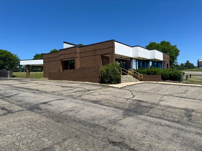
Property Record
21211 Haggerty Rd, Novi, MI 48375


NEARBY LISTINGS FOR SALE OR LEASE
Property Detail
21211 Haggerty Rd
Detroit-Warren-Dearborn, MI
Oakland County Condominium
22-36-477-011
Oakland
Condominium
Michigan
X
1.34 AC
26163C0035E
Central I-96 Corridor
3,062 SF
Detroit
DEMOGRAPHICS near 21211 Haggerty Rd
1 Mile
3 Mile
5 Mile
2024 Total Population
7,819
75,552
176,083
2029 Population
7,679
73,783
171,815
Pop Growth 2024-2029
(1.79%)
(2.34%)
(2.42%)
Average Age
42
42
43
2024 Total Households
3,092
32,919
73,903
HH Growth 2024-2029
(1.84%)
(2.32%)
(2.39%)
Median Household Inc
$111,842
$99,405
$103,411
Avg Household Size
2.50
2.30
2.30
2024 Avg HH Vehicles
2.00
2.00
2.00
Median Home Value
$354,759
$338,833
$328,267
Median Year Built
1980
1981
1980
Nearby Places
Map Layers
Map Styles
 Street
 Aerial
- Restaurants
- Banks
- Shops
- Fitness
- Groceries
PUBLIC TRANSPORTATION
AIRPORT
Detroit Metro Wayne County
DRIVE
WALK
Distance
Detroit Metro Wayne County
27 min
22.4 mi
Windsor International
DRIVE
WALK
Distance
Windsor International
54 min
36.5 mi
Freight Ports
Port of Toledo
DRIVE
WALK
Distance
Port of Toledo
77 min
64.0 mi
SALE & LEASE HISTORY
LISTING DATE
SALE/LEASE

Oct 18, 2021
For Lease
Oct 18, 2021
For Sale
Oct 06, 2022
For Sale
Nov 16, 2023
For Sale
May 14, 2024
For Sale
May 14, 2024
For Lease
Mar 02, 2021
For Sale
Jul 08, 2023
For Lease
Apr 29, 2022
For Lease
Apr 07, 2020
For Lease
Nearby Properties
Address
Land Use
TOTAL SIZE
Lot Size
Zoning
Address
Land Use
TOTAL SIZE
Lot Size
Zoning
1,393,561 SF
123.23 AC
AI
Address
Land Use
TOTAL SIZE
Lot Size
Zoning
886 SF
26.58 AC
GATEWY
Address
Land Use
TOTAL SIZE
Lot Size
Zoning
57.28 AC
RM-1
Address
Land Use
TOTAL SIZE
Lot Size
Zoning
182,121 SF
10.85 AC
HPUD
Address
Land Use
TOTAL SIZE
Lot Size
Zoning
406,560 SF
46.04 AC
AI
Address
Land Use
TOTAL SIZE
Lot Size
Zoning
42.06 AC
RM-1
Address
Land Use
TOTAL SIZE
Lot Size
Zoning
38 AC
RM-1
Address
Land Use
TOTAL SIZE
Lot Size
Zoning
14,463 SF
26.97 AC
TC-1
Address
Land Use
TOTAL SIZE
Lot Size
Zoning
325,281 SF
36.25 AC
AI
Address
Land Use
TOTAL SIZE
Lot Size
Zoning
102,878 SF
10.48 AC
CJ
Address
Land Use
TOTAL SIZE
Lot Size
Zoning
327,206 SF
29.93 AC
AI
Address
Land Use
TOTAL SIZE
Lot Size
Zoning
312,634 SF
20.19 AC
AI
Address
Land Use
TOTAL SIZE
Lot Size
Zoning
289,722 SF
7.34 AC
C-2
Address
Land Use
TOTAL SIZE
Lot Size
Zoning
226,753 SF
27.92 AC
AI
Address
Land Use
TOTAL SIZE
Lot Size
Zoning
228,748 SF
25.06 AC
AI
Address
Land Use
TOTAL SIZE
Lot Size
Zoning
30.32 AC
RM-1
Address
Land Use
TOTAL SIZE
Lot Size
Zoning
5,339 SF
20.10 AC
R-3
Address
Land Use
TOTAL SIZE
Lot Size
Zoning
Address
Land Use
TOTAL SIZE
Lot Size
Zoning
214,242 SF
22.40 AC
AI
Address
Land Use
TOTAL SIZE
Lot Size
Zoning
264,994 SF
19.75 AC
AI
Address
Land Use
TOTAL SIZE
Lot Size
Zoning
730,656 SF
13.73 AC
C-4
Address
Land Use
TOTAL SIZE
Lot Size
Zoning
206,496 SF
12.72 AC
PO
Address
Land Use
TOTAL SIZE
Lot Size
Zoning
25.93 AC
RM-1
Address
Land Use
TOTAL SIZE
Lot Size
Zoning
218,690 SF
10.02 AC
AI
Address
Land Use
TOTAL SIZE
Lot Size
Zoning
80,574 SF
19.95 AC
7MIPUD
Address
Land Use
TOTAL SIZE
Lot Size
Zoning
186,465 SF
18.54 AC
AI
Address
Land Use
TOTAL SIZE
Lot Size
Zoning
146,397 SF
10.59 AC
AI
Address
Land Use
TOTAL SIZE
Lot Size
Zoning
9,706 SF
40.41 AC
RM-1
Address
Land Use
TOTAL SIZE
Lot Size
Zoning
129,448 SF
9.37 AC
OSC
Address
Land Use
TOTAL SIZE
Lot Size
Zoning
6,984 SF
9.77 AC
RM-2
The World's #1 Commercial Real Estate Marketplace
Connect with us
© 2025 CoStar Group
The information above has been obtained from sources believed reliable. While we do not doubt its accuracy we have not verified it and make no guarantee, warranty or representation about it. It is your responsibility to independently confirm its accuracy and completeness. Any projections, opinions, assumptions, or estimates used are for example only and do not represent the current or future performance of the property. The value of this transaction to you depends on tax and other factors which should be evaluated by your tax, financial, and legal advisors. You and your advisors should conduct a careful, independent investigation of the property to determine to your satisfaction the suitability of the property for your needs.