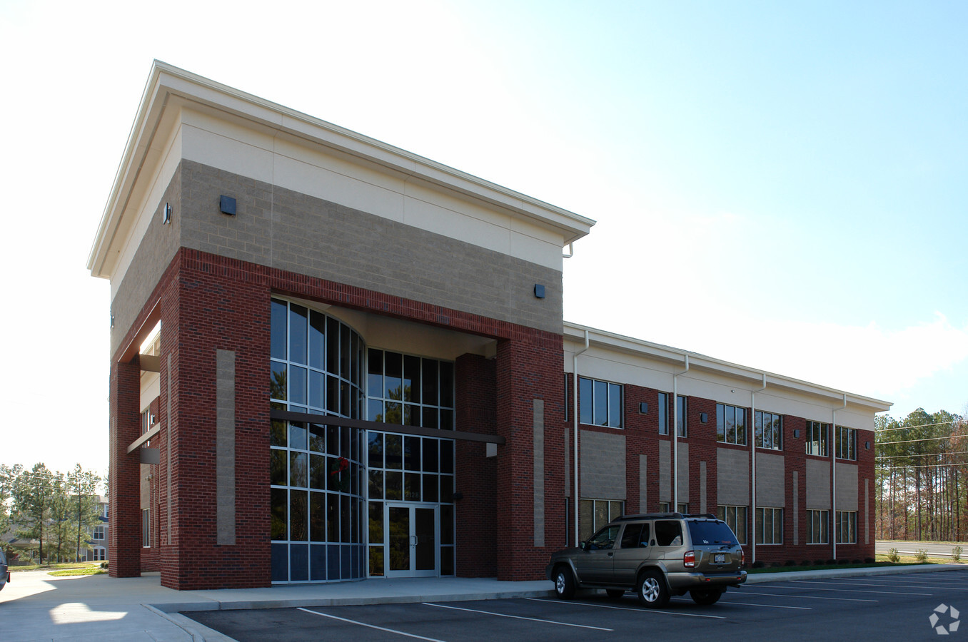
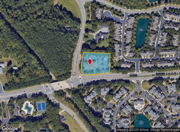
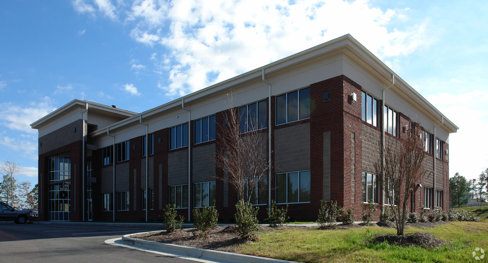
Property Record
2128 High House Rd, Cary, NC 27519
NEARBY LISTINGS FOR SALE OR LEASE
Property Detail
2128 High House Rd
Raleigh, NC
Prop Advantage Group Realty Iv Llc
0744.03-22-5423-000
PROP ADVANTAGE GROUP REALTY IV LLC BM2007-01152
Officebuilding
Wake
X
North Carolina
3720074400K
13
2024
1.62 AC
2024
Cary
053604
Raleigh/Durham
15,150 SF
DEMOGRAPHICS near 2128 High House Rd
1 Mile
3 Mile
5 Mile
2024 Total Population
10,676
83,990
213,819
2029 Population
11,470
91,138
233,019
Pop Growth 2024-2029
+ 7.44%
+ 8.51%
+ 8.98%
Average Age
40
38
38
2024 Total Households
3,643
30,002
79,592
HH Growth 2024-2029
+ 7.41%
+ 8.42%
+ 8.98%
Median Household Inc
$164,035
$141,980
$122,308
Avg Household Size
2.90
2.80
2.70
2024 Avg HH Vehicles
2.00
2.00
2.00
Median Home Value
$499,165
$471,753
$444,832
Median Year Built
1998
1999
2001
Nearby Places
- Restaurants
- Banks
- Shops
- Fitness
- Groceries
PUBLIC TRANSPORTATION
COMMUTER RAIL
Cary Station (Piedmont - North Carolina by Train (NC Train))
DRIVE
WALK
Distance
Cary Station (Piedmont - North Carolina by Train (NC Train))
9 min
4.7 mi
AIRPORT
Raleigh-Durham International
DRIVE
WALK
Distance
Raleigh-Durham International
18 min
9.0 mi
Freight Ports
Port of Wilmington
DRIVE
WALK
Distance
Port of Wilmington
171 min
145.1 mi
SALE & LEASE HISTORY
LISTING DATE
SALE/LEASE

Aug 28, 2018
For Lease
Apr 10, 2018
For Lease
Nearby Properties
Address
Land Use
TOTAL SIZE
Lot Size
Zoning
Address
Land Use
TOTAL SIZE
Lot Size
Zoning
517,812 SF
18.51 AC
RMFP
Address
Land Use
TOTAL SIZE
Lot Size
Zoning
534,604 SF
16.38 AC
RMFM
Address
Land Use
TOTAL SIZE
Lot Size
Zoning
318,890 SF
86.86 AC
R40
Address
Land Use
TOTAL SIZE
Lot Size
Zoning
375,689 SF
32.73 AC
HDR
Address
Land Use
TOTAL SIZE
Lot Size
Zoning
453,970 SF
41.48 AC
RMF-C
Address
Land Use
TOTAL SIZE
Lot Size
Zoning
368,195 SF
32.11 AC
HDR
Address
Land Use
TOTAL SIZE
Lot Size
Zoning
358,853 SF
16.94 AC
RMFP
Address
Land Use
TOTAL SIZE
Lot Size
Zoning
444,236 SF
8.51 AC
ORDP
Address
Land Use
TOTAL SIZE
Lot Size
Zoning
273,637 SF
19.57 AC
C-NAC
Address
Land Use
TOTAL SIZE
Lot Size
Zoning
408,968 SF
32.58 AC
HDR
Address
Land Use
TOTAL SIZE
Lot Size
Zoning
323,036 SF
30.09 AC
RMF-C
Address
Land Use
TOTAL SIZE
Lot Size
Zoning
263,023 SF
72.48 AC
R40
Address
Land Use
TOTAL SIZE
Lot Size
Zoning
394,181 SF
28.62 AC
HDR
Address
Land Use
TOTAL SIZE
Lot Size
Zoning
294,088 SF
24.72 AC
RMF-C
Address
Land Use
TOTAL SIZE
Lot Size
Zoning
313,623 SF
23.92 AC
HD MF
Address
Land Use
TOTAL SIZE
Lot Size
Zoning
285,822 SF
24.57 AC
RMFP
Address
Land Use
TOTAL SIZE
Lot Size
Zoning
287,626 SF
14.61 AC
MUPD
Address
Land Use
TOTAL SIZE
Lot Size
Zoning
364,972 SF
35.18 AC
RMF-C
Address
Land Use
TOTAL SIZE
Lot Size
Zoning
282,961 SF
5.59 AC
GCP
Address
Land Use
TOTAL SIZE
Lot Size
Zoning
301,891 SF
53.55 AC
R40
Address
Land Use
TOTAL SIZE
Lot Size
Zoning
198,055 SF
16.62 AC
TRM
Address
Land Use
TOTAL SIZE
Lot Size
Zoning
290,381 SF
17.41 AC
RMFM
Address
Land Use
TOTAL SIZE
Lot Size
Zoning
236,374 SF
20.53 AC
HDR
Address
Land Use
TOTAL SIZE
Lot Size
Zoning
194,635 SF
13.92 AC
GCM
Address
Land Use
TOTAL SIZE
Lot Size
Zoning
190,473 SF
6.46 AC
GCP
Address
Land Use
TOTAL SIZE
Lot Size
Zoning
252,361 SF
10.59 AC
CAC
Address
Land Use
TOTAL SIZE
Lot Size
Zoning
209,936 SF
55.26 AC
R8
Address
Land Use
TOTAL SIZE
Lot Size
Zoning
145,001 SF
20.31 AC
PC-CZ
Address
Land Use
TOTAL SIZE
Lot Size
Zoning
191,865 SF
8.12 AC
NAC
Address
Land Use
TOTAL SIZE
Lot Size
Zoning
198,911 SF
39.70 AC
MUPD
The World's #1 Commercial Real Estate Marketplace
Connect with us
© 2025 CoStar Group
The information above has been obtained from sources believed reliable. While we do not doubt its accuracy we have not verified it and make no guarantee, warranty or representation about it. It is your responsibility to independently confirm its accuracy and completeness. Any projections, opinions, assumptions, or estimates used are for example only and do not represent the current or future performance of the property. The value of this transaction to you depends on tax and other factors which should be evaluated by your tax, financial, and legal advisors. You and your advisors should conduct a careful, independent investigation of the property to determine to your satisfaction the suitability of the property for your needs.