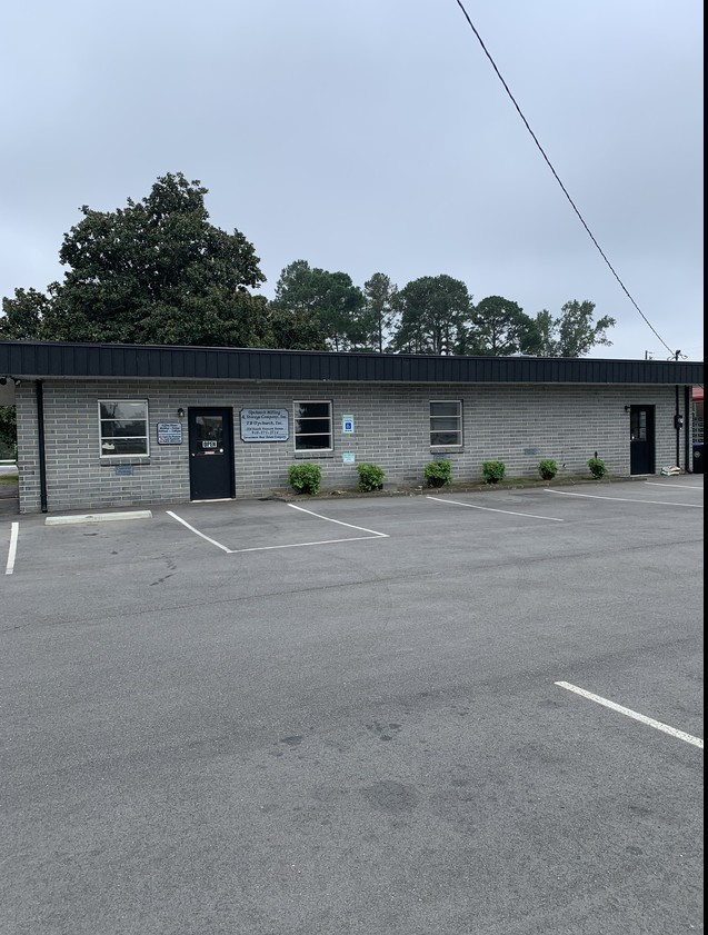
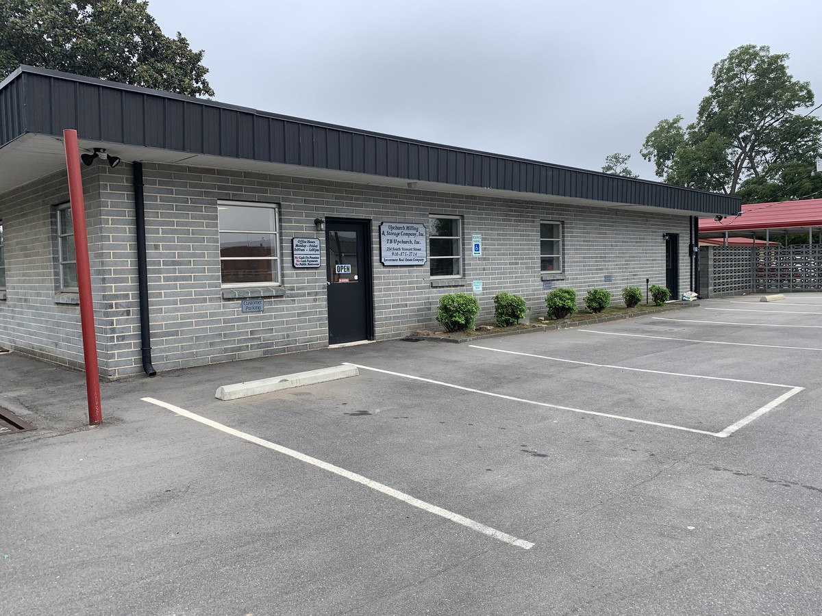
Property Record
214 S Stewart St, Raeford, NC 28376
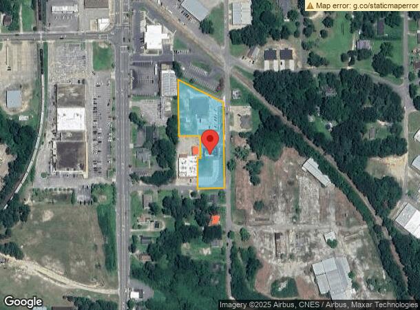
NEARBY LISTINGS FOR SALE OR LEASE
Property Detail
214 S Stewart St
694341001104
PARCELS #104,105,106 #NAME #NAME NEW MEDICAL OFFICE BLDG FOR 23
Officebuilding
Hoke
X
North Carolina
3710943400J
1.66 AC
2024
Raeford
2024
Fayetteville
970300
Fayetteville, NC
1,920 SF
DEMOGRAPHICS near 214 S Stewart St
1 Mile
3 Mile
5 Mile
2024 Total Population
3,371
10,496
20,853
2029 Population
3,665
11,454
22,682
Pop Growth 2024-2029
+ 8.72%
+ 9.13%
+ 8.77%
Average Age
41
38
37
2024 Total Households
1,334
3,917
7,530
HH Growth 2024-2029
+ 8.70%
+ 9.01%
+ 8.63%
Median Household Inc
$34,102
$37,247
$41,353
Avg Household Size
2.30
2.60
2.70
2024 Avg HH Vehicles
2.00
2.00
2.00
Median Home Value
$134,843
$142,557
$144,827
Median Year Built
1970
1986
1993
Nearby Places
- Restaurants
- Banks
- Shops
- Fitness
- Groceries
PUBLIC TRANSPORTATION
AIRPORT
Fayetteville Regional/Grannis Field
DRIVE
WALK
Distance
Fayetteville Regional/Grannis Field
37 min
24.2 mi
Freight Ports
Port of Wilmington
DRIVE
WALK
Distance
Port of Wilmington
146 min
99.7 mi
SALE & LEASE HISTORY
LISTING DATE
SALE/LEASE

Sep 27, 2019
For Sale
Nearby Properties
Address
Land Use
TOTAL SIZE
Lot Size
Zoning
Address
Land Use
TOTAL SIZE
Lot Size
Zoning
127,085 SF
11.18 AC
Address
Land Use
TOTAL SIZE
Lot Size
Zoning
27,376 SF
60.37 AC
Address
Land Use
TOTAL SIZE
Lot Size
Zoning
393,812 SF
54.94 AC
Address
Land Use
TOTAL SIZE
Lot Size
Zoning
235,275 SF
52.78 AC
Address
Land Use
TOTAL SIZE
Lot Size
Zoning
94,234 SF
22.80 AC
Address
Land Use
TOTAL SIZE
Lot Size
Zoning
3,638 SF
1.86 AC
Address
Land Use
TOTAL SIZE
Lot Size
Zoning
20,265 SF
20.04 AC
Address
Land Use
TOTAL SIZE
Lot Size
Zoning
38,504 SF
14.18 AC
Address
Land Use
TOTAL SIZE
Lot Size
Zoning
662,780 SF
81.32 AC
Address
Land Use
TOTAL SIZE
Lot Size
Zoning
34,563 SF
17.79 AC
Address
Land Use
TOTAL SIZE
Lot Size
Zoning
43.64 AC
Address
Land Use
TOTAL SIZE
Lot Size
Zoning
25,640 SF
14.81 AC
Address
Land Use
TOTAL SIZE
Lot Size
Zoning
20,212 SF
0.98 AC
Address
Land Use
TOTAL SIZE
Lot Size
Zoning
85.20 AC
Address
Land Use
TOTAL SIZE
Lot Size
Zoning
76,774 SF
8.76 AC
Address
Land Use
TOTAL SIZE
Lot Size
Zoning
30,675 SF
4.40 AC
Address
Land Use
TOTAL SIZE
Lot Size
Zoning
4,960 SF
10.20 AC
Address
Land Use
TOTAL SIZE
Lot Size
Zoning
42,947 SF
3.86 AC
Address
Land Use
TOTAL SIZE
Lot Size
Zoning
10,066 SF
5.10 AC
Address
Land Use
TOTAL SIZE
Lot Size
Zoning
Address
Land Use
TOTAL SIZE
Lot Size
Zoning
18,158 SF
1.28 AC
Address
Land Use
TOTAL SIZE
Lot Size
Zoning
33,599 SF
1.38 AC
Address
Land Use
TOTAL SIZE
Lot Size
Zoning
20.69 AC
Address
Land Use
TOTAL SIZE
Lot Size
Zoning
26,861 SF
1.56 AC
Address
Land Use
TOTAL SIZE
Lot Size
Zoning
28.61 AC
Address
Land Use
TOTAL SIZE
Lot Size
Zoning
5,000 SF
2.91 AC
Address
Land Use
TOTAL SIZE
Lot Size
Zoning
24,000 SF
18.55 AC
Address
Land Use
TOTAL SIZE
Lot Size
Zoning
18,828 SF
2.74 AC
Address
Land Use
TOTAL SIZE
Lot Size
Zoning
14.18 AC
Address
Land Use
TOTAL SIZE
Lot Size
Zoning
20,236 SF
4.99 AC
The World's #1 Commercial Real Estate Marketplace
Connect with us
© 2025 CoStar Group
The information above has been obtained from sources believed reliable. While we do not doubt its accuracy we have not verified it and make no guarantee, warranty or representation about it. It is your responsibility to independently confirm its accuracy and completeness. Any projections, opinions, assumptions, or estimates used are for example only and do not represent the current or future performance of the property. The value of this transaction to you depends on tax and other factors which should be evaluated by your tax, financial, and legal advisors. You and your advisors should conduct a careful, independent investigation of the property to determine to your satisfaction the suitability of the property for your needs.