Property Record
215 Environmental Way, Seagoville, TX 75159

NEARBY LISTINGS FOR SALE OR LEASE
Property Detail
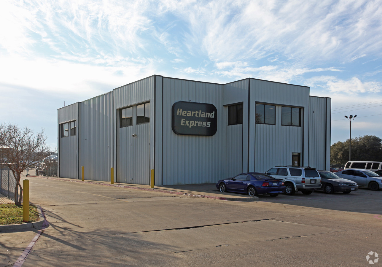
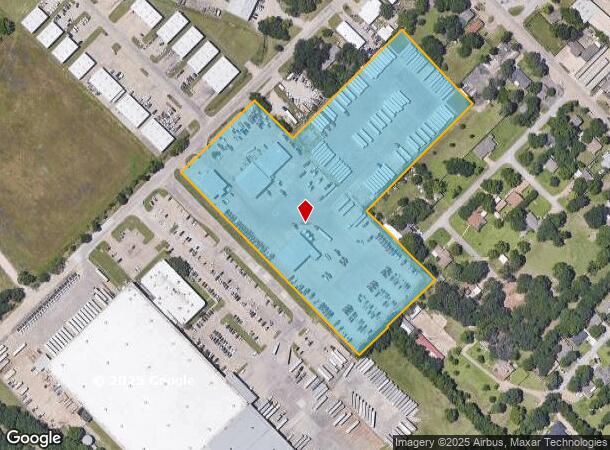
215 Environmental Way
Dallas-Fort Worth-Arlington, TX
Heartland Express
500195600101R0000
HEARTLAND EXPRESS BLK A LT 1R ACS 10.5894 INT202200205591 DD07272022 CO-DC 0195600101R00 4CJ01893851
Warehouse
Dallas
X
Texas
48257C0150E
1r
2023
10.59 AC
2023
SE Dallas/I-45
017006
Dallas/Ft Worth
25,380 SF
DEMOGRAPHICS near 215 Environmental Way
1 Mile
3 Mile
5 Mile
2024 Total Population
7,318
29,992
58,051
2029 Population
7,416
30,166
58,747
Pop Growth 2024-2029
+ 1.34%
+ 0.58%
+ 1.20%
Average Age
38
34
33
2024 Total Households
1,872
8,216
16,211
HH Growth 2024-2029
+ 1.87%
+ 0.45%
+ 1.15%
Median Household Inc
$44,999
$52,208
$53,236
Avg Household Size
3.00
3.30
3.40
2024 Avg HH Vehicles
2.00
2.00
2.00
Median Home Value
$171,373
$180,422
$180,793
Median Year Built
1988
1998
1998
Nearby Places
- Restaurants
- Banks
- Shops
- Fitness
- Groceries
PUBLIC TRANSPORTATION
AIRPORT
Dallas Love Field
DRIVE
WALK
Distance
Dallas Love Field
34 min
23.5 mi
Freight Ports
Port of Shreveport
DRIVE
WALK
Distance
Port of Shreveport
199 min
183.6 mi
SALE & LEASE HISTORY
LISTING DATE
SALE/LEASE

Oct 21, 2020
For Sale
Nearby Properties
Address
Land Use
TOTAL SIZE
Lot Size
Zoning
Address
Land Use
TOTAL SIZE
Lot Size
Zoning
457,110 SF
100.05 AC
Z293
Address
Land Use
TOTAL SIZE
Lot Size
Zoning
386 SF
40.51 AC
MFA
Address
Land Use
TOTAL SIZE
Lot Size
Zoning
106,462 SF
9.58 AC
Z236
Address
Land Use
TOTAL SIZE
Lot Size
Zoning
401 SF
50.76 AC
MFA
Address
Land Use
TOTAL SIZE
Lot Size
Zoning
319 SF
37.74 AC
SUP1
Address
Land Use
TOTAL SIZE
Lot Size
Zoning
377,133 SF
16.71 AC
Z131
Address
Land Use
TOTAL SIZE
Lot Size
Zoning
172,068 SF
17.25 AC
Z137
Address
Land Use
TOTAL SIZE
Lot Size
Zoning
88,320 SF
4.48 AC
Z72
Address
Land Use
TOTAL SIZE
Lot Size
Zoning
97 SF
14.18 AC
I2
Address
Land Use
TOTAL SIZE
Lot Size
Zoning
65,577 SF
11.80 AC
Z31
Address
Land Use
TOTAL SIZE
Lot Size
Zoning
108 SF
14.44 AC
Z31
Address
Land Use
TOTAL SIZE
Lot Size
Zoning
75,908 SF
11.11 AC
Z308
Address
Land Use
TOTAL SIZE
Lot Size
Zoning
28,126 SF
166.45 AC
Z05
Address
Land Use
TOTAL SIZE
Lot Size
Zoning
92 SF
11.39 AC
SUP12
Address
Land Use
TOTAL SIZE
Lot Size
Zoning
83,266 SF
6.73 AC
Z131
Address
Land Use
TOTAL SIZE
Lot Size
Zoning
8 AC
MFA
Address
Land Use
TOTAL SIZE
Lot Size
Zoning
51,770 SF
7.61 AC
Z31
Address
Land Use
TOTAL SIZE
Lot Size
Zoning
85 SF
9.99 AC
MFA
Address
Land Use
TOTAL SIZE
Lot Size
Zoning
94,615 SF
3.34 AC
Z399
Address
Land Use
TOTAL SIZE
Lot Size
Zoning
19,670 SF
1.95 AC
Z137
Address
Land Use
TOTAL SIZE
Lot Size
Zoning
40,360 SF
4.16 AC
Z31
Address
Land Use
TOTAL SIZE
Lot Size
Zoning
114 SF
17.69 AC
AA
Address
Land Use
TOTAL SIZE
Lot Size
Zoning
100,200 SF
6.93 AC
Z05
Address
Land Use
TOTAL SIZE
Lot Size
Zoning
750 SF
115.63 AC
Z31
Address
Land Use
TOTAL SIZE
Lot Size
Zoning
750 SF
115.63 AC
Z31
Address
Land Use
TOTAL SIZE
Lot Size
Zoning
0.01 AC
Z306
Address
Land Use
TOTAL SIZE
Lot Size
Zoning
22,870 SF
1.14 AC
Z31
Address
Land Use
TOTAL SIZE
Lot Size
Zoning
64,420 SF
8.91 AC
Z131
Address
Land Use
TOTAL SIZE
Lot Size
Zoning
50,872 SF
4.99 AC
Z137
Address
Land Use
TOTAL SIZE
Lot Size
Zoning
41,865 SF
20.04 AC
Z308
The World's #1 Commercial Real Estate Marketplace
Connect with us
© 2025 CoStar Group
The information above has been obtained from sources believed reliable. While we do not doubt its accuracy we have not verified it and make no guarantee, warranty or representation about it. It is your responsibility to independently confirm its accuracy and completeness. Any projections, opinions, assumptions, or estimates used are for example only and do not represent the current or future performance of the property. The value of this transaction to you depends on tax and other factors which should be evaluated by your tax, financial, and legal advisors. You and your advisors should conduct a careful, independent investigation of the property to determine to your satisfaction the suitability of the property for your needs.