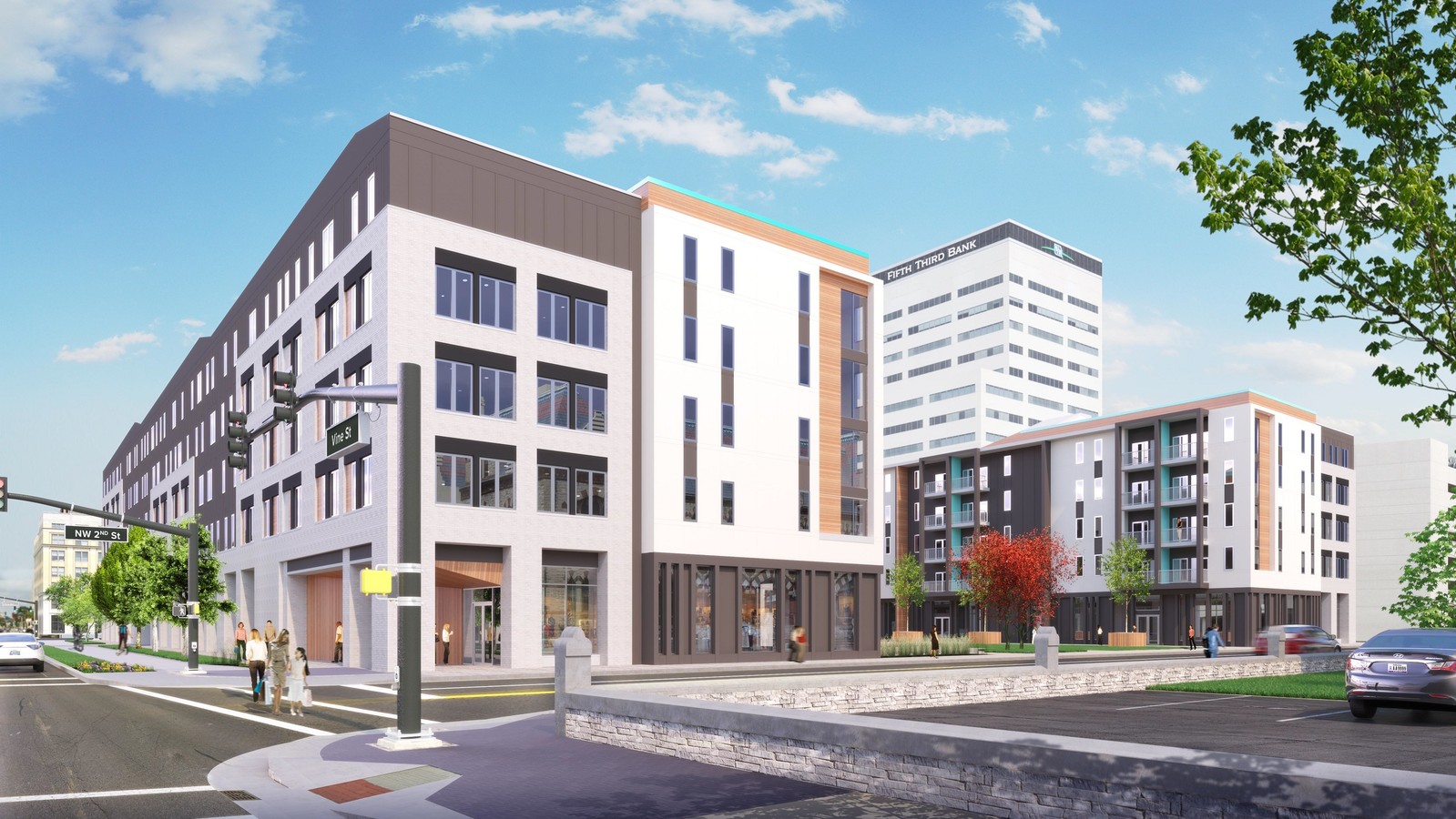
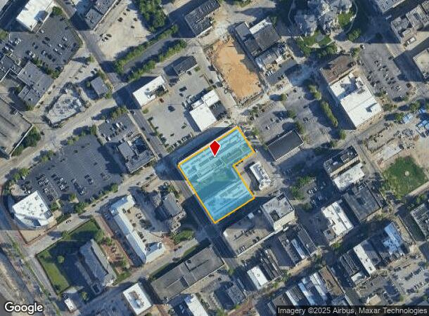
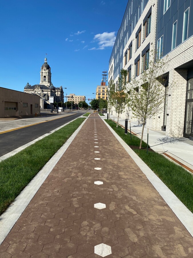
Property Record
215 Vine St, Evansville, IN 47708
NEARBY LISTINGS FOR SALE OR LEASE
Property Detail
215 Vine St
82-06-30-020-113.001-029
Post House
Apartment
POST HOUSE LT 1
X
Vanderburgh
21101C0080F
Indiana
2023
1.74 AC
2023
Downtown Evansville
001800
Evansville
117,580 SF
Evansville, IN-KY
DEMOGRAPHICS near 215 Vine St
1 Mile
3 Mile
5 Mile
2024 Total Population
7,517
66,487
120,766
2029 Population
7,838
67,568
121,520
Pop Growth 2024-2029
+ 4.27%
+ 1.63%
+ 0.62%
Average Age
41
39
40
2024 Total Households
3,670
28,790
52,837
HH Growth 2024-2029
+ 4.77%
+ 1.67%
+ 0.62%
Median Household Inc
$35,044
$43,529
$47,688
Avg Household Size
1.80
2.20
2.20
2024 Avg HH Vehicles
1.00
2.00
2.00
Median Home Value
$133,645
$83,419
$113,643
Median Year Built
1952
1949
1958
Nearby Places
- Restaurants
- Banks
- Shops
- Fitness
- Groceries
PUBLIC TRANSPORTATION
AIRPORT
Evansville Regional
DRIVE
WALK
Distance
Evansville Regional
13 min
6.5 mi
Freight Ports
Port of Toledo
DRIVE
WALK
Distance
Port of Toledo
461 min
395.7 mi
SALE & LEASE HISTORY
LISTING DATE
SALE/LEASE

Jul 17, 2019
For Lease
Nearby Properties
Address
Land Use
TOTAL SIZE
Lot Size
Zoning
Address
Land Use
TOTAL SIZE
Lot Size
Zoning
84,660 SF
12.95 AC
Address
Land Use
TOTAL SIZE
Lot Size
Zoning
20,964 SF
1.35 AC
Address
Land Use
TOTAL SIZE
Lot Size
Zoning
15,233 SF
3.31 AC
Address
Land Use
TOTAL SIZE
Lot Size
Zoning
51,342 SF
4.42 AC
Address
Land Use
TOTAL SIZE
Lot Size
Zoning
21,831 SF
3.03 AC
Address
Land Use
TOTAL SIZE
Lot Size
Zoning
165,472 SF
1.38 AC
Address
Land Use
TOTAL SIZE
Lot Size
Zoning
23,108 SF
2.92 AC
Address
Land Use
TOTAL SIZE
Lot Size
Zoning
92,132 SF
1.68 AC
Address
Land Use
TOTAL SIZE
Lot Size
Zoning
223,202 SF
2.28 AC
Address
Land Use
TOTAL SIZE
Lot Size
Zoning
784,971 SF
15.37 AC
Address
Land Use
TOTAL SIZE
Lot Size
Zoning
13,182 SF
25.33 AC
Address
Land Use
TOTAL SIZE
Lot Size
Zoning
20,286 SF
4.57 AC
Address
Land Use
TOTAL SIZE
Lot Size
Zoning
87,099 SF
2.28 AC
Address
Land Use
TOTAL SIZE
Lot Size
Zoning
25,595 SF
14.99 AC
Address
Land Use
TOTAL SIZE
Lot Size
Zoning
82,488 SF
1.90 AC
8
Address
Land Use
TOTAL SIZE
Lot Size
Zoning
61,652 SF
15.02 AC
Address
Land Use
TOTAL SIZE
Lot Size
Zoning
331,588 SF
0.96 AC
Address
Land Use
TOTAL SIZE
Lot Size
Zoning
4,160 SF
9.22 AC
Address
Land Use
TOTAL SIZE
Lot Size
Zoning
8,920 SF
2.62 AC
Address
Land Use
TOTAL SIZE
Lot Size
Zoning
11,286 SF
4.07 AC
Address
Land Use
TOTAL SIZE
Lot Size
Zoning
75,109 SF
1.64 AC
Address
Land Use
TOTAL SIZE
Lot Size
Zoning
94,551 SF
6.12 AC
Address
Land Use
TOTAL SIZE
Lot Size
Zoning
4,284 SF
13.14 AC
Address
Land Use
TOTAL SIZE
Lot Size
Zoning
229,140 SF
1.03 AC
Address
Land Use
TOTAL SIZE
Lot Size
Zoning
150,102 SF
20.72 AC
Address
Land Use
TOTAL SIZE
Lot Size
Zoning
185,563 SF
12.47 AC
Address
Land Use
TOTAL SIZE
Lot Size
Zoning
1,800 SF
28.13 AC
Address
Land Use
TOTAL SIZE
Lot Size
Zoning
57,240 SF
1.79 AC
Address
Land Use
TOTAL SIZE
Lot Size
Zoning
69,144 SF
3.28 AC
The World's #1 Commercial Real Estate Marketplace
Connect with us
© 2025 CoStar Group
The information above has been obtained from sources believed reliable. While we do not doubt its accuracy we have not verified it and make no guarantee, warranty or representation about it. It is your responsibility to independently confirm its accuracy and completeness. Any projections, opinions, assumptions, or estimates used are for example only and do not represent the current or future performance of the property. The value of this transaction to you depends on tax and other factors which should be evaluated by your tax, financial, and legal advisors. You and your advisors should conduct a careful, independent investigation of the property to determine to your satisfaction the suitability of the property for your needs.