Property Record
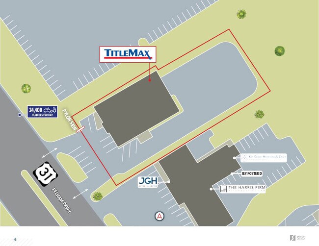
2151 Pelham Pky, Pelham, AL 35124


NEARBY LISTINGS FOR SALE OR LEASE
Property Detail
2151 Pelham Pky
10-9-31-2-001-022-000
BEG PT ON E LN US#31 N810(S) E970(S) FROM SW COR OF NW1/4 NWLY104.71 NELY250 SELY104.71 SWLY250 TO POB ALSO: BEG 655 SE OF INT S ROW PARKVIEW RD & E ROW US HWY #31 NE132 SE5 SW132 NW5 TO POB
Storebuilding
Shelby
X
Alabama
01117C0208F
0.62 AC
2024
I-65 Corr/S Shelby County
2024
Birmingham
030315
Birmingham-Hoover, AL
5,700 SF
DEMOGRAPHICS near 2151 Pelham Pky
1 Mile
3 Mile
5 Mile
2024 Total Population
6,743
37,579
90,591
2029 Population
7,651
39,373
93,251
Pop Growth 2024-2029
+ 13.47%
+ 4.77%
+ 2.94%
Average Age
37
39
40
2024 Total Households
2,595
15,844
36,411
HH Growth 2024-2029
+ 12.83%
+ 4.13%
+ 2.57%
Median Household Inc
$64,121
$70,581
$83,187
Avg Household Size
2.50
2.30
2.40
2024 Avg HH Vehicles
2.00
2.00
2.00
Median Home Value
$205,033
$274,537
$296,227
Median Year Built
1994
1990
1989
Nearby Places
Map Layers
Map Styles
 Street
 Aerial
- Restaurants
- Banks
- Shops
- Fitness
- Groceries
PUBLIC TRANSPORTATION
AIRPORT
Birmingham-Shuttlesworth International
DRIVE
WALK
Distance
Birmingham-Shuttlesworth International
28 min
20.1 mi
Freight Ports
Port of Mobile
DRIVE
WALK
Distance
Port of Mobile
264 min
242.9 mi
SALE & LEASE HISTORY
LISTING DATE
SALE/LEASE

Sep 23, 2016
For Sale
Sep 01, 2022
For Sale
Nearby Properties
Address
Land Use
TOTAL SIZE
Lot Size
Zoning
Address
Land Use
TOTAL SIZE
Lot Size
Zoning
515,818 SF
38 AC
CP
Address
Land Use
TOTAL SIZE
Lot Size
Zoning
501,099 SF
33 AC
PO
Address
Land Use
TOTAL SIZE
Lot Size
Zoning
1,008,008 SF
73.91 AC
R4
Address
Land Use
TOTAL SIZE
Lot Size
Zoning
745,655 SF
16 AC
C-1
Address
Land Use
TOTAL SIZE
Lot Size
Zoning
Address
Land Use
TOTAL SIZE
Lot Size
Zoning
333,513 SF
40.80 AC
C2
Address
Land Use
TOTAL SIZE
Lot Size
Zoning
442,000 SF
36.44 AC
Address
Land Use
TOTAL SIZE
Lot Size
Zoning
267,122 SF
26 AC
PC
Address
Land Use
TOTAL SIZE
Lot Size
Zoning
582,638 SF
43.76 AC
PUDP
Address
Land Use
TOTAL SIZE
Lot Size
Zoning
80,269 SF
2.50 AC
C-1
Address
Land Use
TOTAL SIZE
Lot Size
Zoning
12,200 SF
28.77 AC
Address
Land Use
TOTAL SIZE
Lot Size
Zoning
69,151 SF
4.90 AC
PC
Address
Land Use
TOTAL SIZE
Lot Size
Zoning
240,661 SF
53 AC
Address
Land Use
TOTAL SIZE
Lot Size
Zoning
210,033 SF
7.85 AC
Address
Land Use
TOTAL SIZE
Lot Size
Zoning
186,953 SF
20 AC
PR2
Address
Land Use
TOTAL SIZE
Lot Size
Zoning
2,199 SF
23 AC
Address
Land Use
TOTAL SIZE
Lot Size
Zoning
237,921 SF
6.35 AC
PUDP
Address
Land Use
TOTAL SIZE
Lot Size
Zoning
18,781 SF
12.09 AC
Address
Land Use
TOTAL SIZE
Lot Size
Zoning
41,980 SF
26.70 AC
PC
Address
Land Use
TOTAL SIZE
Lot Size
Zoning
241,232 SF
15.01 AC
PR2
Address
Land Use
TOTAL SIZE
Lot Size
Zoning
94,094 SF
14.40 AC
PO-P
Address
Land Use
TOTAL SIZE
Lot Size
Zoning
446,170 SF
18.93 AC
PR2
Address
Land Use
TOTAL SIZE
Lot Size
Zoning
165,474 SF
90 AC
PR2
Address
Land Use
TOTAL SIZE
Lot Size
Zoning
160,443 SF
23 AC
C-2
Address
Land Use
TOTAL SIZE
Lot Size
Zoning
238,304 SF
18.90 AC
PR-2
Address
Land Use
TOTAL SIZE
Lot Size
Zoning
200,679 SF
20 AC
PR2
Address
Land Use
TOTAL SIZE
Lot Size
Zoning
176,949 SF
19 AC
PC
Address
Land Use
TOTAL SIZE
Lot Size
Zoning
2,792 SF
15 AC
Address
Land Use
TOTAL SIZE
Lot Size
Zoning
224,746 SF
46 AC
C2
Address
Land Use
TOTAL SIZE
Lot Size
Zoning
191,623 SF
19.93 AC
R4
The World's #1 Commercial Real Estate Marketplace
Connect with us
© 2025 CoStar Group
The information above has been obtained from sources believed reliable. While we do not doubt its accuracy we have not verified it and make no guarantee, warranty or representation about it. It is your responsibility to independently confirm its accuracy and completeness. Any projections, opinions, assumptions, or estimates used are for example only and do not represent the current or future performance of the property. The value of this transaction to you depends on tax and other factors which should be evaluated by your tax, financial, and legal advisors. You and your advisors should conduct a careful, independent investigation of the property to determine to your satisfaction the suitability of the property for your needs.