Property Record
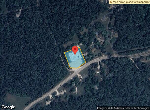
2155 Highway 100, Labadie, MO 63055
NEARBY LISTINGS FOR SALE OR LEASE
-
-
View all Labadie listings for sale on LoopNet.com
Property Detail
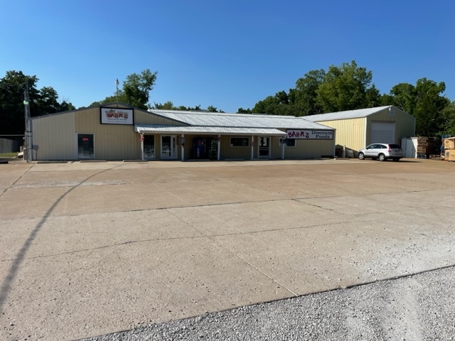
2155 Highway 100
08-8-340-0-000-015000
BAHR'S DISCOUNT FOODS PT SW 1/4 OF SW 1/4 NW OF HWY 100
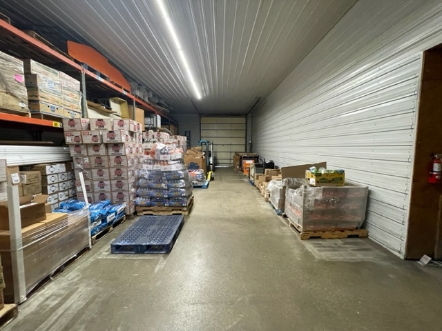
Supermarket
Franklin
X
Missouri
29071C0195E
1 AC
2024
Franklin County
2024
St. Louis
800101
St. Louis, MO-IL
13,666 SF
DEMOGRAPHICS near 2155 Highway 100
1 Mile
3 Mile
5 Mile
2024 Total Population
967
9,039
15,472
2029 Population
983
9,269
15,871
Pop Growth 2024-2029
+ 1.65%
+ 2.54%
+ 2.58%
Average Age
41
41
42
2024 Total Households
373
3,695
6,185
HH Growth 2024-2029
+ 1.61%
+ 2.57%
+ 2.59%
Median Household Inc
$77,333
$64,252
$68,131
Avg Household Size
2.60
2.40
2.50
2024 Avg HH Vehicles
2.00
2.00
2.00
Median Home Value
$148,750
$199,088
$238,227
Median Year Built
1985
1985
1986
Nearby Places
- Restaurants
- Banks
- Shops
- Fitness
- Groceries
PUBLIC TRANSPORTATION
AIRPORT
St Louis Lambert International
DRIVE
WALK
Distance
St Louis Lambert International
58 min
39.7 mi
Freight Ports
Tulsa Port of Inola
DRIVE
WALK
Distance
Tulsa Port of Inola
382 min
348.8 mi
Nearby Properties
Address
Land Use
TOTAL SIZE
Lot Size
Zoning
Address
Land Use
TOTAL SIZE
Lot Size
Zoning
239,954 SF
59.50 AC
Address
Land Use
TOTAL SIZE
Lot Size
Zoning
12.60 AC
Address
Land Use
TOTAL SIZE
Lot Size
Zoning
Address
Land Use
TOTAL SIZE
Lot Size
Zoning
Address
Land Use
TOTAL SIZE
Lot Size
Zoning
17,690 SF
5 AC
Address
Land Use
TOTAL SIZE
Lot Size
Zoning
2,205 SF
80 AC
SD
Address
Land Use
TOTAL SIZE
Lot Size
Zoning
9,982 SF
1.50 AC
Address
Land Use
TOTAL SIZE
Lot Size
Zoning
1,515 SF
232.80 AC
CD
Address
Land Use
TOTAL SIZE
Lot Size
Zoning
10,126 SF
1.10 AC
Address
Land Use
TOTAL SIZE
Lot Size
Zoning
21,900 SF
2.20 AC
Address
Land Use
TOTAL SIZE
Lot Size
Zoning
13,100 SF
6.10 AC
Address
Land Use
TOTAL SIZE
Lot Size
Zoning
462 SF
239.60 AC
CD
Address
Land Use
TOTAL SIZE
Lot Size
Zoning
206,798 SF
10.60 AC
Address
Land Use
TOTAL SIZE
Lot Size
Zoning
201,013 SF
13.60 AC
Address
Land Use
TOTAL SIZE
Lot Size
Zoning
1,748 SF
491.50 AC
ANU
Address
Land Use
TOTAL SIZE
Lot Size
Zoning
270,948 SF
23.30 AC
Address
Land Use
TOTAL SIZE
Lot Size
Zoning
2,880 SF
9.10 AC
CD
Address
Land Use
TOTAL SIZE
Lot Size
Zoning
25,510 SF
4.30 AC
Address
Land Use
TOTAL SIZE
Lot Size
Zoning
111,677 SF
15 AC
Address
Land Use
TOTAL SIZE
Lot Size
Zoning
9,000 SF
1.70 AC
CD
Address
Land Use
TOTAL SIZE
Lot Size
Zoning
57,940 SF
6.20 AC
Address
Land Use
TOTAL SIZE
Lot Size
Zoning
14,783 SF
1.90 AC
Address
Land Use
TOTAL SIZE
Lot Size
Zoning
10,284 SF
2 AC
CD
Address
Land Use
TOTAL SIZE
Lot Size
Zoning
34,200 SF
2.40 AC
Address
Land Use
TOTAL SIZE
Lot Size
Zoning
8,760 SF
2 AC
CD
Address
Land Use
TOTAL SIZE
Lot Size
Zoning
9,320 SF
3.80 AC
CA
Address
Land Use
TOTAL SIZE
Lot Size
Zoning
12,654 SF
4.70 AC
Address
Land Use
TOTAL SIZE
Lot Size
Zoning
72,320 SF
4.30 AC
Address
Land Use
TOTAL SIZE
Lot Size
Zoning
7,368 SF
0.70 AC
Address
Land Use
TOTAL SIZE
Lot Size
Zoning
8,720 SF
0.70 AC
The World's #1 Commercial Real Estate Marketplace
Connect with us
© 2025 CoStar Group
The information above has been obtained from sources believed reliable. While we do not doubt its accuracy we have not verified it and make no guarantee, warranty or representation about it. It is your responsibility to independently confirm its accuracy and completeness. Any projections, opinions, assumptions, or estimates used are for example only and do not represent the current or future performance of the property. The value of this transaction to you depends on tax and other factors which should be evaluated by your tax, financial, and legal advisors. You and your advisors should conduct a careful, independent investigation of the property to determine to your satisfaction the suitability of the property for your needs.