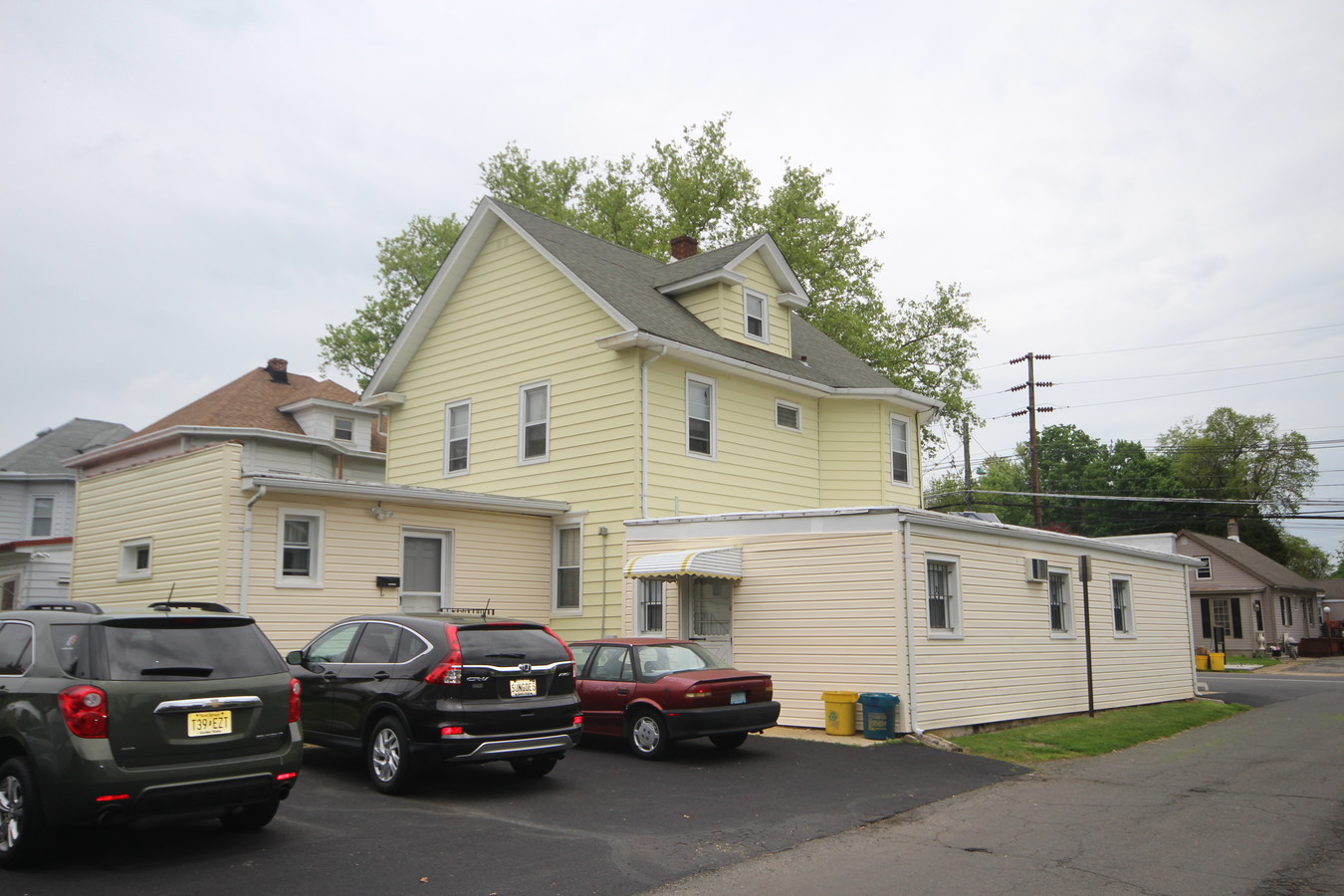
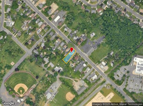
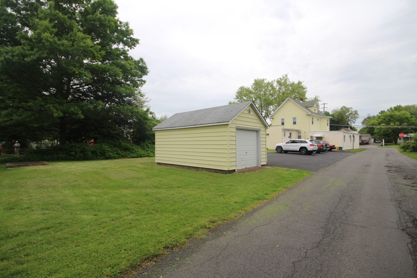
Property Record
4301 S Broad St, Trenton, NJ 08620
NEARBY LISTINGS FOR SALE OR LEASE
Property Detail
4301 S Broad St
03-02640-0000-00007
08251-
Commercialnec
Mercer
X
New Jersey
34005C0041F
7
2023
0.22 AC
2024
Trenton
003003
Northern New Jersey
2,461 SF
Trenton, NJ
DEMOGRAPHICS near 4301 S Broad St
1 Mile
3 Mile
5 Mile
2024 Total Population
8,478
55,561
175,073
2029 Population
8,363
55,337
172,764
Pop Growth 2024-2029
(1.36%)
(0.40%)
(1.32%)
Average Age
45
43
40
2024 Total Households
3,511
21,638
62,360
HH Growth 2024-2029
(1.62%)
(0.62%)
(1.39%)
Median Household Inc
$89,448
$89,167
$81,557
Avg Household Size
2.40
2.40
2.70
2024 Avg HH Vehicles
2.00
2.00
2.00
Median Home Value
$263,742
$272,279
$273,804
Median Year Built
1960
1966
1960
Nearby Places
- Restaurants
- Banks
- Shops
- Fitness
- Groceries
PUBLIC TRANSPORTATION
COMMUTER RAIL
Trenton Transit Center (Njt) (Northeast Corridor Line - NJ Transit Commuter Rail (NJ Transit), R7 - NJ Transit Commuter Rail (NJ Transit), River LINE - NJ Transit Commuter Rail (NJ Transit))
DRIVE
WALK
Distance
Trenton Transit Center (Njt) (Northeast Corridor Line - NJ Transit Commuter Rail (NJ Transit), R7 - NJ Transit Commuter Rail (NJ Transit), River LINE - NJ Transit Commuter Rail (NJ Transit))
12 min
5.6 mi
Hamilton (Northeast Corridor Line - NJ Transit Commuter Rail (NJ Transit))
DRIVE
WALK
Distance
Hamilton (Northeast Corridor Line - NJ Transit Commuter Rail (NJ Transit))
12 min
7.1 mi
AIRPORT
Trenton Mercer
DRIVE
WALK
Distance
Trenton Mercer
21 min
12.0 mi
Freight Ports
Port of Philadelphia
DRIVE
WALK
Distance
Port of Philadelphia
45 min
33.6 mi
SALE & LEASE HISTORY
LISTING DATE
SALE/LEASE

Jun 05, 2019
For Sale
Nearby Properties
Address
Land Use
TOTAL SIZE
Lot Size
Zoning
Address
Land Use
TOTAL SIZE
Lot Size
Zoning
561.91 AC
AG
Address
Land Use
TOTAL SIZE
Lot Size
Zoning
30.94 AC
Address
Land Use
TOTAL SIZE
Lot Size
Zoning
51.10 AC
Address
Land Use
TOTAL SIZE
Lot Size
Zoning
60.26 AC
RD
Address
Land Use
TOTAL SIZE
Lot Size
Zoning
44.82 AC
RD
Address
Land Use
TOTAL SIZE
Lot Size
Zoning
62.02 AC
Address
Land Use
TOTAL SIZE
Lot Size
Zoning
18.33 AC
Address
Land Use
TOTAL SIZE
Lot Size
Zoning
Address
Land Use
TOTAL SIZE
Lot Size
Zoning
32.71 AC
HC
Address
Land Use
TOTAL SIZE
Lot Size
Zoning
1,836 SF
33.91 AC
RD
Address
Land Use
TOTAL SIZE
Lot Size
Zoning
9.63 AC
RD
Address
Land Use
TOTAL SIZE
Lot Size
Zoning
263,232 SF
39.16 AC
CI
Address
Land Use
TOTAL SIZE
Lot Size
Zoning
23.53 AC
AT
Address
Land Use
TOTAL SIZE
Lot Size
Zoning
6.79 AC
R7
Address
Land Use
TOTAL SIZE
Lot Size
Zoning
15.80 AC
C
Address
Land Use
TOTAL SIZE
Lot Size
Zoning
21.62 AC
RD
Address
Land Use
TOTAL SIZE
Lot Size
Zoning
17,500 SF
18.14 AC
HC
Address
Land Use
TOTAL SIZE
Lot Size
Zoning
55.48 AC
RD
Address
Land Use
TOTAL SIZE
Lot Size
Zoning
Address
Land Use
TOTAL SIZE
Lot Size
Zoning
77,722 SF
39.13 AC
Address
Land Use
TOTAL SIZE
Lot Size
Zoning
17.06 AC
RD
Address
Land Use
TOTAL SIZE
Lot Size
Zoning
2.89 AC
RD
Address
Land Use
TOTAL SIZE
Lot Size
Zoning
21.91 AC
R10
Address
Land Use
TOTAL SIZE
Lot Size
Zoning
13.61 AC
AT
Address
Land Use
TOTAL SIZE
Lot Size
Zoning
27.89 AC
C
Address
Land Use
TOTAL SIZE
Lot Size
Zoning
40.24 AC
RD
Address
Land Use
TOTAL SIZE
Lot Size
Zoning
25.32 AC
RD
Address
Land Use
TOTAL SIZE
Lot Size
Zoning
14.16 AC
RD
Address
Land Use
TOTAL SIZE
Lot Size
Zoning
145,427 SF
16.18 AC
RD
Address
Land Use
TOTAL SIZE
Lot Size
Zoning
15,096 SF
21.76 AC
AT
The World's #1 Commercial Real Estate Marketplace
Connect with us
© 2025 CoStar Group
The information above has been obtained from sources believed reliable. While we do not doubt its accuracy we have not verified it and make no guarantee, warranty or representation about it. It is your responsibility to independently confirm its accuracy and completeness. Any projections, opinions, assumptions, or estimates used are for example only and do not represent the current or future performance of the property. The value of this transaction to you depends on tax and other factors which should be evaluated by your tax, financial, and legal advisors. You and your advisors should conduct a careful, independent investigation of the property to determine to your satisfaction the suitability of the property for your needs.