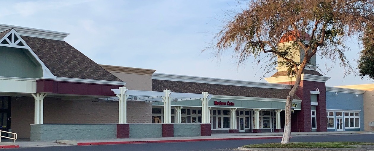
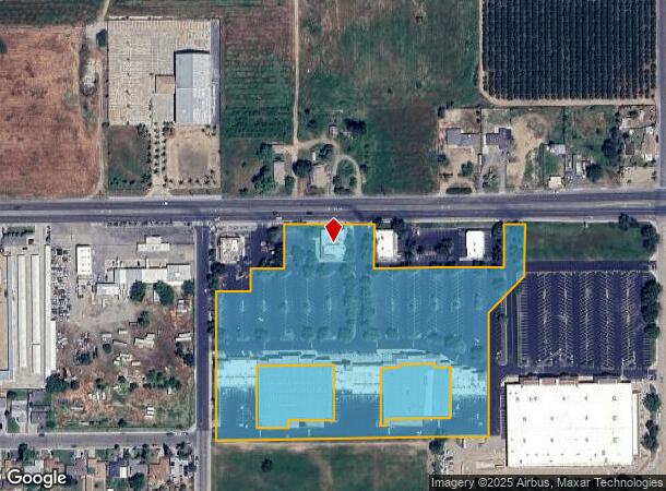
Property Record
2164 E El Monte Way, Dinuba, CA 93618

NEARBY LISTINGS FOR SALE OR LEASE
Property Detail
2164 E El Monte Way
018-180-035-000
POR PARCEL 4 PARCEL MAP 3796 B38 P99 PM
Regionalshoppingcenterormallwithanchorstore
Tulare
X
California
06107C0340E
8.21 AC
2023
Dinuba
2024
Visalia/Porterville
000502
Visalia-Porterville, CA
DEMOGRAPHICS near 2164 E El Monte Way
1 Mile
3 Mile
5 Mile
2024 Total Population
9,720
27,419
45,702
2029 Population
9,983
28,162
46,767
Pop Growth 2024-2029
+ 2.71%
+ 2.71%
+ 2.33%
Average Age
33
33
34
2024 Total Households
2,564
7,446
12,178
HH Growth 2024-2029
+ 2.69%
+ 2.70%
+ 2.32%
Median Household Inc
$57,675
$53,991
$54,928
Avg Household Size
3.80
3.60
3.70
2024 Avg HH Vehicles
2.00
2.00
2.00
Median Home Value
$243,218
$261,136
$257,649
Median Year Built
1971
1977
1978
Nearby Places
- Restaurants
- Banks
- Shops
- Fitness
- Groceries
PUBLIC TRANSPORTATION
AIRPORT
Fresno Yosemite International
DRIVE
WALK
Distance
Fresno Yosemite International
46 min
31.5 mi
Freight Ports
Port of Stockton
DRIVE
WALK
Distance
Port of Stockton
187 min
156.6 mi
SALE & LEASE HISTORY
LISTING DATE
SALE/LEASE

Mar 29, 2017
For Lease
Dec 15, 2017
For Lease
Nearby Properties
Address
Land Use
TOTAL SIZE
Lot Size
Zoning
Address
Land Use
TOTAL SIZE
Lot Size
Zoning
311,815 SF
18.19 AC
M-1
Address
Land Use
TOTAL SIZE
Lot Size
Zoning
1,022,425 SF
97.93 AC
M-1
Address
Land Use
TOTAL SIZE
Lot Size
Zoning
23.40 AC
Address
Land Use
TOTAL SIZE
Lot Size
Zoning
52,140 SF
10 AC
M-1
Address
Land Use
TOTAL SIZE
Lot Size
Zoning
57,608 SF
44.37 AC
AE-20
Address
Land Use
TOTAL SIZE
Lot Size
Zoning
92,923 SF
12.33 AC
M-1
Address
Land Use
TOTAL SIZE
Lot Size
Zoning
68,775 SF
4.68 AC
RM-2
Address
Land Use
TOTAL SIZE
Lot Size
Zoning
38,907 SF
1.24 AC
C-4
Address
Land Use
TOTAL SIZE
Lot Size
Zoning
81,771 SF
5.37 AC
RM-2
Address
Land Use
TOTAL SIZE
Lot Size
Zoning
38,285 SF
4.53 AC
C-3
Address
Land Use
TOTAL SIZE
Lot Size
Zoning
2,998 SF
1.09 AC
C-4
Address
Land Use
TOTAL SIZE
Lot Size
Zoning
7,502 SF
1.75 AC
Address
Land Use
TOTAL SIZE
Lot Size
Zoning
26,692 SF
1.50 AC
Address
Land Use
TOTAL SIZE
Lot Size
Zoning
2.51 AC
Address
Land Use
TOTAL SIZE
Lot Size
Zoning
38,278 SF
1.38 AC
C-4
Address
Land Use
TOTAL SIZE
Lot Size
Zoning
10,893 SF
1.27 AC
C-4
Address
Land Use
TOTAL SIZE
Lot Size
Zoning
19,092 SF
2.85 AC
C4
Address
Land Use
TOTAL SIZE
Lot Size
Zoning
5.08 AC
Address
Land Use
TOTAL SIZE
Lot Size
Zoning
14,837 SF
1.39 AC
C-3P
Address
Land Use
TOTAL SIZE
Lot Size
Zoning
9.42 AC
Address
Land Use
TOTAL SIZE
Lot Size
Zoning
2,900 SF
4.95 AC
Address
Land Use
TOTAL SIZE
Lot Size
Zoning
480 SF
4.89 AC
M-1
Address
Land Use
TOTAL SIZE
Lot Size
Zoning
16.44 AC
AE-20
Address
Land Use
TOTAL SIZE
Lot Size
Zoning
17,388 SF
1.61 AC
C-3
Address
Land Use
TOTAL SIZE
Lot Size
Zoning
2.63 AC
Address
Land Use
TOTAL SIZE
Lot Size
Zoning
2.52 AC
Address
Land Use
TOTAL SIZE
Lot Size
Zoning
58,804 SF
4.15 AC
Address
Land Use
TOTAL SIZE
Lot Size
Zoning
4.94 AC
The World's #1 Commercial Real Estate Marketplace
Connect with us
© 2025 CoStar Group
The information above has been obtained from sources believed reliable. While we do not doubt its accuracy we have not verified it and make no guarantee, warranty or representation about it. It is your responsibility to independently confirm its accuracy and completeness. Any projections, opinions, assumptions, or estimates used are for example only and do not represent the current or future performance of the property. The value of this transaction to you depends on tax and other factors which should be evaluated by your tax, financial, and legal advisors. You and your advisors should conduct a careful, independent investigation of the property to determine to your satisfaction the suitability of the property for your needs.