Property Record
2165 Mount Bethel Hwy, Mount Bethel, PA 18343
NEARBY LISTINGS FOR SALE OR LEASE
-
-
View all Mount Bethel listings for lease on LoopNet.com
Property Detail
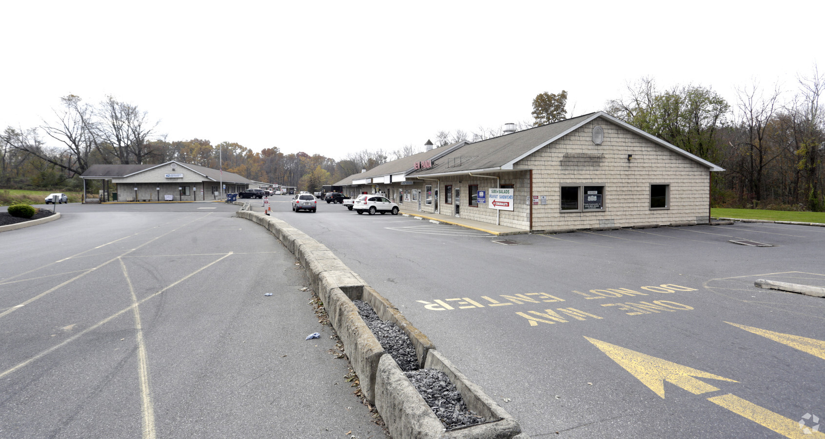
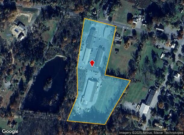
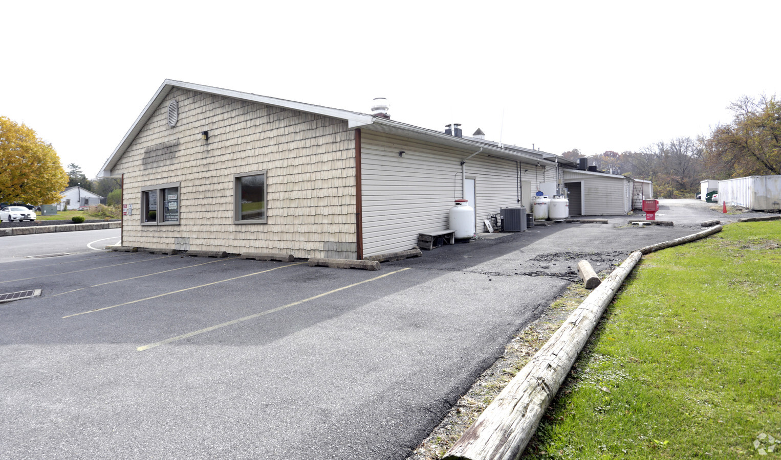
2165 Mount Bethel Hwy
Storebuilding
Northampton
X
Pennsylvania
42095C0063E
8.29 AC
2024
Lehigh Valley
2024
Philadelphia
018200
Allentown-Bethlehem-Easton, PA-NJ
11,000 SF
C11-32-14B-0131
DEMOGRAPHICS near 2165 Mount Bethel Hwy
1 Mile
3 Mile
5 Mile
2024 Total Population
627
4,626
13,301
2029 Population
626
4,583
13,318
Pop Growth 2024-2029
(0.16%)
(0.93%)
+ 0.13%
Average Age
48
47
44
2024 Total Households
264
1,927
5,342
HH Growth 2024-2029
(0.38%)
(0.83%)
+ 0.21%
Median Household Inc
$72,364
$73,937
$75,076
Avg Household Size
2.30
2.40
2.50
2024 Avg HH Vehicles
2.00
2.00
2.00
Median Home Value
$265,908
$272,819
$262,669
Median Year Built
1972
1969
1963
Nearby Places
- Restaurants
- Banks
- Shops
- Fitness
- Groceries
PUBLIC TRANSPORTATION
AIRPORT
Lehigh Valley International
DRIVE
WALK
Distance
Lehigh Valley International
49 min
28.9 mi
Freight Ports
Maher Terminal
DRIVE
WALK
Distance
Maher Terminal
82 min
63.8 mi
SALE & LEASE HISTORY
LISTING DATE
SALE/LEASE

Sep 25, 2016
For Lease
May 21, 2019
For Lease
Feb 06, 2018
For Lease
Nearby Properties
Address
Land Use
TOTAL SIZE
Lot Size
Zoning
Address
Land Use
TOTAL SIZE
Lot Size
Zoning
85,078 SF
100.04 AC
AR
Address
Land Use
TOTAL SIZE
Lot Size
Zoning
265,682 SF
46.27 AC
I2
Address
Land Use
TOTAL SIZE
Lot Size
Zoning
1,092 SF
20.83 AC
C
Address
Land Use
TOTAL SIZE
Lot Size
Zoning
164,000 SF
35.88 AC
I2
Address
Land Use
TOTAL SIZE
Lot Size
Zoning
153,705 SF
15.49 AC
IND
Address
Land Use
TOTAL SIZE
Lot Size
Zoning
2.70 AC
C
Address
Land Use
TOTAL SIZE
Lot Size
Zoning
463.70 AC
I2
Address
Land Use
TOTAL SIZE
Lot Size
Zoning
2,765 SF
6.20 AC
Address
Land Use
TOTAL SIZE
Lot Size
Zoning
118,224 SF
11.58 AC
IND
Address
Land Use
TOTAL SIZE
Lot Size
Zoning
105,186 SF
29.20 AC
I1
Address
Land Use
TOTAL SIZE
Lot Size
Zoning
218.16 AC
FPD
Address
Land Use
TOTAL SIZE
Lot Size
Zoning
1,440 SF
79.90 AC
AR
Address
Land Use
TOTAL SIZE
Lot Size
Zoning
229.07 AC
I2
Address
Land Use
TOTAL SIZE
Lot Size
Zoning
64,184 SF
151.90 AC
I2
Address
Land Use
TOTAL SIZE
Lot Size
Zoning
194.09 AC
FPD
Address
Land Use
TOTAL SIZE
Lot Size
Zoning
14,580 SF
27.75 AC
I2
Address
Land Use
TOTAL SIZE
Lot Size
Zoning
2.40 AC
C
Address
Land Use
TOTAL SIZE
Lot Size
Zoning
1,880 SF
8.43 AC
C
Address
Land Use
TOTAL SIZE
Lot Size
Zoning
41,230 SF
4.92 AC
I1
Address
Land Use
TOTAL SIZE
Lot Size
Zoning
500 SF
5.72 AC
C
Address
Land Use
TOTAL SIZE
Lot Size
Zoning
3,317 SF
27.48 AC
AR
Address
Land Use
TOTAL SIZE
Lot Size
Zoning
15,240 SF
9.66 AC
R3
Address
Land Use
TOTAL SIZE
Lot Size
Zoning
4,404 SF
2.24 AC
C
Address
Land Use
TOTAL SIZE
Lot Size
Zoning
33,444 SF
6.98 AC
I1
Address
Land Use
TOTAL SIZE
Lot Size
Zoning
5,600 SF
1.38 AC
PCD
Address
Land Use
TOTAL SIZE
Lot Size
Zoning
17,564 SF
4.27 AC
AR
Address
Land Use
TOTAL SIZE
Lot Size
Zoning
1,256 SF
0.59 AC
C
Address
Land Use
TOTAL SIZE
Lot Size
Zoning
80.77 AC
Address
Land Use
TOTAL SIZE
Lot Size
Zoning
2,040 SF
2.68 AC
VR
The World's #1 Commercial Real Estate Marketplace
Connect with us
© 2025 CoStar Group
The information above has been obtained from sources believed reliable. While we do not doubt its accuracy we have not verified it and make no guarantee, warranty or representation about it. It is your responsibility to independently confirm its accuracy and completeness. Any projections, opinions, assumptions, or estimates used are for example only and do not represent the current or future performance of the property. The value of this transaction to you depends on tax and other factors which should be evaluated by your tax, financial, and legal advisors. You and your advisors should conduct a careful, independent investigation of the property to determine to your satisfaction the suitability of the property for your needs.