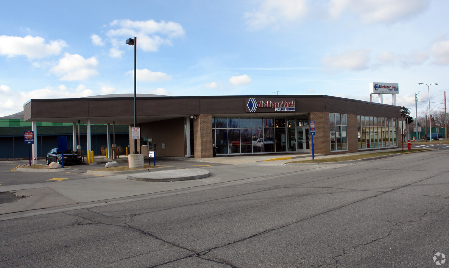
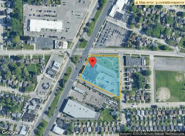
Property Record
21650 Gratiot Ave, Eastpointe, MI 48021


NEARBY LISTINGS FOR SALE OR LEASE
Property Detail
21650 Gratiot Ave
Detroit-Warren-Dearborn, MI
Adam Belli Subdivision
02-14-31-307-023
ADAM BELLI SUBDIVISION ; LOTS 1, 2 & 3; ALSO ASSESSORS PLAT NO 17 LOTS 270, 271, 272 & 273 LIBER 38, PAGE 12 AND LIBER 22,
Centrallyassessed
Macomb
X
Michigan
26163C0130F
1-3,270
2023
2.78 AC
2024
Macomb East
258800
Detroit
10,908 SF
DEMOGRAPHICS near 21650 Gratiot Ave
1 Mile
3 Mile
5 Mile
2024 Total Population
21,628
159,673
379,017
2029 Population
21,310
159,104
376,334
Pop Growth 2024-2029
(1.47%)
(0.36%)
(0.71%)
Average Age
37
37
39
2024 Total Households
7,951
59,790
148,364
HH Growth 2024-2029
(1.48%)
(0.51%)
(0.83%)
Median Household Inc
$46,604
$46,752
$50,901
Avg Household Size
2.70
2.60
2.50
2024 Avg HH Vehicles
2.00
2.00
2.00
Median Home Value
$87,814
$99,171
$130,328
Median Year Built
1953
1954
1955
Nearby Places
- Restaurants
- Banks
- Shops
- Fitness
- Groceries
PUBLIC TRANSPORTATION
COMMUTER RAIL
Detroit (Wolverine - Amtrak)
DRIVE
WALK
Distance
Detroit (Wolverine - Amtrak)
19 min
9.6 mi
AIRPORT
Windsor International
DRIVE
WALK
Distance
Windsor International
44 min
21.0 mi
Detroit Metro Wayne County
DRIVE
WALK
Distance
Detroit Metro Wayne County
48 min
30.5 mi
Freight Ports
Port of Toledo
DRIVE
WALK
Distance
Port of Toledo
93 min
71.3 mi
Nearby Properties
Address
Land Use
TOTAL SIZE
Lot Size
Zoning
Address
Land Use
TOTAL SIZE
Lot Size
Zoning
260,164 SF
Address
Land Use
TOTAL SIZE
Lot Size
Zoning
1,034,990 SF
28.60 AC
Address
Land Use
TOTAL SIZE
Lot Size
Zoning
450,958 SF
Address
Land Use
TOTAL SIZE
Lot Size
Zoning
323,858 SF
20.66 AC
R-3
Address
Land Use
TOTAL SIZE
Lot Size
Zoning
661,151 SF
37.28 AC
MZ
Address
Land Use
TOTAL SIZE
Lot Size
Zoning
182,866 SF
5.08 AC
PD
Address
Land Use
TOTAL SIZE
Lot Size
Zoning
238,144 SF
12.15 AC
MZ
Address
Land Use
TOTAL SIZE
Lot Size
Zoning
401,671 SF
19.40 AC
MZ
Address
Land Use
TOTAL SIZE
Lot Size
Zoning
162,597 SF
17.94 AC
C-2
Address
Land Use
TOTAL SIZE
Lot Size
Zoning
296,850 SF
42.84 AC
Address
Land Use
TOTAL SIZE
Lot Size
Zoning
362,350 SF
22.39 AC
M-2
Address
Land Use
TOTAL SIZE
Lot Size
Zoning
166,064 SF
6.33 AC
M-3
Address
Land Use
TOTAL SIZE
Lot Size
Zoning
103,069 SF
11.41 AC
B-3
Address
Land Use
TOTAL SIZE
Lot Size
Zoning
92,800 SF
6.71 AC
R-3
Address
Land Use
TOTAL SIZE
Lot Size
Zoning
105,354 SF
2.33 AC
B-3
Address
Land Use
TOTAL SIZE
Lot Size
Zoning
75,284 SF
0.87 AC
C
Address
Land Use
TOTAL SIZE
Lot Size
Zoning
167,589 SF
16.80 AC
B-3
Address
Land Use
TOTAL SIZE
Lot Size
Zoning
410,359 SF
27.52 AC
M4
Address
Land Use
TOTAL SIZE
Lot Size
Zoning
42.61 AC
M-2
Address
Land Use
TOTAL SIZE
Lot Size
Zoning
119,898 SF
14.64 AC
B-2
Address
Land Use
TOTAL SIZE
Lot Size
Zoning
136,270 SF
3.42 AC
LI
Address
Land Use
TOTAL SIZE
Lot Size
Zoning
36,191 SF
3.86 AC
B-2
Address
Land Use
TOTAL SIZE
Lot Size
Zoning
91,739 SF
6.54 AC
B-2
Address
Land Use
TOTAL SIZE
Lot Size
Zoning
116,778 SF
12.98 AC
MZ
Address
Land Use
TOTAL SIZE
Lot Size
Zoning
252,633 SF
10.78 AC
M-2
Address
Land Use
TOTAL SIZE
Lot Size
Zoning
28,300 SF
11.49 AC
I-1
Address
Land Use
TOTAL SIZE
Lot Size
Zoning
156,352 SF
2.72 AC
MU3
Address
Land Use
TOTAL SIZE
Lot Size
Zoning
114,589 SF
5.18 AC
R-3
Address
Land Use
TOTAL SIZE
Lot Size
Zoning
154,377 SF
8.07 AC
M-3
Address
Land Use
TOTAL SIZE
Lot Size
Zoning
180,834 SF
17.97 AC
M-3
The World's #1 Commercial Real Estate Marketplace
Connect with us
© 2025 CoStar Group
The information above has been obtained from sources believed reliable. While we do not doubt its accuracy we have not verified it and make no guarantee, warranty or representation about it. It is your responsibility to independently confirm its accuracy and completeness. Any projections, opinions, assumptions, or estimates used are for example only and do not represent the current or future performance of the property. The value of this transaction to you depends on tax and other factors which should be evaluated by your tax, financial, and legal advisors. You and your advisors should conduct a careful, independent investigation of the property to determine to your satisfaction the suitability of the property for your needs.