Property Record
217 Nw Victoria Dr, Lees Summit, MO 64086
NEARBY LISTINGS FOR SALE OR LEASE
Property Detail
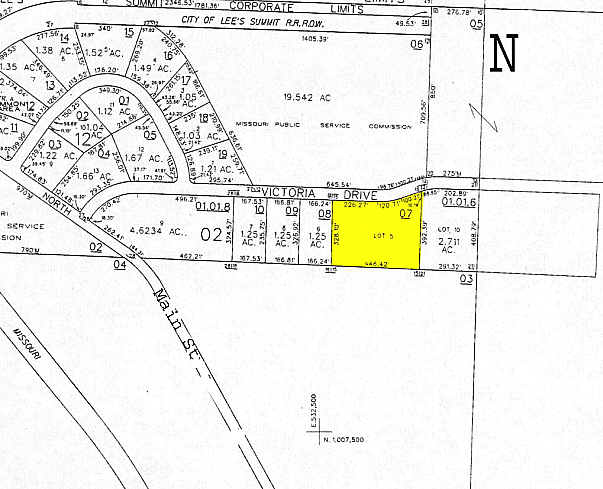
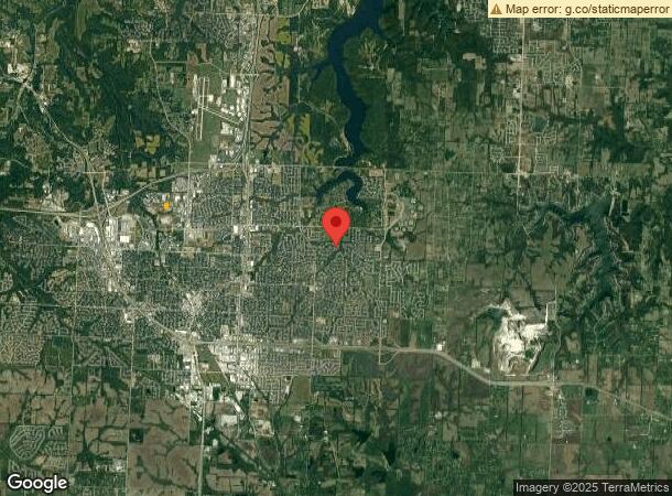
217 Nw Victoria Dr
Kansas City, MO-KS
Lees Summit North Industrial Park
52-900-02-30-00-0-00-000
LEES SUMMIT NORTH IND PARK LOTS 5D & 5E---LOT 5E
Wholesaleoutletdiscountstore
Jackson
X
Missouri
29095C0417G
5d,5e
2023
1.56 AC
2024
Southeast Jackson County
013916
Kansas City
24,200 SF
DEMOGRAPHICS near 217 Nw Victoria Dr
1 Mile
3 Mile
5 Mile
2024 Total Population
3,227
45,134
89,910
2029 Population
3,224
44,888
89,424
Pop Growth 2024-2029
(0.09%)
(0.55%)
(0.54%)
Average Age
40
41
40
2024 Total Households
1,481
18,755
34,785
HH Growth 2024-2029
+ 0.20%
(0.49%)
(0.59%)
Median Household Inc
$77,990
$81,534
$95,565
Avg Household Size
2.10
2.30
2.50
2024 Avg HH Vehicles
2.00
2.00
2.00
Median Home Value
$229,259
$243,988
$274,284
Median Year Built
1991
1983
1989
Nearby Places
- Restaurants
- Banks
- Shops
- Fitness
- Groceries
PUBLIC TRANSPORTATION
COMMUTER RAIL
Lee's Summit Amtrak (Lincoln Service Missouri River Runner - Amtrak, Missouri River Runner - Amtrak)
DRIVE
WALK
Distance
Lee's Summit Amtrak (Lincoln Service Missouri River Runner - Amtrak, Missouri River Runner - Amtrak)
8 min
3.3 mi
Freight Ports
Tulsa Port Of Catoosa
DRIVE
WALK
Distance
Tulsa Port Of Catoosa
265 min
240.6 mi
Nearby Properties
Address
Land Use
TOTAL SIZE
Lot Size
Zoning
Address
Land Use
TOTAL SIZE
Lot Size
Zoning
332,178 SF
40.14 AC
Address
Land Use
TOTAL SIZE
Lot Size
Zoning
246,379 SF
51.99 AC
Address
Land Use
TOTAL SIZE
Lot Size
Zoning
93,845 SF
464.50 AC
Address
Land Use
TOTAL SIZE
Lot Size
Zoning
195,589 SF
47.72 AC
Address
Land Use
TOTAL SIZE
Lot Size
Zoning
38,692 SF
11.81 AC
Address
Land Use
TOTAL SIZE
Lot Size
Zoning
73,375 SF
2.89 AC
Address
Land Use
TOTAL SIZE
Lot Size
Zoning
383,280 SF
0.91 AC
Address
Land Use
TOTAL SIZE
Lot Size
Zoning
139,949 SF
27 AC
Address
Land Use
TOTAL SIZE
Lot Size
Zoning
104,704 SF
11.28 AC
Address
Land Use
TOTAL SIZE
Lot Size
Zoning
192,014 SF
20.95 AC
Address
Land Use
TOTAL SIZE
Lot Size
Zoning
59,625 SF
6.22 AC
Address
Land Use
TOTAL SIZE
Lot Size
Zoning
99,891 SF
9.71 AC
Address
Land Use
TOTAL SIZE
Lot Size
Zoning
65,290 SF
15.70 AC
Address
Land Use
TOTAL SIZE
Lot Size
Zoning
12,788 SF
16.29 AC
Address
Land Use
TOTAL SIZE
Lot Size
Zoning
33,136 SF
3.99 AC
Address
Land Use
TOTAL SIZE
Lot Size
Zoning
37,489 SF
9.22 AC
Address
Land Use
TOTAL SIZE
Lot Size
Zoning
118,310 SF
10.54 AC
Address
Land Use
TOTAL SIZE
Lot Size
Zoning
43,075 SF
10.04 AC
Address
Land Use
TOTAL SIZE
Lot Size
Zoning
145,562 SF
28.46 AC
Address
Land Use
TOTAL SIZE
Lot Size
Zoning
33,894 SF
3 AC
Address
Land Use
TOTAL SIZE
Lot Size
Zoning
32,463 SF
13.28 AC
Address
Land Use
TOTAL SIZE
Lot Size
Zoning
69,312 SF
2.50 AC
Address
Land Use
TOTAL SIZE
Lot Size
Zoning
67,800 SF
2.53 AC
Address
Land Use
TOTAL SIZE
Lot Size
Zoning
21,561 SF
4.36 AC
Address
Land Use
TOTAL SIZE
Lot Size
Zoning
26,696 SF
2.53 AC
Address
Land Use
TOTAL SIZE
Lot Size
Zoning
32,142 SF
10.77 AC
Address
Land Use
TOTAL SIZE
Lot Size
Zoning
11,030 SF
13.74 AC
Address
Land Use
TOTAL SIZE
Lot Size
Zoning
65,539 SF
19.24 AC
Address
Land Use
TOTAL SIZE
Lot Size
Zoning
136,620 SF
12.52 AC
Address
Land Use
TOTAL SIZE
Lot Size
Zoning
79,596 SF
7.18 AC
The World's #1 Commercial Real Estate Marketplace
Connect with us
© 2025 CoStar Group
The information above has been obtained from sources believed reliable. While we do not doubt its accuracy we have not verified it and make no guarantee, warranty or representation about it. It is your responsibility to independently confirm its accuracy and completeness. Any projections, opinions, assumptions, or estimates used are for example only and do not represent the current or future performance of the property. The value of this transaction to you depends on tax and other factors which should be evaluated by your tax, financial, and legal advisors. You and your advisors should conduct a careful, independent investigation of the property to determine to your satisfaction the suitability of the property for your needs.