Property Record
217 Trimble Station Rd, Hogansville, GA 30230
NEARBY LISTINGS FOR SALE OR LEASE
-
-
View all Hogansville listings for sale on LoopNet.com
Property Detail
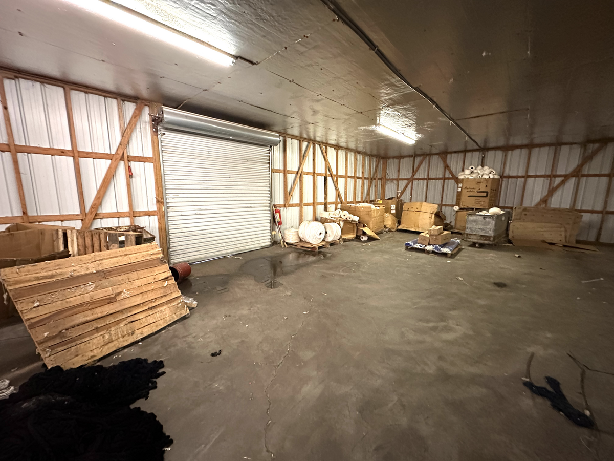
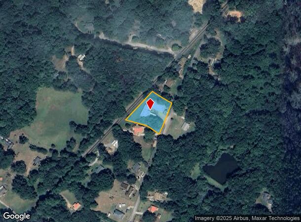
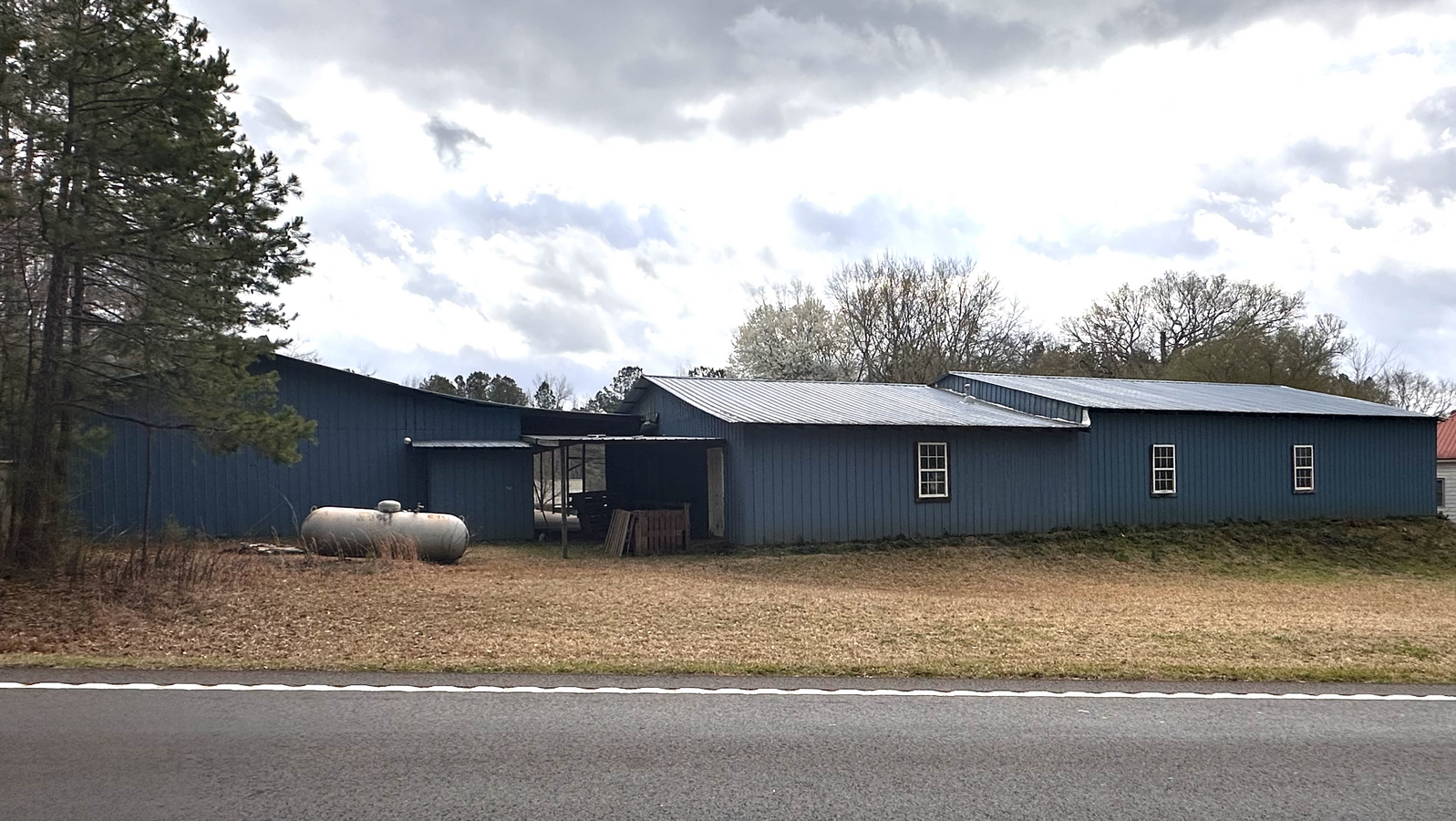
217 Trimble Station Rd
022-3-000-058A
217 TRIMBLE STATION RD
Industrialgeneral
Troup
X
Georgia
13077C0335D
34
2024
1 AC
2024
Troup County
960102
Columbus GA
8,200 SF
LaGrange, GA
DEMOGRAPHICS near 217 Trimble Station Rd
1 Mile
3 Mile
5 Mile
2024 Total Population
244
4,868
9,822
2029 Population
250
5,130
10,473
Pop Growth 2024-2029
+ 2.46%
+ 5.38%
+ 6.63%
Average Age
37
38
38
2024 Total Households
86
1,829
3,671
HH Growth 2024-2029
+ 2.33%
+ 5.30%
+ 6.62%
Median Household Inc
$51,250
$51,789
$56,818
Avg Household Size
2.80
2.70
2.70
2024 Avg HH Vehicles
2.00
2.00
2.00
Median Home Value
$139,583
$145,085
$159,523
Median Year Built
1985
1980
1987
Nearby Places
- Restaurants
- Banks
- Shops
- Fitness
- Groceries
SALE & LEASE HISTORY
LISTING DATE
SALE/LEASE

Mar 01, 2024
For Sale
Nearby Properties
Address
Land Use
TOTAL SIZE
Lot Size
Zoning
Address
Land Use
TOTAL SIZE
Lot Size
Zoning
390,000 SF
74.30 AC
Address
Land Use
TOTAL SIZE
Lot Size
Zoning
20,916 SF
36.96 AC
Address
Land Use
TOTAL SIZE
Lot Size
Zoning
477.38 AC
18-PUD
Address
Land Use
TOTAL SIZE
Lot Size
Zoning
1,972.76 AC
01-AGR
Address
Land Use
TOTAL SIZE
Lot Size
Zoning
26,554 SF
15.45 AC
Address
Land Use
TOTAL SIZE
Lot Size
Zoning
74,076 SF
20 AC
Address
Land Use
TOTAL SIZE
Lot Size
Zoning
11,021 SF
3 AC
Address
Land Use
TOTAL SIZE
Lot Size
Zoning
24,818 SF
5.76 AC
Address
Land Use
TOTAL SIZE
Lot Size
Zoning
37.60 AC
Address
Land Use
TOTAL SIZE
Lot Size
Zoning
Address
Land Use
TOTAL SIZE
Lot Size
Zoning
1,152 SF
13.50 AC
Address
Land Use
TOTAL SIZE
Lot Size
Zoning
102.99 AC
18-PUD
Address
Land Use
TOTAL SIZE
Lot Size
Zoning
11,544 SF
9.92 AC
18-R3
Address
Land Use
TOTAL SIZE
Lot Size
Zoning
460 AC
01-AGR
Address
Land Use
TOTAL SIZE
Lot Size
Zoning
157.05 AC
Address
Land Use
TOTAL SIZE
Lot Size
Zoning
402.40 AC
01-SFMD
Address
Land Use
TOTAL SIZE
Lot Size
Zoning
267.88 AC
01-LR
Address
Land Use
TOTAL SIZE
Lot Size
Zoning
463.95 AC
01-SFMD
Address
Land Use
TOTAL SIZE
Lot Size
Zoning
494.73 AC
001
Address
Land Use
TOTAL SIZE
Lot Size
Zoning
11,432 SF
1.10 AC
Address
Land Use
TOTAL SIZE
Lot Size
Zoning
Address
Land Use
TOTAL SIZE
Lot Size
Zoning
363.56 AC
01-AGR
Address
Land Use
TOTAL SIZE
Lot Size
Zoning
13,820 SF
2.02 AC
Address
Land Use
TOTAL SIZE
Lot Size
Zoning
3,036 SF
1.66 AC
Address
Land Use
TOTAL SIZE
Lot Size
Zoning
310.36 AC
01-SFMD
Address
Land Use
TOTAL SIZE
Lot Size
Zoning
612.54 AC
01-AG
Address
Land Use
TOTAL SIZE
Lot Size
Zoning
680.84 AC
01-SFMD
Address
Land Use
TOTAL SIZE
Lot Size
Zoning
6,672 SF
1.25 AC
Address
Land Use
TOTAL SIZE
Lot Size
Zoning
379.15 AC
001
Address
Land Use
TOTAL SIZE
Lot Size
Zoning
52.75 AC
18-PUD
The World's #1 Commercial Real Estate Marketplace
Connect with us
© 2025 CoStar Group
The information above has been obtained from sources believed reliable. While we do not doubt its accuracy we have not verified it and make no guarantee, warranty or representation about it. It is your responsibility to independently confirm its accuracy and completeness. Any projections, opinions, assumptions, or estimates used are for example only and do not represent the current or future performance of the property. The value of this transaction to you depends on tax and other factors which should be evaluated by your tax, financial, and legal advisors. You and your advisors should conduct a careful, independent investigation of the property to determine to your satisfaction the suitability of the property for your needs.