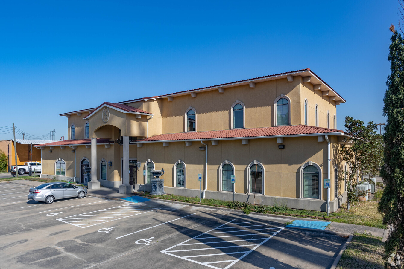
Property Record
21720 Highland Knolls Dr, Katy, TX 77450


Current Lease Availabilities
General Retail LEASE
$20.00 - $27.00 SF/YR
4,944 - 10,440 SF
NEARBY LISTINGS FOR SALE OR LEASE
Property Detail
21720 Highland Knolls Dr
1231840010001
Highland Salon Subdivision
Storebuilding
RES A BLK 1 HIGHLAND SALON
X
Harris
48201C0615M
Texas
2023
1.26 AC
2023
Far Katy South
454802
Houston
10,440 SF
Houston-The Woodlands-Sugar Land, TX
DEMOGRAPHICS near 21720 Highland Knolls Dr
1 Mile
3 Mile
5 Mile
2024 Total Population
19,612
110,616
284,439
2029 Population
20,070
118,241
311,558
Pop Growth 2024-2029
+ 2.34%
+ 6.89%
+ 9.53%
Average Age
39
38
37
2024 Total Households
6,728
38,890
94,823
HH Growth 2024-2029
+ 2.29%
+ 6.81%
+ 9.41%
Median Household Inc
$90,326
$94,869
$95,000
Avg Household Size
2.90
2.80
3.00
2024 Avg HH Vehicles
2.00
2.00
2.00
Median Home Value
$259,634
$312,757
$290,240
Median Year Built
1990
1998
2003
Nearby Places
- Restaurants
- Banks
- Shops
- Fitness
- Groceries
PUBLIC TRANSPORTATION
AIRPORT
William P Hobby
DRIVE
WALK
Distance
William P Hobby
57 min
38.9 mi
George Bush Intcntl/Houston
DRIVE
WALK
Distance
George Bush Intcntl/Houston
51 min
40.2 mi
Freight Ports
Port of Houston
DRIVE
WALK
Distance
Port of Houston
50 min
35.7 mi
Nearby Properties
Address
Land Use
TOTAL SIZE
Lot Size
Zoning
Address
Land Use
TOTAL SIZE
Lot Size
Zoning
433,000 SF
59.75 AC
Address
Land Use
TOTAL SIZE
Lot Size
Zoning
455,592 SF
27.53 AC
Address
Land Use
TOTAL SIZE
Lot Size
Zoning
352,733 SF
13.66 AC
Address
Land Use
TOTAL SIZE
Lot Size
Zoning
614,847 SF
42 AC
Address
Land Use
TOTAL SIZE
Lot Size
Zoning
351,758 SF
18.23 AC
Address
Land Use
TOTAL SIZE
Lot Size
Zoning
319,341 SF
14.88 AC
Address
Land Use
TOTAL SIZE
Lot Size
Zoning
523,641 SF
17.31 AC
X
Address
Land Use
TOTAL SIZE
Lot Size
Zoning
361,382 SF
14.60 AC
Address
Land Use
TOTAL SIZE
Lot Size
Zoning
375,757 SF
18.37 AC
Address
Land Use
TOTAL SIZE
Lot Size
Zoning
455,592 SF
20.95 AC
Address
Land Use
TOTAL SIZE
Lot Size
Zoning
183,216 SF
10.84 AC
Address
Land Use
TOTAL SIZE
Lot Size
Zoning
891,129 SF
44.38 AC
Address
Land Use
TOTAL SIZE
Lot Size
Zoning
492,836 SF
30.20 AC
Address
Land Use
TOTAL SIZE
Lot Size
Zoning
440,214 SF
23.66 AC
Address
Land Use
TOTAL SIZE
Lot Size
Zoning
327,793 SF
10.86 AC
Address
Land Use
TOTAL SIZE
Lot Size
Zoning
297,040 SF
11.64 AC
Address
Land Use
TOTAL SIZE
Lot Size
Zoning
348,199 SF
16.69 AC
Address
Land Use
TOTAL SIZE
Lot Size
Zoning
420,671 SF
23.29 AC
Address
Land Use
TOTAL SIZE
Lot Size
Zoning
322,774 SF
9.19 AC
Address
Land Use
TOTAL SIZE
Lot Size
Zoning
312,053 SF
14.11 AC
Address
Land Use
TOTAL SIZE
Lot Size
Zoning
367,873 SF
15.74 AC
Address
Land Use
TOTAL SIZE
Lot Size
Zoning
384,260 SF
18 AC
Address
Land Use
TOTAL SIZE
Lot Size
Zoning
41,083 SF
23.66 AC
Address
Land Use
TOTAL SIZE
Lot Size
Zoning
351,505 SF
13.38 AC
Address
Land Use
TOTAL SIZE
Lot Size
Zoning
313,705 SF
14.11 AC
Address
Land Use
TOTAL SIZE
Lot Size
Zoning
278,684 SF
13 AC
Address
Land Use
TOTAL SIZE
Lot Size
Zoning
307,596 SF
9.62 AC
Address
Land Use
TOTAL SIZE
Lot Size
Zoning
693,781 SF
6.86 AC
Address
Land Use
TOTAL SIZE
Lot Size
Zoning
377,890 SF
12.68 AC
Address
Land Use
TOTAL SIZE
Lot Size
Zoning
317,277 SF
16.16 AC
The World's #1 Commercial Real Estate Marketplace
Connect with us
© 2025 CoStar Group
The information above has been obtained from sources believed reliable. While we do not doubt its accuracy we have not verified it and make no guarantee, warranty or representation about it. It is your responsibility to independently confirm its accuracy and completeness. Any projections, opinions, assumptions, or estimates used are for example only and do not represent the current or future performance of the property. The value of this transaction to you depends on tax and other factors which should be evaluated by your tax, financial, and legal advisors. You and your advisors should conduct a careful, independent investigation of the property to determine to your satisfaction the suitability of the property for your needs.