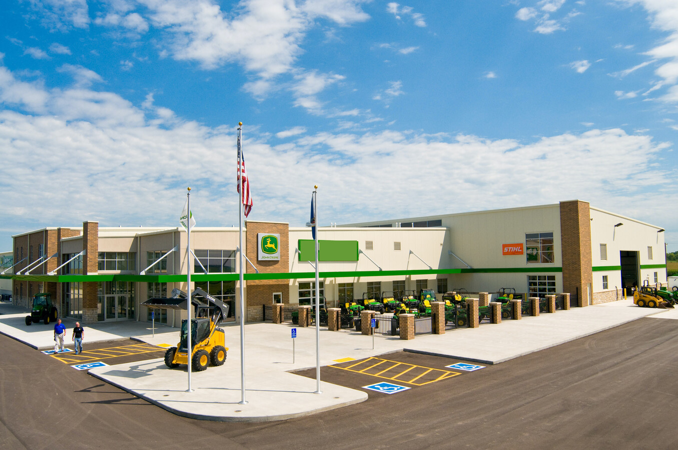
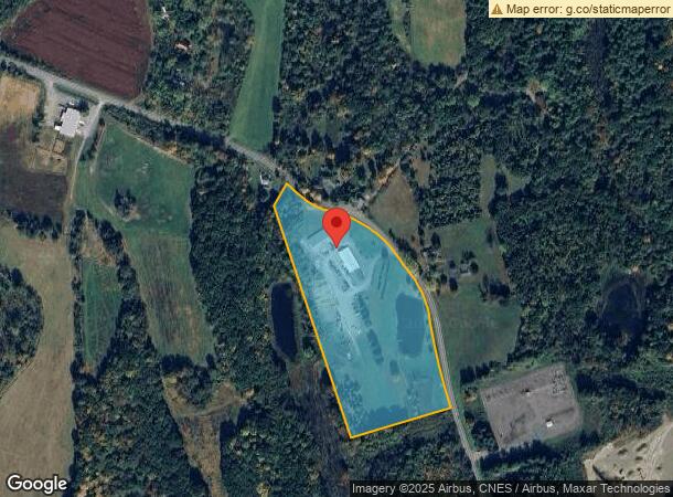
Property Record
2173 State Route 203, Chatham, NY 12037
NEARBY LISTINGS FOR SALE OR LEASE
-
-
View all Chatham listings for sale on LoopNet.com
Property Detail
2173 State Route 203
Hudson, NY
Columbia
102689-055-000-0001-038-000-0000
New York
Storebuilding
38.000
2023
15 AC
2023
Columbia County
000300
Albany/Schenectady/Troy
7,852 SF
DEMOGRAPHICS near 2173 State Route 203
1 Mile
3 Mile
5 Mile
2024 Total Population
155
4,456
11,068
2029 Population
154
4,420
10,868
Pop Growth 2024-2029
(0.65%)
(0.81%)
(1.81%)
Average Age
46
46
46
2024 Total Households
71
2,033
4,779
HH Growth 2024-2029
(1.41%)
(0.79%)
(1.84%)
Median Household Inc
$70,499
$79,732
$81,866
Avg Household Size
2.20
2.20
2.20
2024 Avg HH Vehicles
2.00
2.00
2.00
Median Home Value
$240,625
$274,680
$281,174
Median Year Built
1955
1958
1963
Nearby Places
- Restaurants
- Banks
- Shops
- Fitness
- Groceries
PUBLIC TRANSPORTATION
AIRPORT
Albany International
DRIVE
WALK
Distance
Albany International
51 min
33.8 mi
Freight Ports
Albany, NY Port
DRIVE
WALK
Distance
Albany, NY Port
38 min
26.2 mi
SALE & LEASE HISTORY
LISTING DATE
SALE/LEASE

Apr 21, 2020
For Sale
Nearby Properties
Address
Land Use
TOTAL SIZE
Lot Size
Zoning
Address
Land Use
TOTAL SIZE
Lot Size
Zoning
25.86 AC
07 - MIXED
Address
Land Use
TOTAL SIZE
Lot Size
Zoning
81,712 SF
46.20 AC
05 - COMME
Address
Land Use
TOTAL SIZE
Lot Size
Zoning
115,600 SF
8.60 AC
05 - COMME
Address
Land Use
TOTAL SIZE
Lot Size
Zoning
1,100 SF
74.80 AC
06 - INDUS
Address
Land Use
TOTAL SIZE
Lot Size
Zoning
2,412 SF
107.80 AC
RA1 C
Address
Land Use
TOTAL SIZE
Lot Size
Zoning
73,420 SF
22.90 AC
05 - COMME
Address
Land Use
TOTAL SIZE
Lot Size
Zoning
46,210 SF
6.40 AC
06 - INDUS
Address
Land Use
TOTAL SIZE
Lot Size
Zoning
5,661 SF
231.30 AC
RA1
Address
Land Use
TOTAL SIZE
Lot Size
Zoning
12.20 AC
VB
Address
Land Use
TOTAL SIZE
Lot Size
Zoning
6,863 SF
32.50 AC
06 - INDUS
Address
Land Use
TOTAL SIZE
Lot Size
Zoning
Address
Land Use
TOTAL SIZE
Lot Size
Zoning
7,938 SF
1 AC
05 - COMME
Address
Land Use
TOTAL SIZE
Lot Size
Zoning
9,460 SF
230.39 AC
07 - MIXED
Address
Land Use
TOTAL SIZE
Lot Size
Zoning
21,748 SF
3.10 AC
VB
Address
Land Use
TOTAL SIZE
Lot Size
Zoning
76,045 SF
14 AC
07 - MIXED
Address
Land Use
TOTAL SIZE
Lot Size
Zoning
24,000 SF
5.97 AC
RA1 C
Address
Land Use
TOTAL SIZE
Lot Size
Zoning
14,950 SF
7.40 AC
05 - COMME
Address
Land Use
TOTAL SIZE
Lot Size
Zoning
19,864 SF
3.20 AC
VB
Address
Land Use
TOTAL SIZE
Lot Size
Zoning
203.74 AC
RA1 C
Address
Land Use
TOTAL SIZE
Lot Size
Zoning
1,674 SF
24 AC
I000
Address
Land Use
TOTAL SIZE
Lot Size
Zoning
4,517 SF
28.30 AC
01 - NOT Z
Address
Land Use
TOTAL SIZE
Lot Size
Zoning
1,606 SF
65.20 AC
RL20
Address
Land Use
TOTAL SIZE
Lot Size
Zoning
2,800 SF
1.38 AC
VB C
Address
Land Use
TOTAL SIZE
Lot Size
Zoning
1,008 SF
9.35 AC
01 - NOT Z
Address
Land Use
TOTAL SIZE
Lot Size
Zoning
3,932 SF
1 AC
05 - COMME
Address
Land Use
TOTAL SIZE
Lot Size
Zoning
11,640 SF
1.85 AC
05 - COMME
Address
Land Use
TOTAL SIZE
Lot Size
Zoning
1,716 SF
0.66 AC
05 - COMME
Address
Land Use
TOTAL SIZE
Lot Size
Zoning
13,832 SF
0.47 AC
06 - INDUS
Address
Land Use
TOTAL SIZE
Lot Size
Zoning
163.60 AC
RA1 C
The World's #1 Commercial Real Estate Marketplace
Connect with us
© 2025 CoStar Group
The information above has been obtained from sources believed reliable. While we do not doubt its accuracy we have not verified it and make no guarantee, warranty or representation about it. It is your responsibility to independently confirm its accuracy and completeness. Any projections, opinions, assumptions, or estimates used are for example only and do not represent the current or future performance of the property. The value of this transaction to you depends on tax and other factors which should be evaluated by your tax, financial, and legal advisors. You and your advisors should conduct a careful, independent investigation of the property to determine to your satisfaction the suitability of the property for your needs.