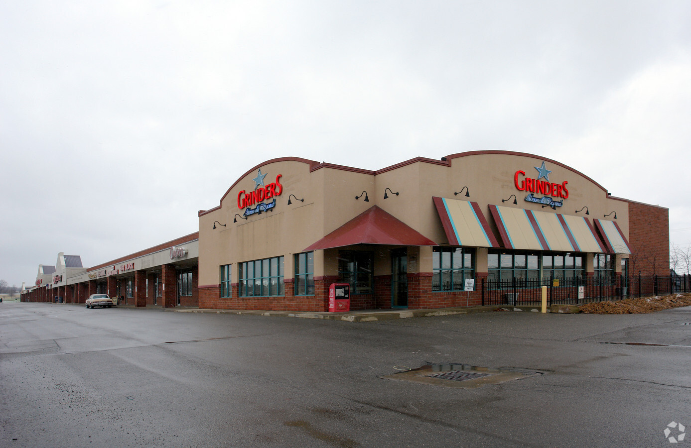
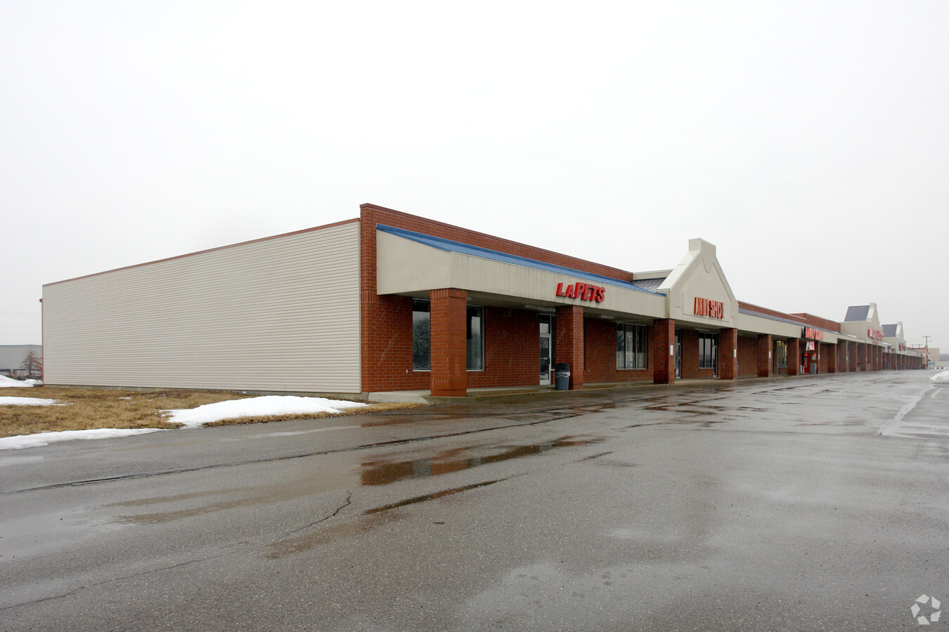
Property Record
219 Hostetler Rd, Orrville, OH 44667
NEARBY LISTINGS FOR SALE OR LEASE
Property Detail
219 Hostetler Rd
Wooster, OH
Schoeppner
59-01379-000
LOT 3265 SCHOEPPNER PROPERTIES SUBDIV 870.65 14.448A MP 40
Regionalshoppingcenterormallwithanchorstore
Wayne
X
Ohio
39169C0250E
3265
2024
14.44 AC
2023
Ohio North Area
001000
Other Market Areas
56,000 SF
DEMOGRAPHICS near 219 Hostetler Rd
1 Mile
3 Mile
5 Mile
2024 Total Population
2,942
11,440
18,770
2029 Population
2,973
11,542
18,784
Pop Growth 2024-2029
+ 1.05%
+ 0.89%
+ 0.07%
Average Age
40
41
41
2024 Total Households
1,163
4,588
7,249
HH Growth 2024-2029
+ 0.86%
+ 0.72%
(0.07%)
Median Household Inc
$57,340
$60,175
$60,911
Avg Household Size
2.50
2.40
2.50
2024 Avg HH Vehicles
2.00
2.00
2.00
Median Home Value
$171,604
$167,667
$180,662
Median Year Built
1977
1972
1973
Nearby Places
- Restaurants
- Banks
- Shops
- Fitness
- Groceries
PUBLIC TRANSPORTATION
AIRPORT
Akron-Canton Regional
DRIVE
WALK
Distance
Akron-Canton Regional
44 min
24.8 mi
Freight Ports
Port of Toledo
DRIVE
WALK
Distance
Port of Toledo
177 min
140.7 mi
SALE & LEASE HISTORY
LISTING DATE
SALE/LEASE

Sep 25, 2016
For Lease
Nearby Properties
Address
Land Use
TOTAL SIZE
Lot Size
Zoning
Address
Land Use
TOTAL SIZE
Lot Size
Zoning
42.13 AC
I2
Address
Land Use
TOTAL SIZE
Lot Size
Zoning
159,758 SF
25.78 AC
R1
Address
Land Use
TOTAL SIZE
Lot Size
Zoning
116,400 SF
27.23 AC
Address
Land Use
TOTAL SIZE
Lot Size
Zoning
146,173 SF
93.20 AC
R1
Address
Land Use
TOTAL SIZE
Lot Size
Zoning
1.27 AC
I2
Address
Land Use
TOTAL SIZE
Lot Size
Zoning
106,771 SF
28.13 AC
C1
Address
Land Use
TOTAL SIZE
Lot Size
Zoning
37.44 AC
Address
Land Use
TOTAL SIZE
Lot Size
Zoning
1.77 AC
I2
Address
Land Use
TOTAL SIZE
Lot Size
Zoning
210,000 SF
35.16 AC
I2
Address
Land Use
TOTAL SIZE
Lot Size
Zoning
74,002 SF
22.98 AC
I1
Address
Land Use
TOTAL SIZE
Lot Size
Zoning
75,859 SF
2.94 AC
R1
Address
Land Use
TOTAL SIZE
Lot Size
Zoning
211,083 SF
14.98 AC
I2
Address
Land Use
TOTAL SIZE
Lot Size
Zoning
5.07 AC
I2
Address
Land Use
TOTAL SIZE
Lot Size
Zoning
40.76 AC
C3
Address
Land Use
TOTAL SIZE
Lot Size
Zoning
3.73 AC
I2
Address
Land Use
TOTAL SIZE
Lot Size
Zoning
282,542 SF
25.72 AC
Address
Land Use
TOTAL SIZE
Lot Size
Zoning
169,787 SF
8.29 AC
I2
Address
Land Use
TOTAL SIZE
Lot Size
Zoning
105,000 SF
9.44 AC
Address
Land Use
TOTAL SIZE
Lot Size
Zoning
7,176 SF
8.08 AC
I2
Address
Land Use
TOTAL SIZE
Lot Size
Zoning
50,540 SF
2.72 AC
I1
Address
Land Use
TOTAL SIZE
Lot Size
Zoning
29.38 AC
I2
Address
Land Use
TOTAL SIZE
Lot Size
Zoning
42,870 SF
19.83 AC
R1
Address
Land Use
TOTAL SIZE
Lot Size
Zoning
19,926 SF
2.65 AC
CBDD
Address
Land Use
TOTAL SIZE
Lot Size
Zoning
33.06 AC
I1
Address
Land Use
TOTAL SIZE
Lot Size
Zoning
35,496 SF
2.46 AC
R2
Address
Land Use
TOTAL SIZE
Lot Size
Zoning
2,492 SF
308.59 AC
Address
Land Use
TOTAL SIZE
Lot Size
Zoning
2.22 AC
I2
Address
Land Use
TOTAL SIZE
Lot Size
Zoning
175,000 SF
11.86 AC
I2
Address
Land Use
TOTAL SIZE
Lot Size
Zoning
36,684 SF
14.04 AC
Address
Land Use
TOTAL SIZE
Lot Size
Zoning
31,497 SF
2.62 AC
I2
The World's #1 Commercial Real Estate Marketplace
Connect with us
© 2025 CoStar Group
The information above has been obtained from sources believed reliable. While we do not doubt its accuracy we have not verified it and make no guarantee, warranty or representation about it. It is your responsibility to independently confirm its accuracy and completeness. Any projections, opinions, assumptions, or estimates used are for example only and do not represent the current or future performance of the property. The value of this transaction to you depends on tax and other factors which should be evaluated by your tax, financial, and legal advisors. You and your advisors should conduct a careful, independent investigation of the property to determine to your satisfaction the suitability of the property for your needs.