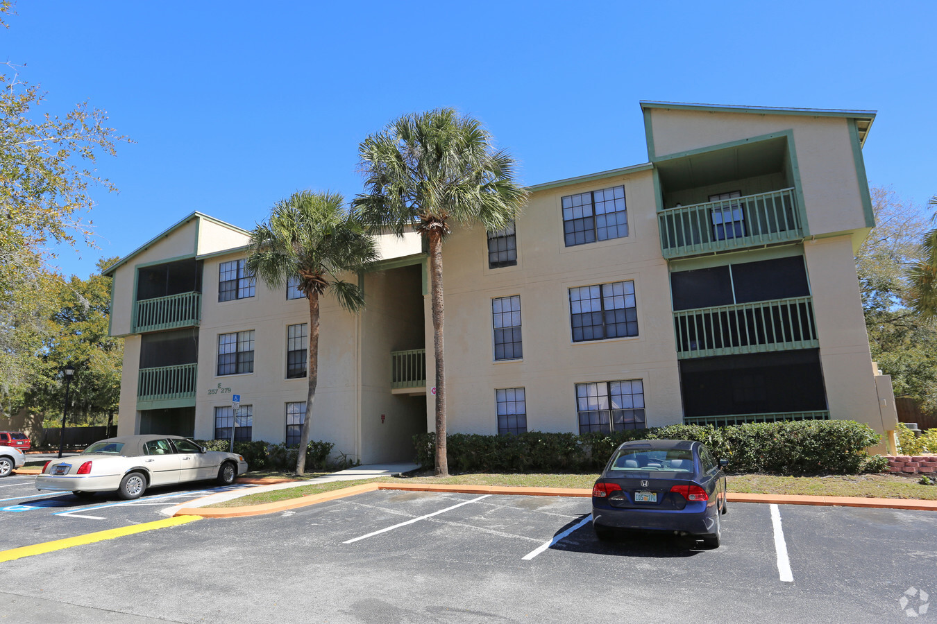
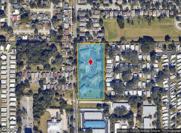
Property Record
219 Monastery Ct, Valrico, FL 33594


NEARBY LISTINGS FOR SALE OR LEASE
-
-
View all Valrico listings for sale on LoopNet.com
Property Detail
219 Monastery Ct
Tampa-St. Petersburg-Clearwater, FL
Unplatted
U-19-29-21-ZZZ-000004-07090.0
N 660 FT OF W 1/4 OF SW 1/4 OF SE 1/4 LESS RD
Multifamilydwelling
Hillsborough
X
Florida
12057C0405H
7090
2023
4.66 AC
2023
Southeast Tampa
012210
Tampa/St Petersburg
61,298 SF
DEMOGRAPHICS near 219 Monastery Ct
1 Mile
3 Mile
5 Mile
2024 Total Population
10,619
68,677
171,153
2029 Population
11,510
74,440
185,900
Pop Growth 2024-2029
+ 8.39%
+ 8.39%
+ 8.62%
Average Age
43
41
40
2024 Total Households
4,192
25,011
62,333
HH Growth 2024-2029
+ 8.66%
+ 8.64%
+ 8.89%
Median Household Inc
$68,568
$78,280
$74,852
Avg Household Size
2.50
2.70
2.70
2024 Avg HH Vehicles
2.00
2.00
2.00
Median Home Value
$269,408
$285,705
$288,609
Median Year Built
1991
1988
1989
Nearby Places
- Restaurants
- Banks
- Shops
- Fitness
- Groceries
PUBLIC TRANSPORTATION
AIRPORT
Tampa International
DRIVE
WALK
Distance
Tampa International
36 min
22.6 mi
St Pete-Clearwater International
DRIVE
WALK
Distance
St Pete-Clearwater International
53 min
31.9 mi
Freight Ports
Port of Tampa Bay
DRIVE
WALK
Distance
Port of Tampa Bay
25 min
14.8 mi
Nearby Properties
Address
Land Use
TOTAL SIZE
Lot Size
Zoning
Address
Land Use
TOTAL SIZE
Lot Size
Zoning
606,551 SF
18.23 AC
PD
Address
Land Use
TOTAL SIZE
Lot Size
Zoning
88,895 SF
587.01 AC
AR
Address
Land Use
TOTAL SIZE
Lot Size
Zoning
172,136 SF
21.94 AC
PD
Address
Land Use
TOTAL SIZE
Lot Size
Zoning
185,184 SF
9.65 AC
PD
Address
Land Use
TOTAL SIZE
Lot Size
Zoning
143,487 SF
8.85 AC
RMC-9
Address
Land Use
TOTAL SIZE
Lot Size
Zoning
123,646 SF
16.10 AC
RSC-6
Address
Land Use
TOTAL SIZE
Lot Size
Zoning
140,058 SF
8.71 AC
RMC-20
Address
Land Use
TOTAL SIZE
Lot Size
Zoning
361,657 SF
24.11 AC
PD
Address
Land Use
TOTAL SIZE
Lot Size
Zoning
141,626 SF
8.88 AC
PD
Address
Land Use
TOTAL SIZE
Lot Size
Zoning
134,594 SF
13.22 AC
PD
Address
Land Use
TOTAL SIZE
Lot Size
Zoning
124,207 SF
28.64 AC
RSC-6
Address
Land Use
TOTAL SIZE
Lot Size
Zoning
116,149 SF
8.14 AC
RMC-9
Address
Land Use
TOTAL SIZE
Lot Size
Zoning
209,392 SF
27.16 AC
PD
Address
Land Use
TOTAL SIZE
Lot Size
Zoning
106,725 SF
2.84 AC
PD
Address
Land Use
TOTAL SIZE
Lot Size
Zoning
147,527 SF
9.25 AC
PD
Address
Land Use
TOTAL SIZE
Lot Size
Zoning
85,972 SF
10.49 AC
PD
Address
Land Use
TOTAL SIZE
Lot Size
Zoning
113,930 SF
19.85 AC
ASC-1
Address
Land Use
TOTAL SIZE
Lot Size
Zoning
182,599 SF
9.47 AC
RMC-12
Address
Land Use
TOTAL SIZE
Lot Size
Zoning
165,601 SF
21.55 AC
PD
Address
Land Use
TOTAL SIZE
Lot Size
Zoning
65,616 SF
43.50 AC
ASC-1
Address
Land Use
TOTAL SIZE
Lot Size
Zoning
135,456 SF
18.76 AC
PD
Address
Land Use
TOTAL SIZE
Lot Size
Zoning
127,479 SF
10.99 AC
PD
Address
Land Use
TOTAL SIZE
Lot Size
Zoning
107,002 SF
17.80 AC
RSC-6
Address
Land Use
TOTAL SIZE
Lot Size
Zoning
68,000 SF
5.21 AC
PD
Address
Land Use
TOTAL SIZE
Lot Size
Zoning
68,247 SF
16.80 AC
PD
Address
Land Use
TOTAL SIZE
Lot Size
Zoning
104,890 SF
15.03 AC
ASC-1
Address
Land Use
TOTAL SIZE
Lot Size
Zoning
54,982 SF
7 AC
CG
Address
Land Use
TOTAL SIZE
Lot Size
Zoning
52,448 SF
9.37 AC
PD
Address
Land Use
TOTAL SIZE
Lot Size
Zoning
33,602 SF
3.69 AC
PD
Address
Land Use
TOTAL SIZE
Lot Size
Zoning
122,173 SF
22.69 AC
RSC-6
The World's #1 Commercial Real Estate Marketplace
Connect with us
© 2025 CoStar Group
The information above has been obtained from sources believed reliable. While we do not doubt its accuracy we have not verified it and make no guarantee, warranty or representation about it. It is your responsibility to independently confirm its accuracy and completeness. Any projections, opinions, assumptions, or estimates used are for example only and do not represent the current or future performance of the property. The value of this transaction to you depends on tax and other factors which should be evaluated by your tax, financial, and legal advisors. You and your advisors should conduct a careful, independent investigation of the property to determine to your satisfaction the suitability of the property for your needs.