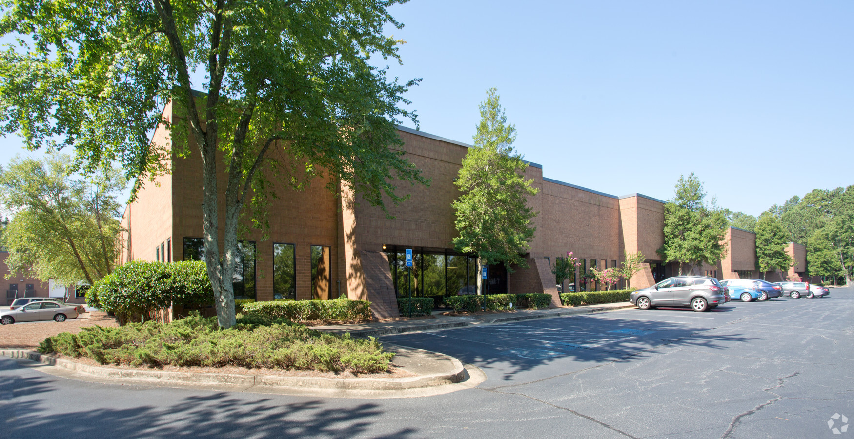
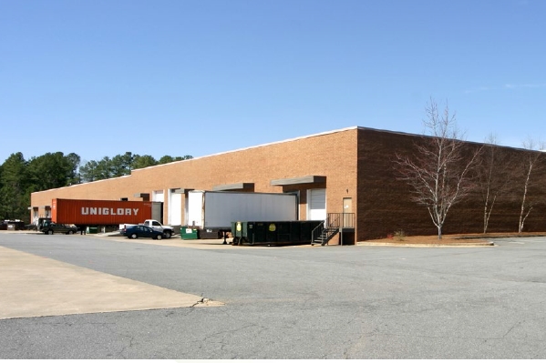
Property Record
2197 Canton Rd, Marietta, GA 30066

Current Lease Availabilities
NEARBY LISTINGS FOR SALE OR LEASE
Property Detail
2197 Canton Rd
16-0709-0-003-0
Canton Road Distribution Cente
Commercialnec
Cobb
X
Georgia
13057C0350E
11.29 AC
2024
SE Cobb Cnty/Marietta
2024
Atlanta
030506
Atlanta-Sandy Springs-Roswell, GA
136,800 SF
DEMOGRAPHICS near 2197 Canton Rd
1 Mile
3 Mile
5 Mile
2024 Total Population
4,709
61,853
182,581
2029 Population
4,742
62,781
185,356
Pop Growth 2024-2029
+ 0.70%
+ 1.50%
+ 1.52%
Average Age
42
39
39
2024 Total Households
1,848
24,204
69,030
HH Growth 2024-2029
+ 0.65%
+ 1.51%
+ 1.56%
Median Household Inc
$84,329
$91,860
$90,296
Avg Household Size
2.50
2.50
2.50
2024 Avg HH Vehicles
2.00
2.00
2.00
Median Home Value
$315,239
$332,354
$351,809
Median Year Built
1977
1986
1986
Nearby Places
- Restaurants
- Banks
- Shops
- Fitness
- Groceries
PUBLIC TRANSPORTATION
AIRPORT
Hartsfield - Jackson Atlanta International
DRIVE
WALK
Distance
Hartsfield - Jackson Atlanta International
43 min
31.4 mi
Freight Ports
Georgia Ports - Savannah
DRIVE
WALK
Distance
Georgia Ports - Savannah
306 min
270.7 mi
Nearby Properties
Address
Land Use
TOTAL SIZE
Lot Size
Zoning
Address
Land Use
TOTAL SIZE
Lot Size
Zoning
379,750 SF
11.14 AC
Address
Land Use
TOTAL SIZE
Lot Size
Zoning
449,337 SF
53.52 AC
RM-12
Address
Land Use
TOTAL SIZE
Lot Size
Zoning
4,812 SF
4.20 AC
PVC
Address
Land Use
TOTAL SIZE
Lot Size
Zoning
416,821 SF
12.96 AC
Address
Land Use
TOTAL SIZE
Lot Size
Zoning
300,369 SF
10.64 AC
Address
Land Use
TOTAL SIZE
Lot Size
Zoning
35,085 SF
3.77 AC
RRC
Address
Land Use
TOTAL SIZE
Lot Size
Zoning
507,196 SF
67.83 AC
RM-12
Address
Land Use
TOTAL SIZE
Lot Size
Zoning
326,166 SF
40 AC
RM-12/WS
Address
Land Use
TOTAL SIZE
Lot Size
Zoning
312,765 SF
12.59 AC
UVC
Address
Land Use
TOTAL SIZE
Lot Size
Zoning
385,954 SF
31 AC
RM-12
Address
Land Use
TOTAL SIZE
Lot Size
Zoning
304,376 SF
19.86 AC
RM-12/WS
Address
Land Use
TOTAL SIZE
Lot Size
Zoning
617,562 SF
35.22 AC
PSC
Address
Land Use
TOTAL SIZE
Lot Size
Zoning
272,064 SF
22.59 AC
RM-12
Address
Land Use
TOTAL SIZE
Lot Size
Zoning
245,066 SF
15.41 AC
UC
Address
Land Use
TOTAL SIZE
Lot Size
Zoning
99,863 SF
21.90 AC
UC
Address
Land Use
TOTAL SIZE
Lot Size
Zoning
7.79 AC
RRC
Address
Land Use
TOTAL SIZE
Lot Size
Zoning
437,231 SF
5.79 AC
PVC
Address
Land Use
TOTAL SIZE
Lot Size
Zoning
3.16 AC
PVC
Address
Land Use
TOTAL SIZE
Lot Size
Zoning
183,262 SF
19.35 AC
RM-12
Address
Land Use
TOTAL SIZE
Lot Size
Zoning
129,168 SF
0.82 AC
OI
Address
Land Use
TOTAL SIZE
Lot Size
Zoning
281,097 SF
31.52 AC
GC
Address
Land Use
TOTAL SIZE
Lot Size
Zoning
250,725 SF
24 AC
GC
Address
Land Use
TOTAL SIZE
Lot Size
Zoning
143,362 SF
1.61 AC
OI
Address
Land Use
TOTAL SIZE
Lot Size
Zoning
251,598 SF
18.76 AC
GC
Address
Land Use
TOTAL SIZE
Lot Size
Zoning
219,912 SF
20.06 AC
GC
Address
Land Use
TOTAL SIZE
Lot Size
Zoning
182,971 SF
11.28 AC
OS
Address
Land Use
TOTAL SIZE
Lot Size
Zoning
13.17 AC
LI
Address
Land Use
TOTAL SIZE
Lot Size
Zoning
18.07 AC
Address
Land Use
TOTAL SIZE
Lot Size
Zoning
367,200 SF
18.44 AC
HI
Address
Land Use
TOTAL SIZE
Lot Size
Zoning
337,481 SF
26.36 AC
HI
The World's #1 Commercial Real Estate Marketplace
Connect with us
© 2025 CoStar Group
The information above has been obtained from sources believed reliable. While we do not doubt its accuracy we have not verified it and make no guarantee, warranty or representation about it. It is your responsibility to independently confirm its accuracy and completeness. Any projections, opinions, assumptions, or estimates used are for example only and do not represent the current or future performance of the property. The value of this transaction to you depends on tax and other factors which should be evaluated by your tax, financial, and legal advisors. You and your advisors should conduct a careful, independent investigation of the property to determine to your satisfaction the suitability of the property for your needs.