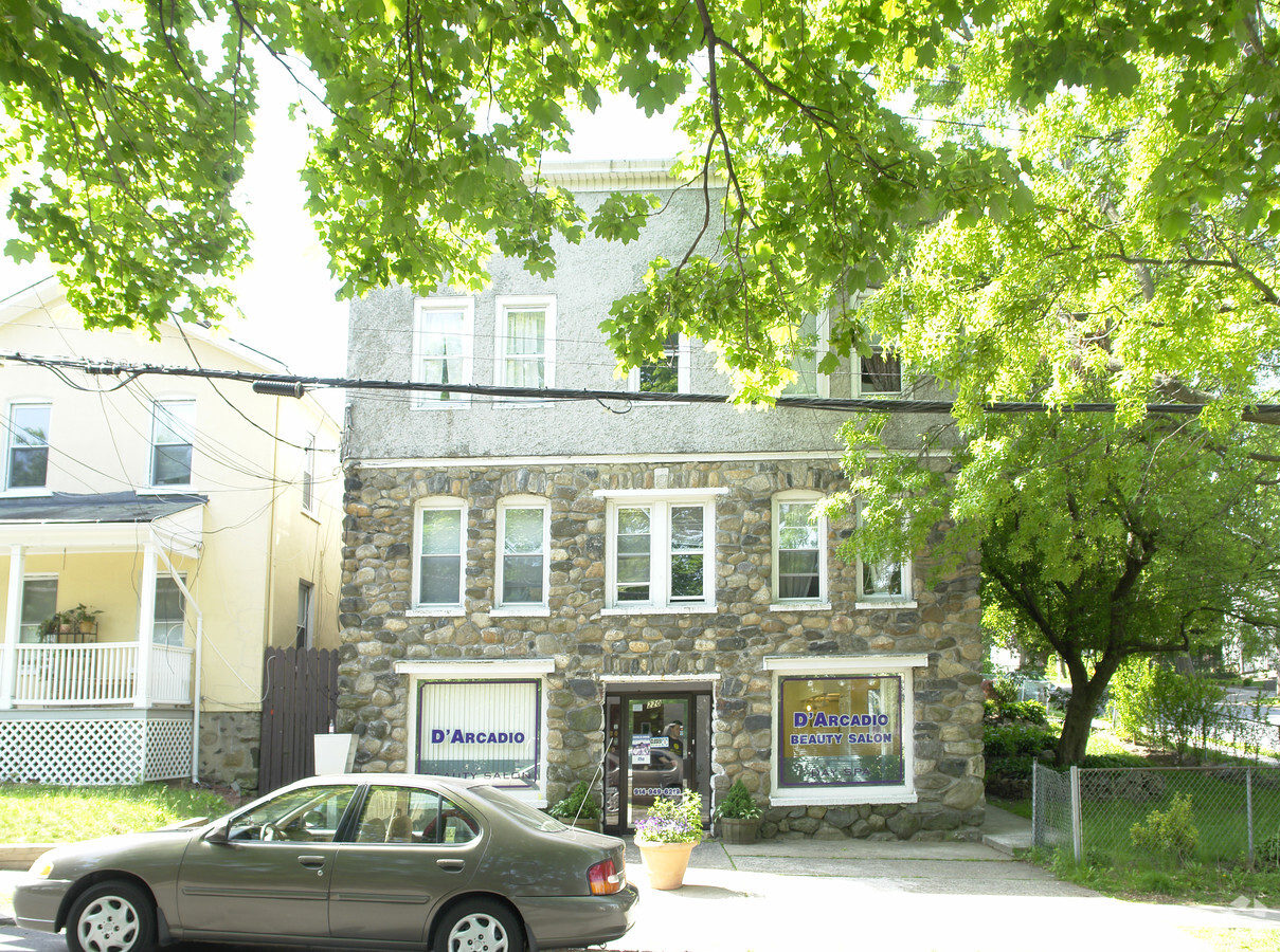
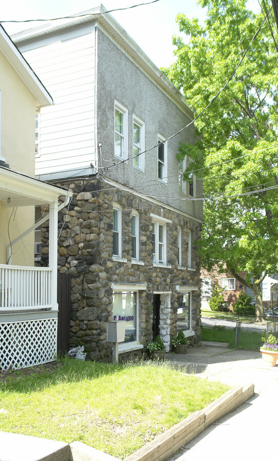
Property Record
220 Battle Ave, White Plains, NY 10606
NEARBY LISTINGS FOR SALE OR LEASE
Property Detail
220 Battle Ave
1700-125-080-00007-000-0001
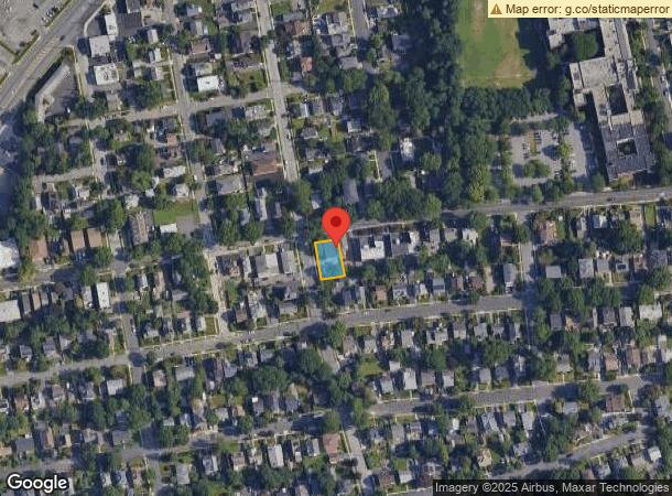
Map Vivian Heights
Commercialofficeresidentialmixeduse
Westchester
X
New York
36119C0268F
1.000
2023
0.14 AC
2023
East I-287 Corridor
009100
Westchester/So Connecticut
2,144 SF
New York-Jersey City-White Plains, NY-NJ
DEMOGRAPHICS near 220 Battle Ave
1 Mile
3 Mile
5 Mile
2024 Total Population
30,064
123,602
220,942
2029 Population
29,846
121,728
217,593
Pop Growth 2024-2029
(0.73%)
(1.52%)
(1.52%)
Average Age
42
42
42
2024 Total Households
11,990
47,555
81,501
HH Growth 2024-2029
(0.51%)
(1.48%)
(1.58%)
Median Household Inc
$103,458
$127,808
$143,844
Avg Household Size
2.30
2.50
2.60
2024 Avg HH Vehicles
1.00
2.00
2.00
Median Home Value
$562,288
$648,040
$725,317
Median Year Built
1967
1959
1958
Nearby Places
- Restaurants
- Banks
- Shops
- Fitness
- Groceries
PUBLIC TRANSPORTATION
COMMUTER RAIL
White Plains Station (Harlem Line - Metro-North Commuter Railroad Company (Metro-North))
DRIVE
WALK
Distance
White Plains Station (Harlem Line - Metro-North Commuter Railroad Company (Metro-North))
2 min
13 min
0.7 mi
Hartsdale Station (Harlem Line - Metro-North Commuter Railroad Company (Metro-North))
DRIVE
WALK
Distance
Hartsdale Station (Harlem Line - Metro-North Commuter Railroad Company (Metro-North))
6 min
1.9 mi
AIRPORT
Westchester County
DRIVE
WALK
Distance
Westchester County
14 min
7.0 mi
Laguardia
DRIVE
WALK
Distance
Laguardia
42 min
28.1 mi
John F Kennedy International
DRIVE
WALK
Distance
John F Kennedy International
49 min
32.0 mi
Freight Ports
NY - Red Hook Container Terminal
DRIVE
WALK
Distance
NY - Red Hook Container Terminal
55 min
36.3 mi
SALE & LEASE HISTORY
LISTING DATE
SALE/LEASE

Mar 31, 2017
For Lease
Jan 17, 2019
For Sale
Nearby Properties
Address
Land Use
TOTAL SIZE
Lot Size
Zoning
Address
Land Use
TOTAL SIZE
Lot Size
Zoning
358.83 AC
Address
Land Use
TOTAL SIZE
Lot Size
Zoning
85.40 AC
Address
Land Use
TOTAL SIZE
Lot Size
Zoning
4.45 AC
B
Address
Land Use
TOTAL SIZE
Lot Size
Zoning
Address
Land Use
TOTAL SIZE
Lot Size
Zoning
381,836 SF
16.68 AC
A3
Address
Land Use
TOTAL SIZE
Lot Size
Zoning
22.92 AC
Address
Land Use
TOTAL SIZE
Lot Size
Zoning
22.92 AC
Address
Land Use
TOTAL SIZE
Lot Size
Zoning
75.87 AC
R-20
Address
Land Use
TOTAL SIZE
Lot Size
Zoning
63.48 AC
R-30
Address
Land Use
TOTAL SIZE
Lot Size
Zoning
66 AC
R-20
Address
Land Use
TOTAL SIZE
Lot Size
Zoning
237,313 SF
22.67 AC
A1
Address
Land Use
TOTAL SIZE
Lot Size
Zoning
77.52 AC
A3
Address
Land Use
TOTAL SIZE
Lot Size
Zoning
19.25 AC
Address
Land Use
TOTAL SIZE
Lot Size
Zoning
8.42 AC
Address
Land Use
TOTAL SIZE
Lot Size
Zoning
22.44 AC
R-20
Address
Land Use
TOTAL SIZE
Lot Size
Zoning
11.61 AC
Address
Land Use
TOTAL SIZE
Lot Size
Zoning
1,975 SF
13.80 AC
CA
Address
Land Use
TOTAL SIZE
Lot Size
Zoning
29.42 AC
PUD
Address
Land Use
TOTAL SIZE
Lot Size
Zoning
10.90 AC
UR
Address
Land Use
TOTAL SIZE
Lot Size
Zoning
68,000 SF
1.53 AC
B
Address
Land Use
TOTAL SIZE
Lot Size
Zoning
3.16 AC
Address
Land Use
TOTAL SIZE
Lot Size
Zoning
64.41 AC
R-20
Address
Land Use
TOTAL SIZE
Lot Size
Zoning
7.98 AC
M-14
Address
Land Use
TOTAL SIZE
Lot Size
Zoning
48,267 SF
11.04 AC
A2 A
Address
Land Use
TOTAL SIZE
Lot Size
Zoning
7.98 AC
CA
Address
Land Use
TOTAL SIZE
Lot Size
Zoning
96,560 SF
12.76 AC
DS
Address
Land Use
TOTAL SIZE
Lot Size
Zoning
1.78 AC
Address
Land Use
TOTAL SIZE
Lot Size
Zoning
1,200 SF
21.21 AC
R-20
Address
Land Use
TOTAL SIZE
Lot Size
Zoning
0.58 AC
B
Address
Land Use
TOTAL SIZE
Lot Size
Zoning
84,450 SF
3.19 AC
B
The World's #1 Commercial Real Estate Marketplace
Connect with us
© 2025 CoStar Group
The information above has been obtained from sources believed reliable. While we do not doubt its accuracy we have not verified it and make no guarantee, warranty or representation about it. It is your responsibility to independently confirm its accuracy and completeness. Any projections, opinions, assumptions, or estimates used are for example only and do not represent the current or future performance of the property. The value of this transaction to you depends on tax and other factors which should be evaluated by your tax, financial, and legal advisors. You and your advisors should conduct a careful, independent investigation of the property to determine to your satisfaction the suitability of the property for your needs.