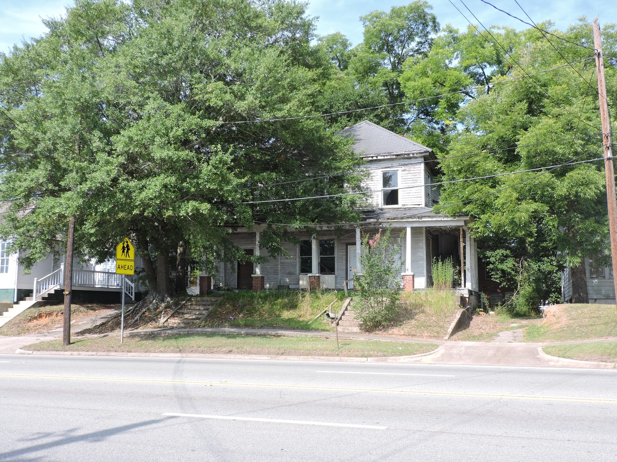
Property Record
220 E Greene St, Milledgeville, GA 31061
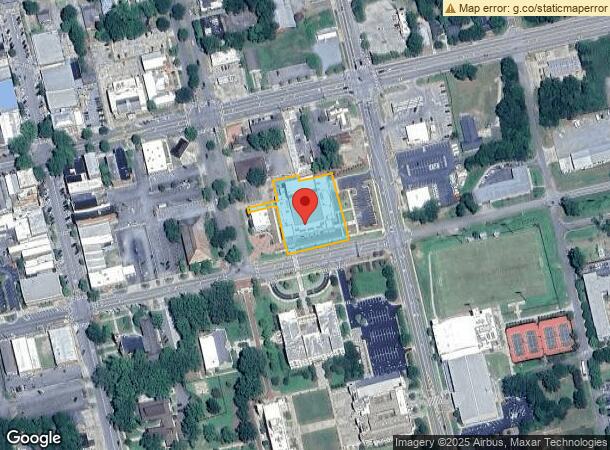
NEARBY LISTINGS FOR SALE OR LEASE
Property Detail
220 E Greene St
M61-087
Comm-Dt Milly-Area 2
Publicschool
NS E GREEN ST SQ 27 DB 1286-1
X
Baldwin
13319C0025C
Georgia
2023
1.11 AC
2024
Georgia South Area
970701
Other Market Areas
6,395 SF
Milledgeville, GA
DEMOGRAPHICS near 220 E Greene St
1 Mile
3 Mile
5 Mile
2024 Total Population
5,741
20,199
27,679
2029 Population
5,835
20,274
27,637
Pop Growth 2024-2029
+ 1.64%
+ 0.37%
(0.15%)
Average Age
30
37
38
2024 Total Households
2,058
7,964
10,675
HH Growth 2024-2029
+ 2.09%
+ 0.34%
(0.18%)
Median Household Inc
$16,371
$34,441
$40,823
Avg Household Size
2.00
2.20
2.30
2024 Avg HH Vehicles
2.00
2.00
2.00
Median Home Value
$130,081
$131,311
$147,668
Median Year Built
1972
1977
1980
Nearby Places
- Restaurants
- Banks
- Shops
- Fitness
- Groceries
SALE & LEASE HISTORY
LISTING DATE
SALE/LEASE

Sep 24, 2016
For Sale
Nearby Properties
Address
Land Use
TOTAL SIZE
Lot Size
Zoning
Address
Land Use
TOTAL SIZE
Lot Size
Zoning
19.20 AC
RESIDENTIA
Address
Land Use
TOTAL SIZE
Lot Size
Zoning
29.65 AC
RESIDENTIA
Address
Land Use
TOTAL SIZE
Lot Size
Zoning
69,820 SF
15 AC
COMMERCIAL
Address
Land Use
TOTAL SIZE
Lot Size
Zoning
5,378 SF
1,875.54 AC
RESIDENTIA
Address
Land Use
TOTAL SIZE
Lot Size
Zoning
74,448 SF
49 AC
RESIDENTIA
Address
Land Use
TOTAL SIZE
Lot Size
Zoning
2.50 AC
RESIDENTIA
Address
Land Use
TOTAL SIZE
Lot Size
Zoning
49,412 SF
0.26 AC
RESIDENTIA
Address
Land Use
TOTAL SIZE
Lot Size
Zoning
313,804 SF
17.50 AC
RESIDENTIA
Address
Land Use
TOTAL SIZE
Lot Size
Zoning
386,880 SF
17.52 AC
RESIDENTIA
Address
Land Use
TOTAL SIZE
Lot Size
Zoning
67,500 SF
1.70 AC
RESIDENTIA
Address
Land Use
TOTAL SIZE
Lot Size
Zoning
30.05 AC
RESIDENTIA
Address
Land Use
TOTAL SIZE
Lot Size
Zoning
866,082 SF
6.61 AC
RESIDENTIA
Address
Land Use
TOTAL SIZE
Lot Size
Zoning
940 SF
24.68 AC
Address
Land Use
TOTAL SIZE
Lot Size
Zoning
40,800 SF
0.14 AC
RESIDENTIA
Address
Land Use
TOTAL SIZE
Lot Size
Zoning
12.30 AC
RESIDENTIA
Address
Land Use
TOTAL SIZE
Lot Size
Zoning
228,844 SF
3.20 AC
RESIDENTIA
Address
Land Use
TOTAL SIZE
Lot Size
Zoning
554,286 SF
24.17 AC
RESIDENTIA
Address
Land Use
TOTAL SIZE
Lot Size
Zoning
19.50 AC
RESIDENTIA
Address
Land Use
TOTAL SIZE
Lot Size
Zoning
6,318 SF
27.92 AC
RESIDENTIA
Address
Land Use
TOTAL SIZE
Lot Size
Zoning
76,800 SF
0.86 AC
UNZONED UR
Address
Land Use
TOTAL SIZE
Lot Size
Zoning
46,858 SF
2.64 AC
RESIDENTIA
Address
Land Use
TOTAL SIZE
Lot Size
Zoning
34,953 SF
2.17 AC
RESIDENTIA
Address
Land Use
TOTAL SIZE
Lot Size
Zoning
76,582 SF
3.17 AC
RESIDENTIA
Address
Land Use
TOTAL SIZE
Lot Size
Zoning
37,296 SF
13.50 AC
RESIDENTIA
Address
Land Use
TOTAL SIZE
Lot Size
Zoning
17,980 SF
2.30 AC
COMMERCIAL
Address
Land Use
TOTAL SIZE
Lot Size
Zoning
160,604 SF
8.29 AC
RESIDENTIA
Address
Land Use
TOTAL SIZE
Lot Size
Zoning
7,764 SF
10 AC
UNZONED RU
Address
Land Use
TOTAL SIZE
Lot Size
Zoning
172,008 SF
2.31 AC
RESIDENTIA
Address
Land Use
TOTAL SIZE
Lot Size
Zoning
1,006.83 AC
UNZONED RU
Address
Land Use
TOTAL SIZE
Lot Size
Zoning
136,469 SF
6.44 AC
RESIDENTIA
The World's #1 Commercial Real Estate Marketplace
Connect with us
© 2025 CoStar Group
The information above has been obtained from sources believed reliable. While we do not doubt its accuracy we have not verified it and make no guarantee, warranty or representation about it. It is your responsibility to independently confirm its accuracy and completeness. Any projections, opinions, assumptions, or estimates used are for example only and do not represent the current or future performance of the property. The value of this transaction to you depends on tax and other factors which should be evaluated by your tax, financial, and legal advisors. You and your advisors should conduct a careful, independent investigation of the property to determine to your satisfaction the suitability of the property for your needs.