Property Record
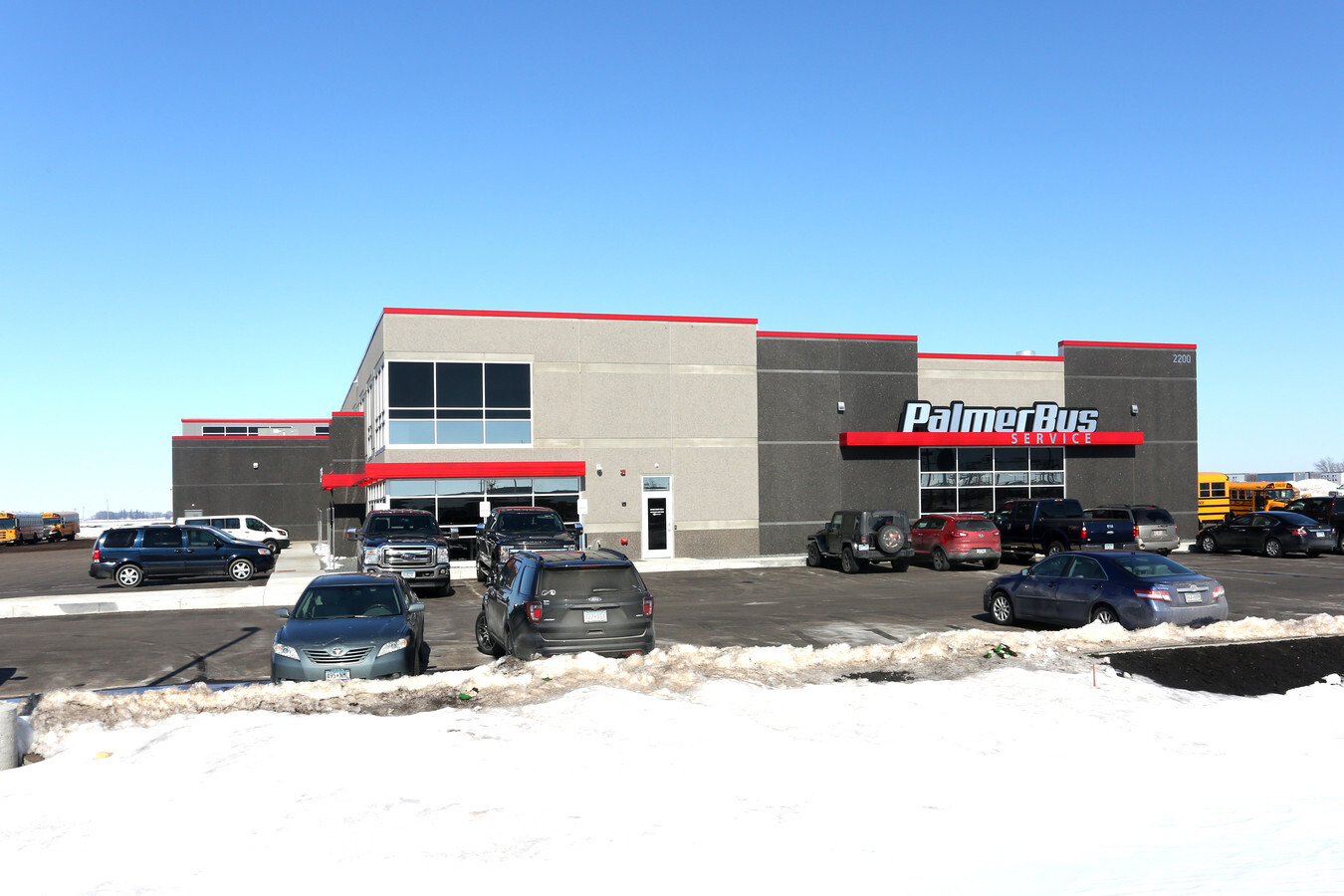
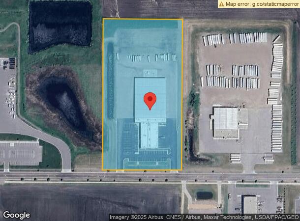
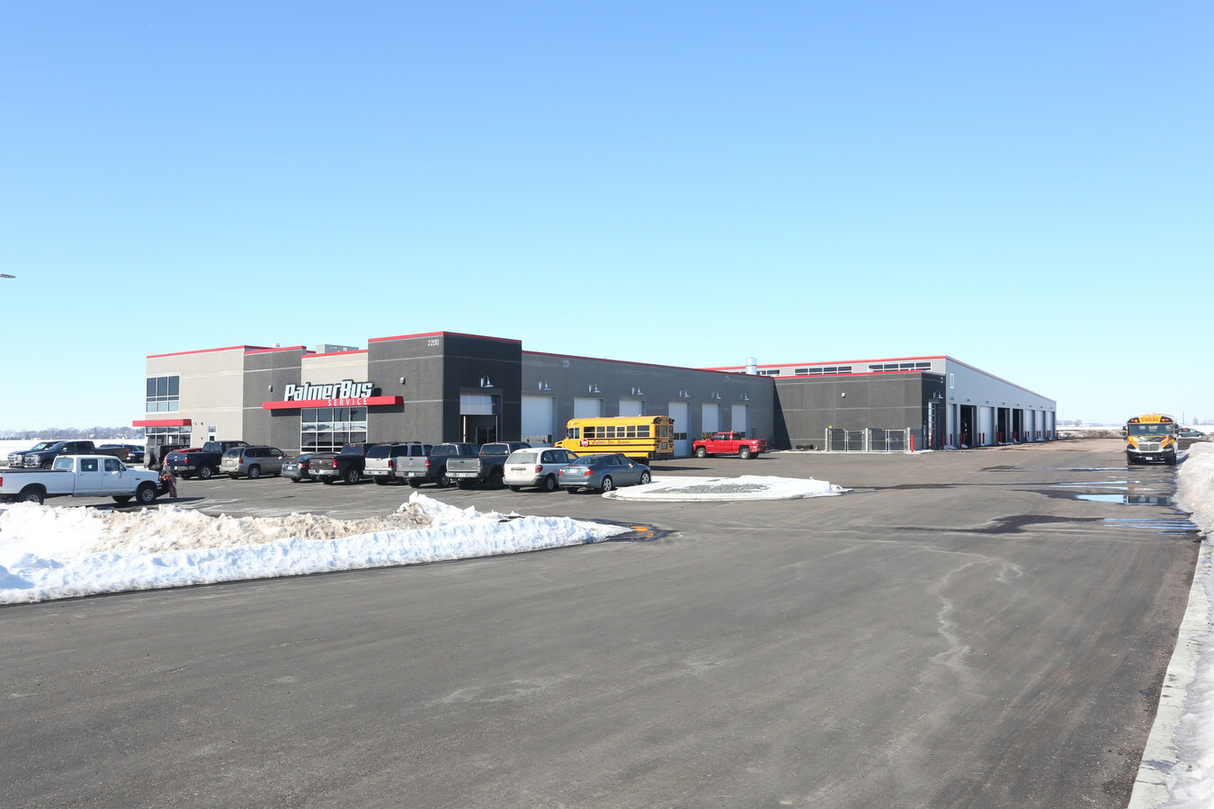
2200 Carlson Dr, North Mankato, MN 56003
NEARBY LISTINGS FOR SALE OR LEASE
Property Detail
2200 Carlson Dr
Other Market Areas
Northport No 20
Mankato-North Mankato, MN
BLOCK 2 LOT 1 SUBDIVISIONCD 18317 SUBDIVISIONNAME NORTHPORT 20
18.317.0020
Nicollet
Autorepair
Minnesota
2024
1
2024
8.94 AC
480502
North Mankato
59,912 SF
DEMOGRAPHICS near 2200 Carlson Dr
1 Mile
3 Mile
5 Mile
2024 Total Population
2,303
16,734
48,133
2029 Population
2,349
16,774
48,754
Pop Growth 2024-2029
+ 2.00%
+ 0.24%
+ 1.29%
Average Age
40
39
37
2024 Total Households
1,009
6,878
19,397
HH Growth 2024-2029
+ 2.28%
+ 0.36%
+ 1.40%
Median Household Inc
$66,169
$73,626
$65,142
Avg Household Size
2.30
2.40
2.30
2024 Avg HH Vehicles
2.00
2.00
2.00
Median Home Value
$220,089
$231,408
$216,629
Median Year Built
2002
1980
1972
Nearby Places
- Restaurants
- Banks
- Shops
- Fitness
- Groceries
Nearby Properties
Address
Land Use
TOTAL SIZE
Lot Size
Zoning
Address
Land Use
TOTAL SIZE
Lot Size
Zoning
269,842 SF
48.03 AC
Address
Land Use
TOTAL SIZE
Lot Size
Zoning
130,218 SF
39.09 AC
Address
Land Use
TOTAL SIZE
Lot Size
Zoning
25,771 SF
3.31 AC
Address
Land Use
TOTAL SIZE
Lot Size
Zoning
67,200 SF
13.04 AC
Address
Land Use
TOTAL SIZE
Lot Size
Zoning
4.28 AC
Address
Land Use
TOTAL SIZE
Lot Size
Zoning
16.15 AC
Address
Land Use
TOTAL SIZE
Lot Size
Zoning
12,400 SF
60.45 AC
Address
Land Use
TOTAL SIZE
Lot Size
Zoning
13,886 SF
19.50 AC
Address
Land Use
TOTAL SIZE
Lot Size
Zoning
10.72 AC
Address
Land Use
TOTAL SIZE
Lot Size
Zoning
60,000 SF
9.11 AC
Address
Land Use
TOTAL SIZE
Lot Size
Zoning
43,476 SF
6.37 AC
Address
Land Use
TOTAL SIZE
Lot Size
Zoning
272,428 SF
22.09 AC
Address
Land Use
TOTAL SIZE
Lot Size
Zoning
185,200 SF
12.87 AC
Address
Land Use
TOTAL SIZE
Lot Size
Zoning
73,749 SF
64.75 AC
Address
Land Use
TOTAL SIZE
Lot Size
Zoning
213,294 SF
12.56 AC
Address
Land Use
TOTAL SIZE
Lot Size
Zoning
67,887 SF
4.48 AC
Address
Land Use
TOTAL SIZE
Lot Size
Zoning
64,757 SF
2.46 AC
Address
Land Use
TOTAL SIZE
Lot Size
Zoning
57,710 SF
14.10 AC
Address
Land Use
TOTAL SIZE
Lot Size
Zoning
70,656 SF
2.85 AC
Address
Land Use
TOTAL SIZE
Lot Size
Zoning
2.85 AC
Address
Land Use
TOTAL SIZE
Lot Size
Zoning
12,800 SF
8.75 AC
Address
Land Use
TOTAL SIZE
Lot Size
Zoning
204,800 SF
9.13 AC
Address
Land Use
TOTAL SIZE
Lot Size
Zoning
34,200 SF
19.47 AC
Address
Land Use
TOTAL SIZE
Lot Size
Zoning
121,600 SF
8.74 AC
Address
Land Use
TOTAL SIZE
Lot Size
Zoning
23,380 SF
25.30 AC
Address
Land Use
TOTAL SIZE
Lot Size
Zoning
3.08 AC
Address
Land Use
TOTAL SIZE
Lot Size
Zoning
10,752 SF
6.38 AC
Address
Land Use
TOTAL SIZE
Lot Size
Zoning
2.63 AC
Address
Land Use
TOTAL SIZE
Lot Size
Zoning
65,686 SF
12 AC
Address
Land Use
TOTAL SIZE
Lot Size
Zoning
75,920 SF
9.32 AC
The World's #1 Commercial Real Estate Marketplace
Connect with us
© 2025 CoStar Group
The information above has been obtained from sources believed reliable. While we do not doubt its accuracy we have not verified it and make no guarantee, warranty or representation about it. It is your responsibility to independently confirm its accuracy and completeness. Any projections, opinions, assumptions, or estimates used are for example only and do not represent the current or future performance of the property. The value of this transaction to you depends on tax and other factors which should be evaluated by your tax, financial, and legal advisors. You and your advisors should conduct a careful, independent investigation of the property to determine to your satisfaction the suitability of the property for your needs.