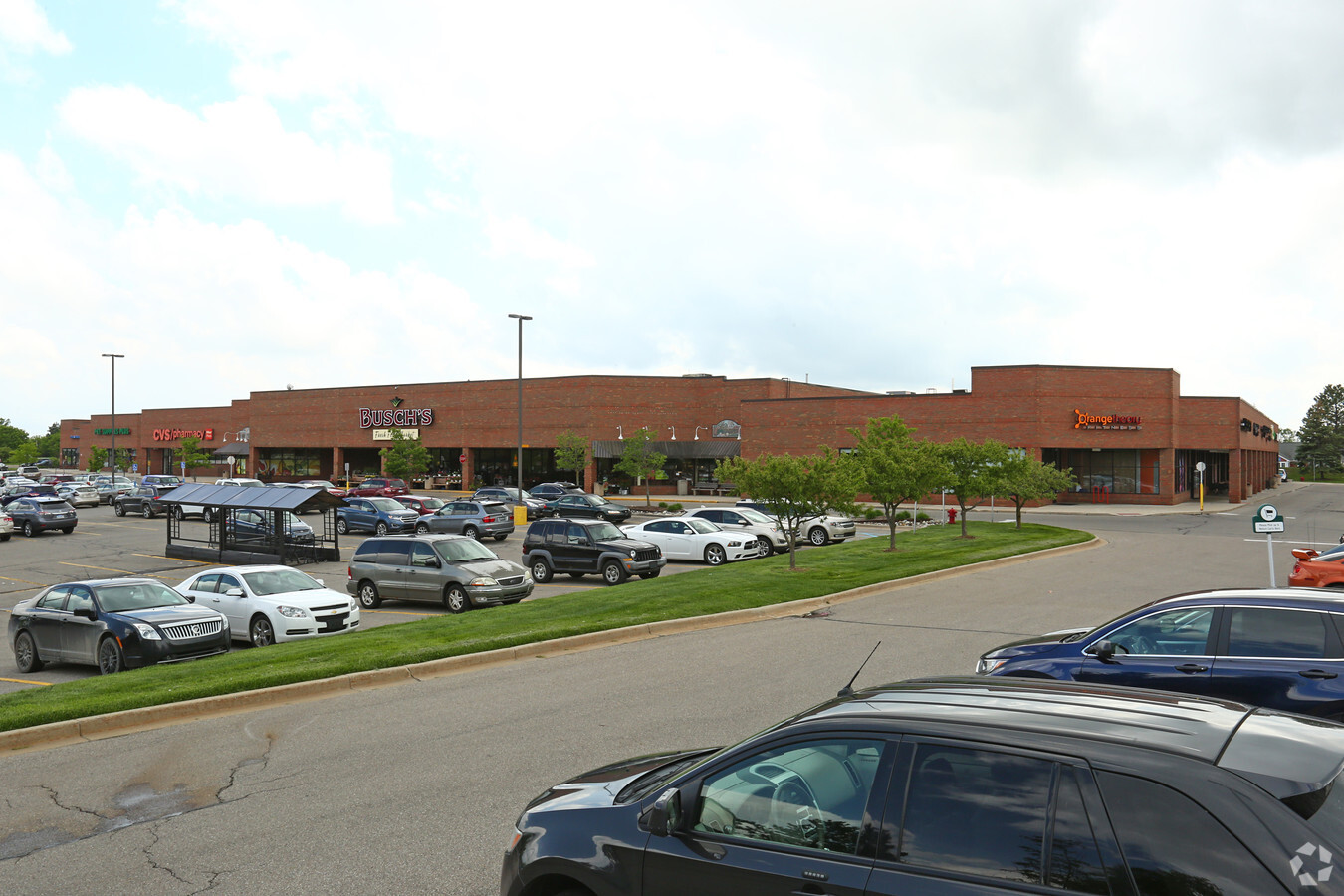
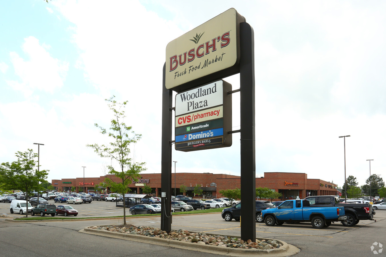
Property Record
2200 S Main St, Ann Arbor, MI 48103
NEARBY LISTINGS FOR SALE OR LEASE
Property Detail
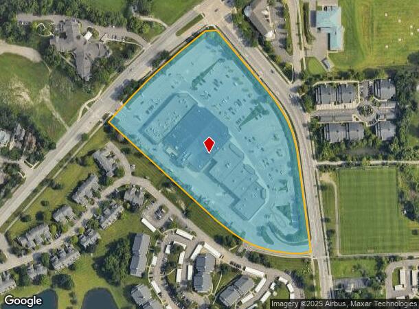
2200 S Main St
12-05-205-006
PRT OF NW FRACTIONAL 1/4 OF SEC 5, T3S, R6E. DESC AS COM AT S 1/4 COR OF SD SEC 5, TH N 3 DEG 19 MIN 40 SEC E 2640 FT, TH
Commercialnec
Washtenaw
X
Michigan
26161C0244E
10.65 AC
2024
Washtenaw W of 23
2024
Detroit
404500
Ann Arbor, MI
DEMOGRAPHICS near 2200 S Main St
1 Mile
3 Mile
5 Mile
2024 Total Population
9,544
97,532
167,223
2029 Population
9,471
96,517
165,514
Pop Growth 2024-2029
(0.76%)
(1.04%)
(1.02%)
Average Age
39
36
37
2024 Total Households
4,756
40,790
69,270
HH Growth 2024-2029
(0.76%)
(0.98%)
(1.04%)
Median Household Inc
$88,317
$77,107
$79,976
Avg Household Size
1.90
2.10
2.20
2024 Avg HH Vehicles
1.00
2.00
2.00
Median Home Value
$424,728
$430,054
$415,196
Median Year Built
1984
1971
1977
Nearby Places
- Restaurants
- Banks
- Shops
- Fitness
- Groceries
PUBLIC TRANSPORTATION
COMMUTER RAIL
Ann Arbor Amtrak Station (Wolverine - Amtrak)
DRIVE
WALK
Distance
Ann Arbor Amtrak Station (Wolverine - Amtrak)
8 min
2.8 mi
AIRPORT
Detroit Metro Wayne County
DRIVE
WALK
Distance
Detroit Metro Wayne County
32 min
25.0 mi
Freight Ports
Port of Toledo
DRIVE
WALK
Distance
Port of Toledo
76 min
58.2 mi
Nearby Properties
Address
Land Use
TOTAL SIZE
Lot Size
Zoning
Address
Land Use
TOTAL SIZE
Lot Size
Zoning
0.80 AC
D1
Address
Land Use
TOTAL SIZE
Lot Size
Zoning
1.15 AC
D1
Address
Land Use
TOTAL SIZE
Lot Size
Zoning
20.92 AC
C2B
Address
Land Use
TOTAL SIZE
Lot Size
Zoning
0.74 AC
D1
Address
Land Use
TOTAL SIZE
Lot Size
Zoning
2.06 AC
D2
Address
Land Use
TOTAL SIZE
Lot Size
Zoning
0.52 AC
D1
Address
Land Use
TOTAL SIZE
Lot Size
Zoning
3.12 AC
PUD
Address
Land Use
TOTAL SIZE
Lot Size
Zoning
0.58 AC
D1
Address
Land Use
TOTAL SIZE
Lot Size
Zoning
173,885 SF
0.43 AC
D1
Address
Land Use
TOTAL SIZE
Lot Size
Zoning
10.43 AC
PUD
Address
Land Use
TOTAL SIZE
Lot Size
Zoning
6.57 AC
C1B
Address
Land Use
TOTAL SIZE
Lot Size
Zoning
20.41 AC
R4B
Address
Land Use
TOTAL SIZE
Lot Size
Zoning
0.50 AC
D1
Address
Land Use
TOTAL SIZE
Lot Size
Zoning
19.32 AC
R4B
Address
Land Use
TOTAL SIZE
Lot Size
Zoning
0.59 AC
D1
Address
Land Use
TOTAL SIZE
Lot Size
Zoning
1.63 AC
C2B
Address
Land Use
TOTAL SIZE
Lot Size
Zoning
0.91 AC
D2
Address
Land Use
TOTAL SIZE
Lot Size
Zoning
1.87 AC
PUD
Address
Land Use
TOTAL SIZE
Lot Size
Zoning
0.35 AC
D1
Address
Land Use
TOTAL SIZE
Lot Size
Zoning
Address
Land Use
TOTAL SIZE
Lot Size
Zoning
Address
Land Use
TOTAL SIZE
Lot Size
Zoning
18.34 AC
Address
Land Use
TOTAL SIZE
Lot Size
Zoning
0.38 AC
D1
Address
Land Use
TOTAL SIZE
Lot Size
Zoning
16.18 AC
PUD
Address
Land Use
TOTAL SIZE
Lot Size
Zoning
0.26 AC
D1
Address
Land Use
TOTAL SIZE
Lot Size
Zoning
0.55 AC
PUD
Address
Land Use
TOTAL SIZE
Lot Size
Zoning
24.18 AC
R4A
Address
Land Use
TOTAL SIZE
Lot Size
Zoning
25.82 AC
UNKNOWN
Address
Land Use
TOTAL SIZE
Lot Size
Zoning
0.32 AC
D1
Address
Land Use
TOTAL SIZE
Lot Size
Zoning
The World's #1 Commercial Real Estate Marketplace
Connect with us
© 2025 CoStar Group
The information above has been obtained from sources believed reliable. While we do not doubt its accuracy we have not verified it and make no guarantee, warranty or representation about it. It is your responsibility to independently confirm its accuracy and completeness. Any projections, opinions, assumptions, or estimates used are for example only and do not represent the current or future performance of the property. The value of this transaction to you depends on tax and other factors which should be evaluated by your tax, financial, and legal advisors. You and your advisors should conduct a careful, independent investigation of the property to determine to your satisfaction the suitability of the property for your needs.