Property Record
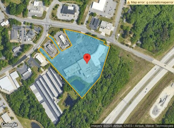
2231 Fleming Rd, Greensboro, NC 27410
NEARBY LISTINGS FOR SALE OR LEASE
Property Detail
2231 Fleming Rd
Greensboro-High Point, NC
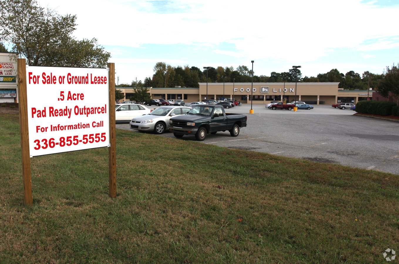
Cardinal Xing Map 03
0096247
CARDINAL CROSSING SHOPPING CENTER
Storebuilding
Guilford
X
North Carolina
3710783600J
13
2023
6.85 AC
2023
NW Guilford County
016009
Greensboro/Winston-Salem
552 SF
DEMOGRAPHICS near 2231 Fleming Rd
1 Mile
3 Mile
5 Mile
2024 Total Population
4,339
40,996
99,017
2029 Population
4,297
40,749
98,603
Pop Growth 2024-2029
(0.97%)
(0.60%)
(0.42%)
Average Age
41
42
41
2024 Total Households
1,655
18,197
44,447
HH Growth 2024-2029
(0.97%)
(0.55%)
(0.42%)
Median Household Inc
$95,571
$77,719
$71,564
Avg Household Size
2.60
2.20
2.20
2024 Avg HH Vehicles
2.00
2.00
2.00
Median Home Value
$242,522
$255,986
$259,656
Median Year Built
1988
1991
1986
Nearby Places
- Restaurants
- Banks
- Shops
- Fitness
- Groceries
PUBLIC TRANSPORTATION
COMMUTER RAIL
Greensboro Station (Piedmont - North Carolina by Train (NC Train))
DRIVE
WALK
Distance
Greensboro Station (Piedmont - North Carolina by Train (NC Train))
15 min
9.1 mi
AIRPORT
Piedmont Triad International
DRIVE
WALK
Distance
Piedmont Triad International
14 min
4.3 mi
Freight Ports
Virginia Port Authority - Richmond
DRIVE
WALK
Distance
Virginia Port Authority - Richmond
242 min
206.7 mi
Nearby Properties
Address
Land Use
TOTAL SIZE
Lot Size
Zoning
Address
Land Use
TOTAL SIZE
Lot Size
Zoning
747,867 SF
349.10 AC
PI
Address
Land Use
TOTAL SIZE
Lot Size
Zoning
404,766 SF
153.35 AC
AR
Address
Land Use
TOTAL SIZE
Lot Size
Zoning
440,925 SF
72.55 AC
CD-GO-M
Address
Land Use
TOTAL SIZE
Lot Size
Zoning
501,140 SF
50.04 AC
R-3
Address
Land Use
TOTAL SIZE
Lot Size
Zoning
410,298 SF
33.10 AC
CU-RM-12
Address
Land Use
TOTAL SIZE
Lot Size
Zoning
472,566 SF
46.77 AC
RM-12
Address
Land Use
TOTAL SIZE
Lot Size
Zoning
309,598 SF
28.10 AC
RM-12
Address
Land Use
TOTAL SIZE
Lot Size
Zoning
400,821 SF
30.06 AC
PUD
Address
Land Use
TOTAL SIZE
Lot Size
Zoning
217,594 SF
20.01 AC
CU-RM-18
Address
Land Use
TOTAL SIZE
Lot Size
Zoning
358,900 SF
60.50 AC
PI
Address
Land Use
TOTAL SIZE
Lot Size
Zoning
82,067 SF
9.41 AC
CU-SC
Address
Land Use
TOTAL SIZE
Lot Size
Zoning
317,844 SF
17.10 AC
PUD
Address
Land Use
TOTAL SIZE
Lot Size
Zoning
156,800 SF
30.81 AC
R-3
Address
Land Use
TOTAL SIZE
Lot Size
Zoning
316,205 SF
17.84 AC
CU-RM-18
Address
Land Use
TOTAL SIZE
Lot Size
Zoning
134,391 SF
19 AC
O
Address
Land Use
TOTAL SIZE
Lot Size
Zoning
249,702 SF
15.39 AC
CU-PDM
Address
Land Use
TOTAL SIZE
Lot Size
Zoning
214,228 SF
21.46 AC
CU-SC
Address
Land Use
TOTAL SIZE
Lot Size
Zoning
204,438 SF
12.06 AC
RM-18
Address
Land Use
TOTAL SIZE
Lot Size
Zoning
488,513 SF
37.16 AC
RM-18
Address
Land Use
TOTAL SIZE
Lot Size
Zoning
69,744 SF
100.01 AC
CD-O
Address
Land Use
TOTAL SIZE
Lot Size
Zoning
287,394 SF
7.47 AC
PUD
Address
Land Use
TOTAL SIZE
Lot Size
Zoning
267,381 SF
18.98 AC
RM-12
Address
Land Use
TOTAL SIZE
Lot Size
Zoning
246,306 SF
44.26 AC
CU-RM-8
Address
Land Use
TOTAL SIZE
Lot Size
Zoning
209,515 SF
30.04 AC
CU-RM-8
Address
Land Use
TOTAL SIZE
Lot Size
Zoning
367,338 SF
28.02 AC
CU-RM-12
Address
Land Use
TOTAL SIZE
Lot Size
Zoning
274,034 SF
5.22 AC
PI
Address
Land Use
TOTAL SIZE
Lot Size
Zoning
134,781 SF
140.63 AC
AR
Address
Land Use
TOTAL SIZE
Lot Size
Zoning
137,800 SF
11.64 AC
CU-RM-12
Address
Land Use
TOTAL SIZE
Lot Size
Zoning
231,049 SF
30.76 AC
CU-RM-8
Address
Land Use
TOTAL SIZE
Lot Size
Zoning
209,128 SF
17.45 AC
PD-R
The World's #1 Commercial Real Estate Marketplace
Connect with us
© 2025 CoStar Group
The information above has been obtained from sources believed reliable. While we do not doubt its accuracy we have not verified it and make no guarantee, warranty or representation about it. It is your responsibility to independently confirm its accuracy and completeness. Any projections, opinions, assumptions, or estimates used are for example only and do not represent the current or future performance of the property. The value of this transaction to you depends on tax and other factors which should be evaluated by your tax, financial, and legal advisors. You and your advisors should conduct a careful, independent investigation of the property to determine to your satisfaction the suitability of the property for your needs.