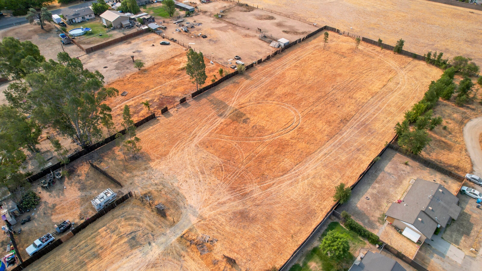
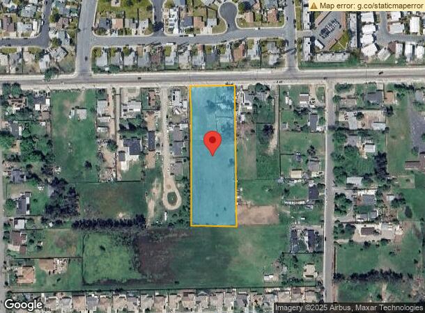
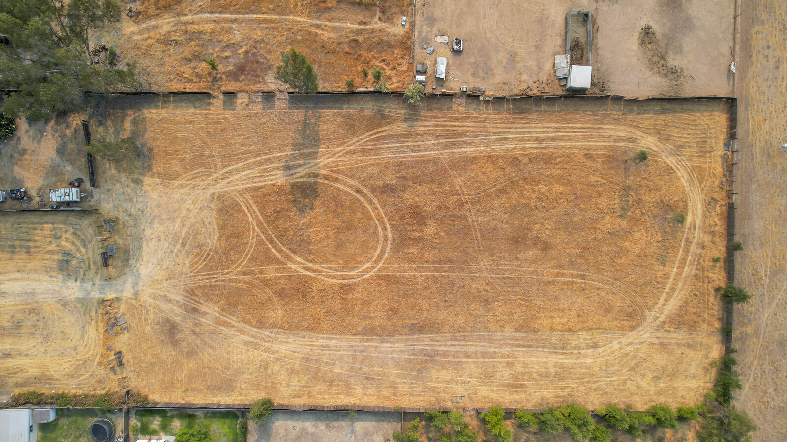
Property Record
2202 Mcgowan Pkwy, Olivehurst, CA 95961
NEARBY LISTINGS FOR SALE OR LEASE
Property Detail
2202 Mcgowan Pkwy
Sacramento
Ostrom Tract Acres
Yuba City, CA
Yuba
014-201-006-000
California
Mobilemanufacturedhomeregardlessoflandownership
2.76 AC
X
Yuba County
06115C0410D
DEMOGRAPHICS near 2202 Mcgowan Pkwy
1 Mile
3 Mile
5 Mile
2024 Total Population
6,394
24,796
57,081
2029 Population
7,060
27,557
62,345
Pop Growth 2024-2029
+ 10.42%
+ 11.13%
+ 9.22%
Average Age
36
35
35
2024 Total Households
1,968
7,509
17,319
HH Growth 2024-2029
+ 10.77%
+ 11.53%
+ 9.72%
Median Household Inc
$60,138
$69,736
$68,277
Avg Household Size
3.10
3.20
3.20
2024 Avg HH Vehicles
2.00
2.00
2.00
Median Home Value
$246,003
$307,328
$323,671
Median Year Built
1978
1994
1996
Nearby Places
- Restaurants
- Banks
- Shops
- Fitness
- Groceries
PUBLIC TRANSPORTATION
AIRPORT
Sacramento International
DRIVE
WALK
Distance
Sacramento International
42 min
33.0 mi
Freight Ports
Port of Stockton
DRIVE
WALK
Distance
Port of Stockton
94 min
81.4 mi
SALE & LEASE HISTORY
LISTING DATE
SALE/LEASE

Jun 13, 2022
For Sale
Aug 19, 2021
For Sale
Nearby Properties
Address
Land Use
TOTAL SIZE
Lot Size
Zoning
Address
Land Use
TOTAL SIZE
Lot Size
Zoning
30.13 AC
AI
Address
Land Use
TOTAL SIZE
Lot Size
Zoning
90 AC
AE-80
Address
Land Use
TOTAL SIZE
Lot Size
Zoning
19,950 SF
7.66 AC
M-1
Address
Land Use
TOTAL SIZE
Lot Size
Zoning
63,320 SF
3.88 AC
R-03
Address
Land Use
TOTAL SIZE
Lot Size
Zoning
17,340 SF
1.78 AC
C
Address
Land Use
TOTAL SIZE
Lot Size
Zoning
21,746 SF
2.18 AC
Address
Land Use
TOTAL SIZE
Lot Size
Zoning
100,000 SF
11.78 AC
M-1
Address
Land Use
TOTAL SIZE
Lot Size
Zoning
1.22 AC
CMX
Address
Land Use
TOTAL SIZE
Lot Size
Zoning
124,835 SF
5.69 AC
C
Address
Land Use
TOTAL SIZE
Lot Size
Zoning
593 AC
AE-80
Address
Land Use
TOTAL SIZE
Lot Size
Zoning
Address
Land Use
TOTAL SIZE
Lot Size
Zoning
498 AC
AE-40
Address
Land Use
TOTAL SIZE
Lot Size
Zoning
9,152 SF
1.40 AC
RRE
Address
Land Use
TOTAL SIZE
Lot Size
Zoning
77,696 SF
4 AC
R-02
Address
Land Use
TOTAL SIZE
Lot Size
Zoning
61,497 SF
15 AC
M-1
Address
Land Use
TOTAL SIZE
Lot Size
Zoning
6,200 SF
1 AC
C
Address
Land Use
TOTAL SIZE
Lot Size
Zoning
8,883 SF
45.03 AC
M-1
Address
Land Use
TOTAL SIZE
Lot Size
Zoning
116,660 SF
10 AC
M1
Address
Land Use
TOTAL SIZE
Lot Size
Zoning
22,948 SF
10.82 AC
M-1
Address
Land Use
TOTAL SIZE
Lot Size
Zoning
91.27 AC
AE-80
Address
Land Use
TOTAL SIZE
Lot Size
Zoning
90,647 SF
33.63 AC
AE-40
Address
Land Use
TOTAL SIZE
Lot Size
Zoning
90,931 SF
589 AC
AE-80
Address
Land Use
TOTAL SIZE
Lot Size
Zoning
3,440 SF
104.04 AC
M-1
Address
Land Use
TOTAL SIZE
Lot Size
Zoning
127.77 AC
AE-40
Address
Land Use
TOTAL SIZE
Lot Size
Zoning
44,322 SF
7.23 AC
M-1
Address
Land Use
TOTAL SIZE
Lot Size
Zoning
68,060 SF
6 AC
M-1
Address
Land Use
TOTAL SIZE
Lot Size
Zoning
112,919 SF
91 AC
AE-80
Address
Land Use
TOTAL SIZE
Lot Size
Zoning
58,150 SF
3.40 AC
RRE
The World's #1 Commercial Real Estate Marketplace
Connect with us
© 2025 CoStar Group
The information above has been obtained from sources believed reliable. While we do not doubt its accuracy we have not verified it and make no guarantee, warranty or representation about it. It is your responsibility to independently confirm its accuracy and completeness. Any projections, opinions, assumptions, or estimates used are for example only and do not represent the current or future performance of the property. The value of this transaction to you depends on tax and other factors which should be evaluated by your tax, financial, and legal advisors. You and your advisors should conduct a careful, independent investigation of the property to determine to your satisfaction the suitability of the property for your needs.