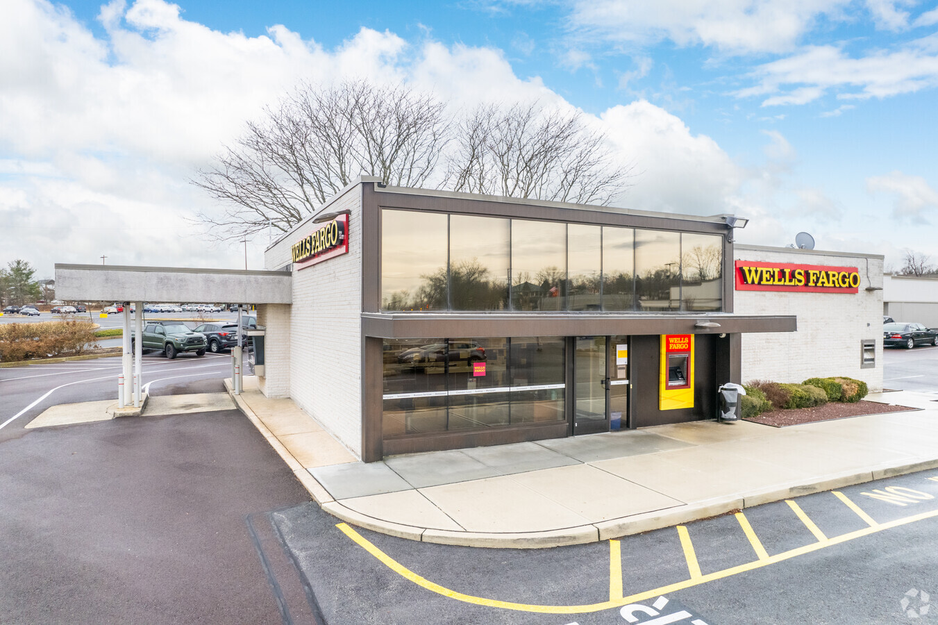
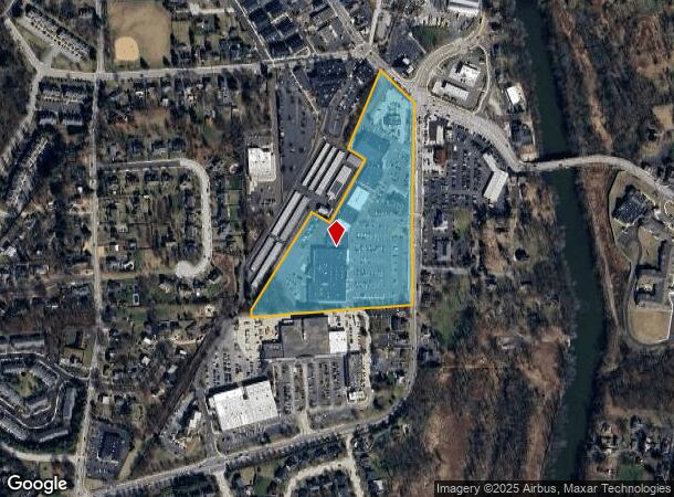
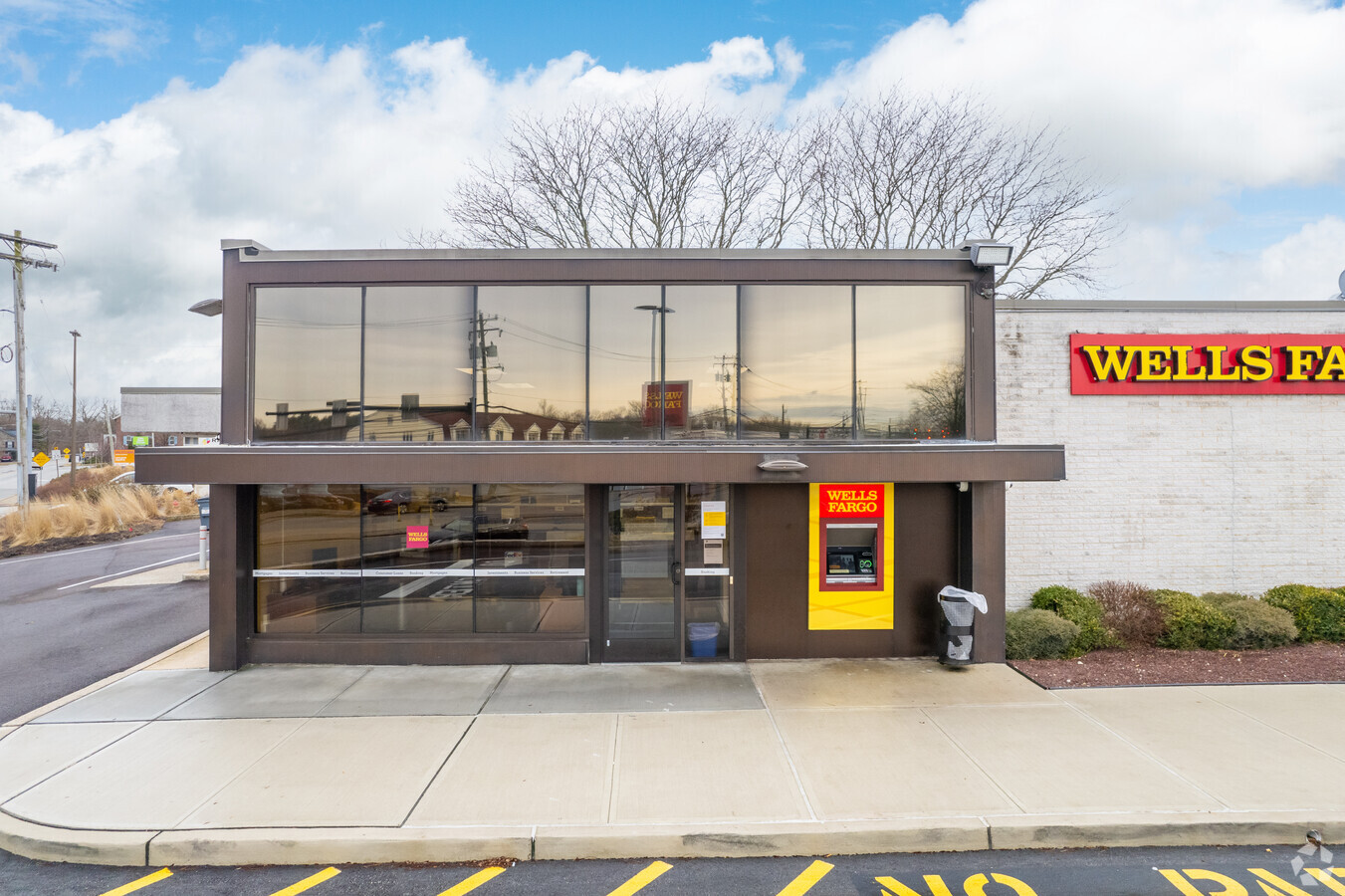
Property Record
222 E Main St, Lansdale, PA 19446
NEARBY LISTINGS FOR SALE OR LEASE
Property Detail
222 E Main St
Philadelphia-Camden-Wilmington, PA-NJ-DE-MD
Plan Of Survey Prepared For Collegeville
04-00-01192-001
INC 04 00 00022 00 1 & 04 00 01633 00 1 & 04 00 01675 00 4 U 32-43 INC 45 & 57
Regionalshoppingcenterormallwithanchorstore
Montgomery
X
Pennsylvania
42029C0065G
31
2024
13.60 AC
2024
West Montgomery County
200907
Philadelphia
114,772 SF
DEMOGRAPHICS near 222 E Main St
1 Mile
3 Mile
5 Mile
2024 Total Population
8,569
42,894
114,485
2029 Population
8,794
43,744
116,446
Pop Growth 2024-2029
+ 2.63%
+ 1.98%
+ 1.71%
Average Age
38
40
41
2024 Total Households
2,827
13,415
41,017
HH Growth 2024-2029
+ 2.55%
+ 2.18%
+ 1.80%
Median Household Inc
$121,874
$142,699
$115,468
Avg Household Size
2.60
2.80
2.60
2024 Avg HH Vehicles
2.00
2.00
2.00
Median Home Value
$412,576
$443,329
$405,672
Median Year Built
1987
1993
1988
Nearby Places
- Restaurants
- Banks
- Shops
- Fitness
- Groceries
PUBLIC TRANSPORTATION
COMMUTER RAIL
Main Street (Norristown) (R6 - Southeastern Pennsylvania Transportation Authority Regional Rail (SEPTA Regional Rail))
DRIVE
WALK
Distance
Main Street (Norristown) (R6 - Southeastern Pennsylvania Transportation Authority Regional Rail (SEPTA Regional Rail))
16 min
7.6 mi
Elm Street (Norristown) (R6 - Southeastern Pennsylvania Transportation Authority Regional Rail (SEPTA Regional Rail))
DRIVE
WALK
Distance
Elm Street (Norristown) (R6 - Southeastern Pennsylvania Transportation Authority Regional Rail (SEPTA Regional Rail))
17 min
8.0 mi
AIRPORT
Philadelphia International
DRIVE
WALK
Distance
Philadelphia International
58 min
37.8 mi
Freight Ports
Port of Philadelphia
DRIVE
WALK
Distance
Port of Philadelphia
53 min
35.0 mi
Nearby Properties
Address
Land Use
TOTAL SIZE
Lot Size
Zoning
Address
Land Use
TOTAL SIZE
Lot Size
Zoning
989,814 SF
8.87 AC
IO
Address
Land Use
TOTAL SIZE
Lot Size
Zoning
1,113,725 SF
196.05 AC
IO
Address
Land Use
TOTAL SIZE
Lot Size
Zoning
975,535 SF
67.40 AC
R2
Address
Land Use
TOTAL SIZE
Lot Size
Zoning
1,145,005 SF
149.21 AC
IO
Address
Land Use
TOTAL SIZE
Lot Size
Zoning
124,789 SF
155.99 AC
INO
Address
Land Use
TOTAL SIZE
Lot Size
Zoning
425,899 SF
78.61 AC
R1
Address
Land Use
TOTAL SIZE
Lot Size
Zoning
348,190 SF
68 AC
R1
Address
Land Use
TOTAL SIZE
Lot Size
Zoning
1,470,449 SF
80.02 AC
R1
Address
Land Use
TOTAL SIZE
Lot Size
Zoning
199,873 SF
71.47 AC
INO
Address
Land Use
TOTAL SIZE
Lot Size
Zoning
400,875 SF
32.32 AC
IO
Address
Land Use
TOTAL SIZE
Lot Size
Zoning
367,115 SF
62.90 AC
AGR
Address
Land Use
TOTAL SIZE
Lot Size
Zoning
204,483 SF
25.02 AC
IO
Address
Land Use
TOTAL SIZE
Lot Size
Zoning
160,533 SF
30.50 AC
PRD
Address
Land Use
TOTAL SIZE
Lot Size
Zoning
634,096 SF
3.09 AC
IO
Address
Land Use
TOTAL SIZE
Lot Size
Zoning
154,371 SF
27.18 AC
IO
Address
Land Use
TOTAL SIZE
Lot Size
Zoning
305,760 SF
22.50 AC
R2
Address
Land Use
TOTAL SIZE
Lot Size
Zoning
234,091 SF
53.94 AC
PBO
Address
Land Use
TOTAL SIZE
Lot Size
Zoning
86,046 SF
12.03 AC
R1
Address
Land Use
TOTAL SIZE
Lot Size
Zoning
102,279 SF
17.14 AC
R1
Address
Land Use
TOTAL SIZE
Lot Size
Zoning
69,060 SF
18.68 AC
R1
Address
Land Use
TOTAL SIZE
Lot Size
Zoning
98,724 SF
35.50 AC
R1
Address
Land Use
TOTAL SIZE
Lot Size
Zoning
137,689 SF
21.46 AC
GC
Address
Land Use
TOTAL SIZE
Lot Size
Zoning
176,130 SF
18.88 AC
C3
Address
Land Use
TOTAL SIZE
Lot Size
Zoning
84,664 SF
14.71 AC
R2
Address
Land Use
TOTAL SIZE
Lot Size
Zoning
66,894 SF
14.18 AC
R2
Address
Land Use
TOTAL SIZE
Lot Size
Zoning
88,738 SF
9.63 AC
GA
Address
Land Use
TOTAL SIZE
Lot Size
Zoning
91,633 SF
4.11 AC
R1
Address
Land Use
TOTAL SIZE
Lot Size
Zoning
70,234 SF
24.42 AC
IN
Address
Land Use
TOTAL SIZE
Lot Size
Zoning
80,565 SF
9.82 AC
IN
Address
Land Use
TOTAL SIZE
Lot Size
Zoning
78,911 SF
6.22 AC
IO
The World's #1 Commercial Real Estate Marketplace
Connect with us
© 2025 CoStar Group
The information above has been obtained from sources believed reliable. While we do not doubt its accuracy we have not verified it and make no guarantee, warranty or representation about it. It is your responsibility to independently confirm its accuracy and completeness. Any projections, opinions, assumptions, or estimates used are for example only and do not represent the current or future performance of the property. The value of this transaction to you depends on tax and other factors which should be evaluated by your tax, financial, and legal advisors. You and your advisors should conduct a careful, independent investigation of the property to determine to your satisfaction the suitability of the property for your needs.