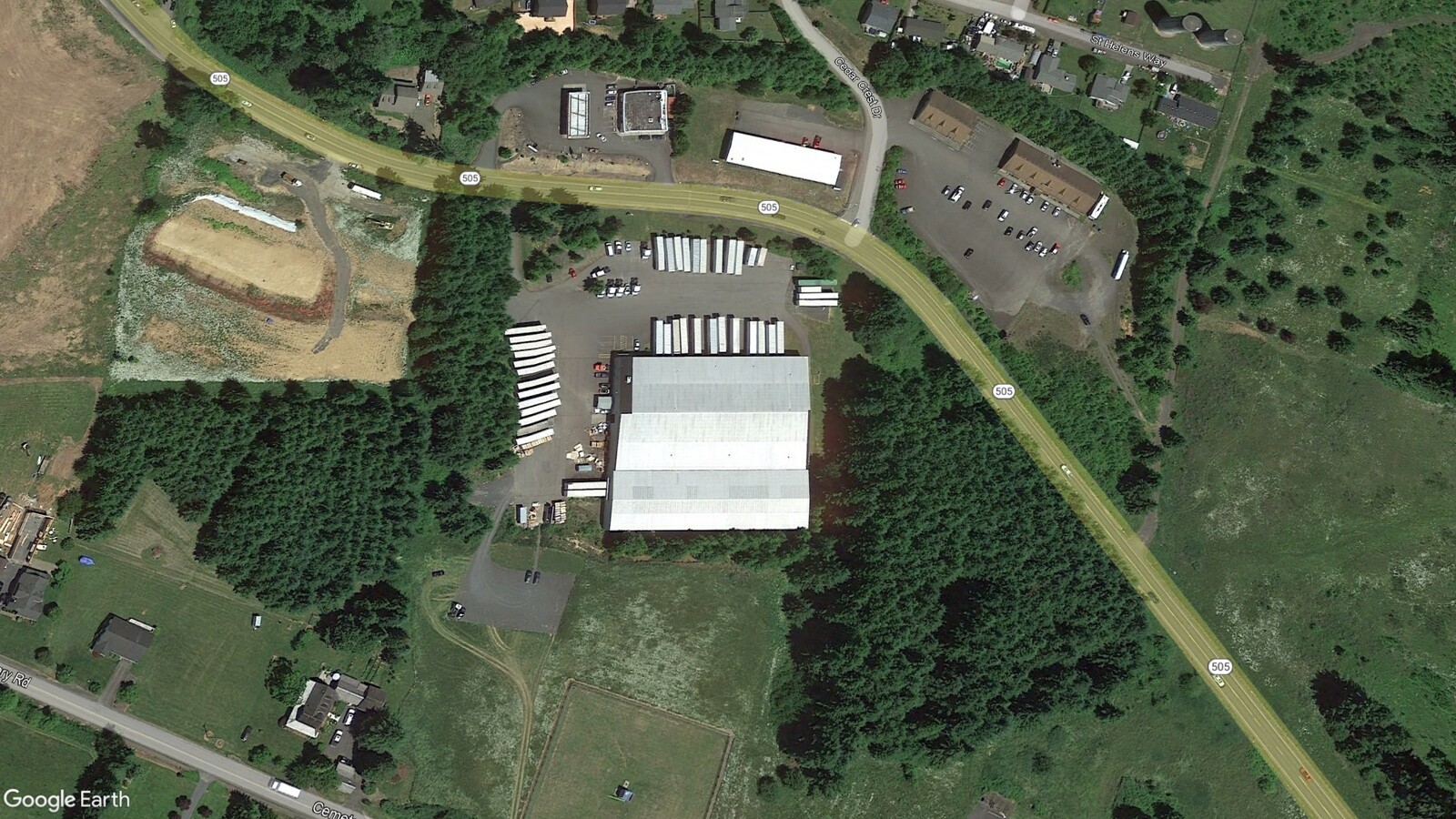
Property Record
222 State Highway 505, Winlock, WA 98596
NEARBY LISTINGS FOR SALE OR LEASE
Property Detail
222 State Highway 505
Centralia, WA
SECTION 34 TOWNSHIP 12N RANGE 02W N 150 GL 3 EX W 411.6
006523-005-000
Lewis
Lightindustrial
Washington
2024
3
2024
3.77 AC
971501
Washington State Area
60,000 SF
Other Market Areas
DEMOGRAPHICS near 222 State Highway 505
1 Mile
3 Mile
5 Mile
2024 Total Population
1,974
4,886
7,956
2029 Population
2,216
5,451
8,792
Pop Growth 2024-2029
+ 12.26%
+ 11.56%
+ 10.51%
Average Age
42
43
43
2024 Total Households
722
1,814
2,955
HH Growth 2024-2029
+ 12.33%
+ 11.69%
+ 10.56%
Median Household Inc
$82,615
$76,562
$77,143
Avg Household Size
2.70
2.70
2.70
2024 Avg HH Vehicles
2.00
3.00
3.00
Median Home Value
$323,529
$339,875
$348,531
Median Year Built
1978
1981
1981
Nearby Places
- Restaurants
- Banks
- Shops
- Fitness
- Groceries
SALE & LEASE HISTORY
LISTING DATE
SALE/LEASE

Jan 03, 2023
For Sale
Dec 13, 2022
For Lease
Nearby Properties
Address
Land Use
TOTAL SIZE
Lot Size
Zoning
Address
Land Use
TOTAL SIZE
Lot Size
Zoning
1,976 SF
69.39 AC
LI
Address
Land Use
TOTAL SIZE
Lot Size
Zoning
Address
Land Use
TOTAL SIZE
Lot Size
Zoning
104.79 AC
Address
Land Use
TOTAL SIZE
Lot Size
Zoning
Address
Land Use
TOTAL SIZE
Lot Size
Zoning
Address
Land Use
TOTAL SIZE
Lot Size
Zoning
1,260 SF
71 AC
LI
Address
Land Use
TOTAL SIZE
Lot Size
Zoning
Address
Land Use
TOTAL SIZE
Lot Size
Zoning
Address
Land Use
TOTAL SIZE
Lot Size
Zoning
Address
Land Use
TOTAL SIZE
Lot Size
Zoning
21,030 SF
40 AC
PF
Address
Land Use
TOTAL SIZE
Lot Size
Zoning
60,000 SF
4.96 AC
ARL
Address
Land Use
TOTAL SIZE
Lot Size
Zoning
0.83 AC
RDD5
Address
Land Use
TOTAL SIZE
Lot Size
Zoning
Address
Land Use
TOTAL SIZE
Lot Size
Zoning
6,228 SF
5.58 AC
ARL
Address
Land Use
TOTAL SIZE
Lot Size
Zoning
1,344 SF
4 AC
PF
Address
Land Use
TOTAL SIZE
Lot Size
Zoning
Address
Land Use
TOTAL SIZE
Lot Size
Zoning
18,380 SF
1.08 AC
MDR
Address
Land Use
TOTAL SIZE
Lot Size
Zoning
2,040 SF
46.07 AC
ARL
Address
Land Use
TOTAL SIZE
Lot Size
Zoning
71.25 AC
RDD10
Address
Land Use
TOTAL SIZE
Lot Size
Zoning
3,713 SF
3.94 AC
C2
Address
Land Use
TOTAL SIZE
Lot Size
Zoning
Address
Land Use
TOTAL SIZE
Lot Size
Zoning
3,332 SF
301.39 AC
ARL
Address
Land Use
TOTAL SIZE
Lot Size
Zoning
4,866 SF
20 AC
RDD5
Address
Land Use
TOTAL SIZE
Lot Size
Zoning
1,636 SF
32.21 AC
ARL
Address
Land Use
TOTAL SIZE
Lot Size
Zoning
4,856 SF
28.16 AC
RDD5
Address
Land Use
TOTAL SIZE
Lot Size
Zoning
1,880 SF
8.19 AC
MX
Address
Land Use
TOTAL SIZE
Lot Size
Zoning
Address
Land Use
TOTAL SIZE
Lot Size
Zoning
2,611 SF
24.84 AC
RDD5
Address
Land Use
TOTAL SIZE
Lot Size
Zoning
3,664 SF
21.05 AC
ARL
The World's #1 Commercial Real Estate Marketplace
Connect with us
© 2025 CoStar Group
The information above has been obtained from sources believed reliable. While we do not doubt its accuracy we have not verified it and make no guarantee, warranty or representation about it. It is your responsibility to independently confirm its accuracy and completeness. Any projections, opinions, assumptions, or estimates used are for example only and do not represent the current or future performance of the property. The value of this transaction to you depends on tax and other factors which should be evaluated by your tax, financial, and legal advisors. You and your advisors should conduct a careful, independent investigation of the property to determine to your satisfaction the suitability of the property for your needs.