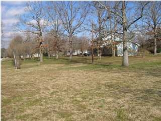
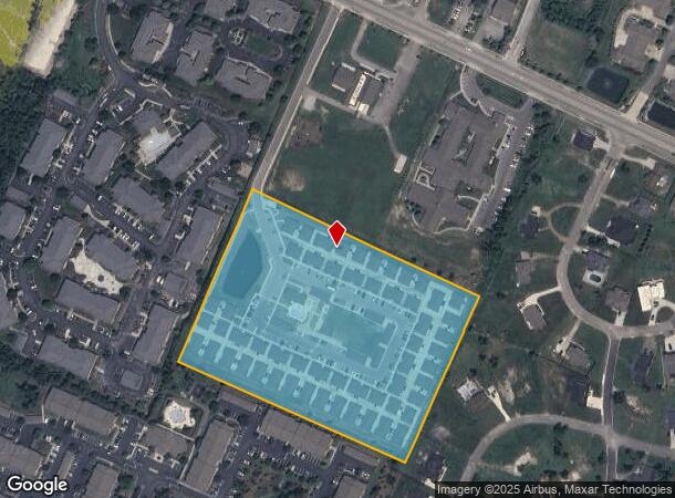
Property Record
2228 Ashford Villa Cir, Chattanooga, TN 37421
NEARBY LISTINGS FOR SALE OR LEASE
Property Detail
2228 Ashford Villa Cir
Chattanooga, TN-GA
Murray Lane Estates Lots 1-4
149J-A-008
LT 1 ASHFORD VILLAS SUB PB 37 PG 21 1 REV 115-138 ASHFORD VILLAS - 82 UNITS
Officebuilding
Hamilton
X
Tennessee
47065C0367G
3
2024
8.87 AC
2024
Outlying Chattanooga
011321
Chattanooga
78,358 SF
DEMOGRAPHICS near 2228 Ashford Villa Cir
1 Mile
3 Mile
5 Mile
2024 Total Population
7,177
49,660
97,134
2029 Population
7,696
52,781
103,114
Pop Growth 2024-2029
+ 7.23%
+ 6.28%
+ 6.16%
Average Age
44
41
41
2024 Total Households
3,195
20,185
38,851
HH Growth 2024-2029
+ 7.42%
+ 6.49%
+ 6.33%
Median Household Inc
$76,089
$76,067
$71,183
Avg Household Size
2.20
2.30
2.40
2024 Avg HH Vehicles
2.00
2.00
2.00
Median Home Value
$266,647
$255,157
$247,157
Median Year Built
2001
1991
1987
Nearby Places
- Restaurants
- Banks
- Shops
- Fitness
- Groceries
PUBLIC TRANSPORTATION
AIRPORT
Lovell Field
DRIVE
WALK
Distance
Lovell Field
14 min
6.0 mi
Freight Ports
Georgia Ports - Savannah
DRIVE
WALK
Distance
Georgia Ports - Savannah
408 min
363.0 mi
Nearby Properties
Address
Land Use
TOTAL SIZE
Lot Size
Zoning
Address
Land Use
TOTAL SIZE
Lot Size
Zoning
22,854.56 AC
M1
Address
Land Use
TOTAL SIZE
Lot Size
Zoning
523,520 SF
12.03 AC
M1
Address
Land Use
TOTAL SIZE
Lot Size
Zoning
564,883 SF
27.46 AC
C2
Address
Land Use
TOTAL SIZE
Lot Size
Zoning
292,309 SF
45.28 AC
M1
Address
Land Use
TOTAL SIZE
Lot Size
Zoning
148,150 SF
23.87 AC
R4
Address
Land Use
TOTAL SIZE
Lot Size
Zoning
1,324 SF
83.82 AC
M1
Address
Land Use
TOTAL SIZE
Lot Size
Zoning
340,492 SF
15.44 AC
C2
Address
Land Use
TOTAL SIZE
Lot Size
Zoning
43,576 SF
6.66 AC
C2
Address
Land Use
TOTAL SIZE
Lot Size
Zoning
361,750 SF
21.34 AC
R3
Address
Land Use
TOTAL SIZE
Lot Size
Zoning
320,068 SF
42.83 AC
R4
Address
Land Use
TOTAL SIZE
Lot Size
Zoning
471,313 SF
18.01 AC
R3
Address
Land Use
TOTAL SIZE
Lot Size
Zoning
15,205 SF
27.72 AC
R3
Address
Land Use
TOTAL SIZE
Lot Size
Zoning
102,382 SF
29.80 AC
M2
Address
Land Use
TOTAL SIZE
Lot Size
Zoning
82,000 SF
22.45 AC
M1
Address
Land Use
TOTAL SIZE
Lot Size
Zoning
277,942 SF
14.01 AC
Address
Land Use
TOTAL SIZE
Lot Size
Zoning
250,720 SF
14.41 AC
R4
Address
Land Use
TOTAL SIZE
Lot Size
Zoning
99,202 SF
17.32 AC
Address
Land Use
TOTAL SIZE
Lot Size
Zoning
254,432 SF
16.20 AC
R1
Address
Land Use
TOTAL SIZE
Lot Size
Zoning
97,000 SF
18.78 AC
Address
Land Use
TOTAL SIZE
Lot Size
Zoning
201,276 SF
15.30 AC
R3
Address
Land Use
TOTAL SIZE
Lot Size
Zoning
296,921 SF
21.90 AC
Address
Land Use
TOTAL SIZE
Lot Size
Zoning
187,512 SF
19.50 AC
R2
Address
Land Use
TOTAL SIZE
Lot Size
Zoning
253,440 SF
27.23 AC
A
Address
Land Use
TOTAL SIZE
Lot Size
Zoning
245,744 SF
24.84 AC
Address
Land Use
TOTAL SIZE
Lot Size
Zoning
50,506 SF
5.14 AC
MD
Address
Land Use
TOTAL SIZE
Lot Size
Zoning
49,857 SF
1.93 AC
R1
Address
Land Use
TOTAL SIZE
Lot Size
Zoning
335,533 SF
14.30 AC
R2
Address
Land Use
TOTAL SIZE
Lot Size
Zoning
110,710 SF
6.69 AC
M1
Address
Land Use
TOTAL SIZE
Lot Size
Zoning
138,790 SF
36.30 AC
R3
Address
Land Use
TOTAL SIZE
Lot Size
Zoning
183,036 SF
11.49 AC
R4
The World's #1 Commercial Real Estate Marketplace
Connect with us
© 2025 CoStar Group
The information above has been obtained from sources believed reliable. While we do not doubt its accuracy we have not verified it and make no guarantee, warranty or representation about it. It is your responsibility to independently confirm its accuracy and completeness. Any projections, opinions, assumptions, or estimates used are for example only and do not represent the current or future performance of the property. The value of this transaction to you depends on tax and other factors which should be evaluated by your tax, financial, and legal advisors. You and your advisors should conduct a careful, independent investigation of the property to determine to your satisfaction the suitability of the property for your needs.