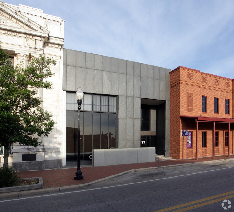
Property Record
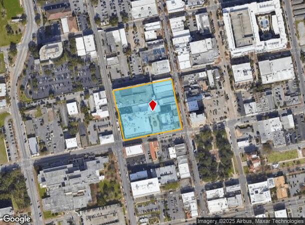
223 Palafox Pl, Pensacola, FL 32502

NEARBY LISTINGS FOR SALE OR LEASE
Property Detail
223 Palafox Pl
Pensacola-Ferry Pass-Brent, FL
Old City Tract
00-0S-00-9001-001-113
ALL OF BLK 15 LESS W 7 1/2 FT FOR STREET OLD CITY TRACT DB 371 P 307 DB 146 P 209/210/211 OR 5464 P 152 OR 3270 P 308 OR 4307 P 1750 OR 4766 P 1668 OR 3857 P 779 OR 4630 P 198 CA 74 ALSO ADJ VAC R/W ORD #06-06 OR 5880 P 672
Officebuilding
Escambia
X
Florida
12033C0390G
1
0
3.17 AC
2024
Downtown Pensacola
000100
Pensacola
368,724 SF
DEMOGRAPHICS near 223 Palafox Pl
1 Mile
3 Mile
5 Mile
2024 Total Population
5,406
39,580
100,682
2029 Population
5,672
41,066
104,200
Pop Growth 2024-2029
+ 4.92%
+ 3.75%
+ 3.49%
Average Age
43
41
39
2024 Total Households
2,583
17,130
40,285
HH Growth 2024-2029
+ 5.07%
+ 3.75%
+ 3.63%
Median Household Inc
$43,124
$41,588
$44,903
Avg Household Size
1.90
2.10
2.20
2024 Avg HH Vehicles
1.00
1.00
2.00
Median Home Value
$334,091
$224,151
$199,741
Median Year Built
1963
1959
1967
Nearby Places
- Restaurants
- Banks
- Shops
- Fitness
- Groceries
PUBLIC TRANSPORTATION
AIRPORT
Pensacola International
DRIVE
WALK
Distance
Pensacola International
12 min
6.1 mi
Freight Ports
Port of Mobile
DRIVE
WALK
Distance
Port of Mobile
69 min
60.0 mi
Nearby Properties
Address
Land Use
TOTAL SIZE
Lot Size
Zoning
Address
Land Use
TOTAL SIZE
Lot Size
Zoning
544,835 SF
3.29 AC
C-2,C-2A
Address
Land Use
TOTAL SIZE
Lot Size
Zoning
365,037 SF
5.79 AC
C-3
Address
Land Use
TOTAL SIZE
Lot Size
Zoning
296,361 SF
13.03 AC
GRD
Address
Land Use
TOTAL SIZE
Lot Size
Zoning
56,970 SF
5.94 AC
WRD
Address
Land Use
TOTAL SIZE
Lot Size
Zoning
289,397 SF
12.38 AC
PUB
Address
Land Use
TOTAL SIZE
Lot Size
Zoning
158,425 SF
9.77 AC
R-2A
Address
Land Use
TOTAL SIZE
Lot Size
Zoning
353,428 SF
30.10 AC
M-1
Address
Land Use
TOTAL SIZE
Lot Size
Zoning
327,045 SF
7.47 AC
C-2A
Address
Land Use
TOTAL SIZE
Lot Size
Zoning
178,451 SF
3.88 AC
GRD
Address
Land Use
TOTAL SIZE
Lot Size
Zoning
114,000 SF
3.23 AC
C-2,C-2A
Address
Land Use
TOTAL SIZE
Lot Size
Zoning
96,686 SF
1.06 AC
C-2A
Address
Land Use
TOTAL SIZE
Lot Size
Zoning
282,738 SF
14.64 AC
PUB
Address
Land Use
TOTAL SIZE
Lot Size
Zoning
258,438 SF
48.49 AC
PUB
Address
Land Use
TOTAL SIZE
Lot Size
Zoning
99,623 SF
1.87 AC
C-2A
Address
Land Use
TOTAL SIZE
Lot Size
Zoning
145,264 SF
9.84 AC
SSD
Address
Land Use
TOTAL SIZE
Lot Size
Zoning
115,500 SF
3.48 AC
C-2
Address
Land Use
TOTAL SIZE
Lot Size
Zoning
166,204 SF
0.97 AC
C-2A
Address
Land Use
TOTAL SIZE
Lot Size
Zoning
75,877 SF
1.55 AC
WRD
Address
Land Use
TOTAL SIZE
Lot Size
Zoning
130,516 SF
4.55 AC
R-2
Address
Land Use
TOTAL SIZE
Lot Size
Zoning
55,337 SF
0.95 AC
C-2A,HC-2
Address
Land Use
TOTAL SIZE
Lot Size
Zoning
81,549 SF
0.46 AC
WRD
Address
Land Use
TOTAL SIZE
Lot Size
Zoning
73,923 SF
2.87 AC
GRD
Address
Land Use
TOTAL SIZE
Lot Size
Zoning
254,937 SF
39.66 AC
R-1AA
Address
Land Use
TOTAL SIZE
Lot Size
Zoning
146,790 SF
8.83 AC
C-1,C-3
Address
Land Use
TOTAL SIZE
Lot Size
Zoning
56,354 SF
3.25 AC
HC-1
Address
Land Use
TOTAL SIZE
Lot Size
Zoning
138,840 SF
4.52 AC
HC/LI,HDMU
Address
Land Use
TOTAL SIZE
Lot Size
Zoning
50,521 SF
2.36 AC
C-2A
Address
Land Use
TOTAL SIZE
Lot Size
Zoning
64,383 SF
0.70 AC
C-2A
Address
Land Use
TOTAL SIZE
Lot Size
Zoning
27,586 SF
33.84 AC
R-1AAA
The World's #1 Commercial Real Estate Marketplace
Connect with us
© 2025 CoStar Group
The information above has been obtained from sources believed reliable. While we do not doubt its accuracy we have not verified it and make no guarantee, warranty or representation about it. It is your responsibility to independently confirm its accuracy and completeness. Any projections, opinions, assumptions, or estimates used are for example only and do not represent the current or future performance of the property. The value of this transaction to you depends on tax and other factors which should be evaluated by your tax, financial, and legal advisors. You and your advisors should conduct a careful, independent investigation of the property to determine to your satisfaction the suitability of the property for your needs.