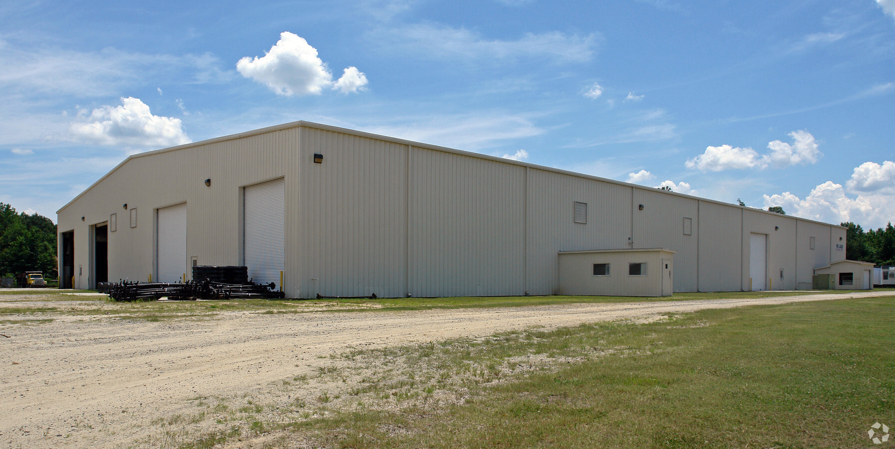
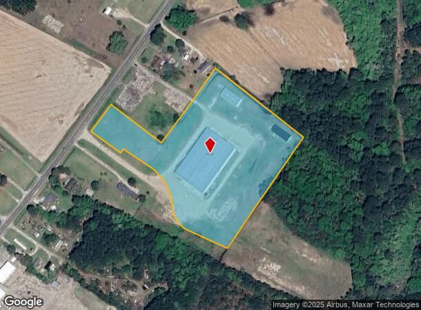
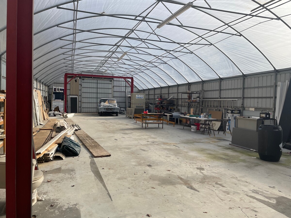
Property Record
2233 Hwy 258 S, Kinston, NC 28504
NEARBY LISTINGS FOR SALE OR LEASE
Property Detail
2233 Hwy 258 S
451404612162
Property For Mrs R L Carter & Roger Lee
Officebuilding
HWY 258S TR 1A/1B/1C HARVEY FARMS
X
Lenoir
3720450400K
North Carolina
2024
16.82 AC
2024
North Carolina Southeast Area
011301
Other Market Areas
41,600 SF
Kinston, NC
DEMOGRAPHICS near 2233 Hwy 258 S
1 Mile
3 Mile
5 Mile
2024 Total Population
653
7,858
26,630
2029 Population
639
7,947
26,565
Pop Growth 2024-2029
(2.14%)
+ 1.13%
(0.24%)
Average Age
44
41
42
2024 Total Households
278
3,529
11,455
HH Growth 2024-2029
(2.52%)
+ 1.13%
(0.22%)
Median Household Inc
$46,591
$27,035
$35,033
Avg Household Size
2.30
2.20
2.20
2024 Avg HH Vehicles
2.00
1.00
2.00
Median Home Value
$95,407
$77,131
$101,969
Median Year Built
1985
1971
1971
Nearby Places
- Restaurants
- Banks
- Shops
- Fitness
- Groceries
PUBLIC TRANSPORTATION
AIRPORT
Albert J Ellis
DRIVE
WALK
Distance
Albert J Ellis
56 min
32.2 mi
Freight Ports
Port of Morehead City
DRIVE
WALK
Distance
Port of Morehead City
108 min
76.8 mi
SALE & LEASE HISTORY
LISTING DATE
SALE/LEASE

Sep 23, 2016
For Sale
Jan 19, 2024
For Sale
Nearby Properties
Address
Land Use
TOTAL SIZE
Lot Size
Zoning
Address
Land Use
TOTAL SIZE
Lot Size
Zoning
598,078 SF
278.06 AC
RA20
Address
Land Use
TOTAL SIZE
Lot Size
Zoning
217,381 SF
77.79 AC
O&I
Address
Land Use
TOTAL SIZE
Lot Size
Zoning
525,504 SF
228 AC
I1
Address
Land Use
TOTAL SIZE
Lot Size
Zoning
122,274 SF
1.86 AC
B2
Address
Land Use
TOTAL SIZE
Lot Size
Zoning
65,100 SF
1.91 AC
B2
Address
Land Use
TOTAL SIZE
Lot Size
Zoning
65,344 SF
27.42 AC
Address
Land Use
TOTAL SIZE
Lot Size
Zoning
69,696 SF
0.32 AC
B2
Address
Land Use
TOTAL SIZE
Lot Size
Zoning
73,536 SF
5.38 AC
B1
Address
Land Use
TOTAL SIZE
Lot Size
Zoning
77,500 SF
1.30 AC
B2
Address
Land Use
TOTAL SIZE
Lot Size
Zoning
83,088 SF
1.19 AC
B2
Address
Land Use
TOTAL SIZE
Lot Size
Zoning
43,295 SF
5.69 AC
SC
Address
Land Use
TOTAL SIZE
Lot Size
Zoning
25,885 SF
88.62 AC
RA6
Address
Land Use
TOTAL SIZE
Lot Size
Zoning
11.45 AC
RA6
Address
Land Use
TOTAL SIZE
Lot Size
Zoning
109,052 SF
7.54 AC
IB
Address
Land Use
TOTAL SIZE
Lot Size
Zoning
12.35 AC
RA5
Address
Land Use
TOTAL SIZE
Lot Size
Zoning
133.26 AC
RA6
Address
Land Use
TOTAL SIZE
Lot Size
Zoning
11,254 SF
16.75 AC
RA5
Address
Land Use
TOTAL SIZE
Lot Size
Zoning
12,000 SF
16.02 AC
I2
Address
Land Use
TOTAL SIZE
Lot Size
Zoning
9.44 AC
RA5
Address
Land Use
TOTAL SIZE
Lot Size
Zoning
49,206 SF
Address
Land Use
TOTAL SIZE
Lot Size
Zoning
5,370 SF
0.90 AC
B1
Address
Land Use
TOTAL SIZE
Lot Size
Zoning
136,296 SF
11.60 AC
I1
Address
Land Use
TOTAL SIZE
Lot Size
Zoning
32,409 SF
19.02 AC
I1
Address
Land Use
TOTAL SIZE
Lot Size
Zoning
22,124 SF
Address
Land Use
TOTAL SIZE
Lot Size
Zoning
30,468 SF
0.75 AC
B2
Address
Land Use
TOTAL SIZE
Lot Size
Zoning
3,610 SF
4 AC
B1
Address
Land Use
TOTAL SIZE
Lot Size
Zoning
5,324 SF
1.22 AC
IB
Address
Land Use
TOTAL SIZE
Lot Size
Zoning
62,485 SF
3.55 AC
IB
Address
Land Use
TOTAL SIZE
Lot Size
Zoning
24,084 SF
2.53 AC
B1
Address
Land Use
TOTAL SIZE
Lot Size
Zoning
9,620 SF
22.71 AC
RA6
The World's #1 Commercial Real Estate Marketplace
Connect with us
© 2025 CoStar Group
The information above has been obtained from sources believed reliable. While we do not doubt its accuracy we have not verified it and make no guarantee, warranty or representation about it. It is your responsibility to independently confirm its accuracy and completeness. Any projections, opinions, assumptions, or estimates used are for example only and do not represent the current or future performance of the property. The value of this transaction to you depends on tax and other factors which should be evaluated by your tax, financial, and legal advisors. You and your advisors should conduct a careful, independent investigation of the property to determine to your satisfaction the suitability of the property for your needs.