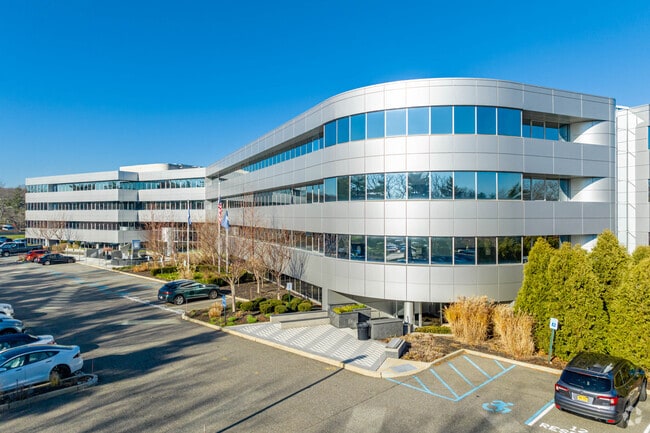
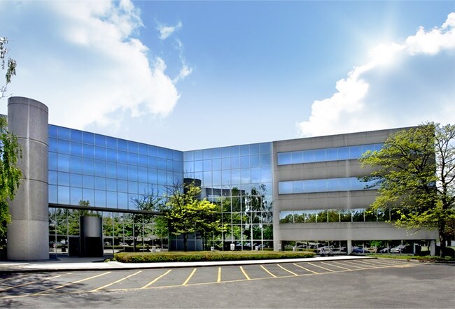
Property Record
225 Broadhollow Rd, Melville, NY 11747

Current Lease Availabilities
NEARBY LISTINGS FOR SALE OR LEASE
Property Detail
225 Broadhollow Rd
Nassau County-Suffolk County, NY
Klein Plat
0400-255-00-01-00-011-004
BLK LOT 4
Officebuilding
Suffolk
X
New York
36103C0620H
11
2024
9.51 AC
2024
Western Suffolk
112218
Long Island (New York)
DEMOGRAPHICS near 225 Broadhollow Rd
1 Mile
3 Mile
5 Mile
2024 Total Population
3,644
47,258
226,700
2029 Population
3,586
46,617
222,503
Pop Growth 2024-2029
(1.59%)
(1.36%)
(1.85%)
Average Age
42
45
42
2024 Total Households
1,253
16,833
73,422
HH Growth 2024-2029
(1.76%)
(1.53%)
(1.96%)
Median Household Inc
$164,452
$147,713
$133,224
Avg Household Size
2.80
2.70
2.90
2024 Avg HH Vehicles
3.00
2.00
2.00
Median Home Value
$729,138
$738,107
$644,379
Median Year Built
1999
1967
1961
Nearby Places
Map Layers
Map Styles
 Street
 Aerial
- Restaurants
- Banks
- Shops
- Fitness
- Groceries
PUBLIC TRANSPORTATION
COMMUTER RAIL
Pinelawn Station (Ronkonkoma Branch - Long Island Rail Road)
DRIVE
WALK
Distance
Pinelawn Station (Ronkonkoma Branch - Long Island Rail Road)
7 min
3.6 mi
Farmingdale Station (Ronkonkoma Branch - Long Island Rail Road)
DRIVE
WALK
Distance
Farmingdale Station (Ronkonkoma Branch - Long Island Rail Road)
9 min
4.9 mi
AIRPORT
Long Island MacArthur
DRIVE
WALK
Distance
Long Island MacArthur
27 min
18.1 mi
LaGuardia
DRIVE
WALK
Distance
LaGuardia
43 min
28.1 mi
John F Kennedy International
DRIVE
WALK
Distance
John F Kennedy International
42 min
29.0 mi
Freight Ports
NY - Red Hook Container Terminal
DRIVE
WALK
Distance
NY - Red Hook Container Terminal
55 min
36.3 mi
Nearby Properties
Address
Land Use
TOTAL SIZE
Lot Size
Zoning
Address
Land Use
TOTAL SIZE
Lot Size
Zoning
37 AC
I2
Address
Land Use
TOTAL SIZE
Lot Size
Zoning
3.31 AC
R40
Address
Land Use
TOTAL SIZE
Lot Size
Zoning
16,520 SF
160.33 AC
Address
Land Use
TOTAL SIZE
Lot Size
Zoning
33.80 AC
Address
Land Use
TOTAL SIZE
Lot Size
Zoning
647,177 SF
51.88 AC
Address
Land Use
TOTAL SIZE
Lot Size
Zoning
3,951 SF
44.33 AC
Address
Land Use
TOTAL SIZE
Lot Size
Zoning
52.10 AC
Address
Land Use
TOTAL SIZE
Lot Size
Zoning
52,750 SF
55.67 AC
Address
Land Use
TOTAL SIZE
Lot Size
Zoning
37.20 AC
I2
Address
Land Use
TOTAL SIZE
Lot Size
Zoning
32.67 AC
R80
Address
Land Use
TOTAL SIZE
Lot Size
Zoning
24.75 AC
R40
Address
Land Use
TOTAL SIZE
Lot Size
Zoning
183.15 AC
Address
Land Use
TOTAL SIZE
Lot Size
Zoning
11.50 AC
C10
Address
Land Use
TOTAL SIZE
Lot Size
Zoning
2.92 AC
R20
Address
Land Use
TOTAL SIZE
Lot Size
Zoning
12 AC
I1
Address
Land Use
TOTAL SIZE
Lot Size
Zoning
22.20 AC
I1
Address
Land Use
TOTAL SIZE
Lot Size
Zoning
14.40 AC
I1
Address
Land Use
TOTAL SIZE
Lot Size
Zoning
292.40 AC
A
Address
Land Use
TOTAL SIZE
Lot Size
Zoning
0.26 AC
R20
Address
Land Use
TOTAL SIZE
Lot Size
Zoning
32.60 AC
I1
Address
Land Use
TOTAL SIZE
Lot Size
Zoning
52.20 AC
R40
Address
Land Use
TOTAL SIZE
Lot Size
Zoning
16 AC
I1
Address
Land Use
TOTAL SIZE
Lot Size
Zoning
23.66 AC
I1
Address
Land Use
TOTAL SIZE
Lot Size
Zoning
21.50 AC
I1
Address
Land Use
TOTAL SIZE
Lot Size
Zoning
21,000 SF
32.02 AC
Address
Land Use
TOTAL SIZE
Lot Size
Zoning
265.70 AC
R80
Address
Land Use
TOTAL SIZE
Lot Size
Zoning
21.10 AC
C5
Address
Land Use
TOTAL SIZE
Lot Size
Zoning
13.12 AC
R40
Address
Land Use
TOTAL SIZE
Lot Size
Zoning
33 AC
R40
Address
Land Use
TOTAL SIZE
Lot Size
Zoning
260,092 SF
7.07 AC
GA
The World's #1 Commercial Real Estate Marketplace
Connect with us
© 2026 CoStar Group
The information above has been obtained from sources believed reliable. While we do not doubt its accuracy we have not verified it and make no guarantee, warranty or representation about it. It is your responsibility to independently confirm its accuracy and completeness. Any projections, opinions, assumptions, or estimates used are for example only and do not represent the current or future performance of the property. The value of this transaction to you depends on tax and other factors which should be evaluated by your tax, financial, and legal advisors. You and your advisors should conduct a careful, independent investigation of the property to determine to your satisfaction the suitability of the property for your needs.