Property Record
225 Carson Rd N, Birmingham, AL 35215
NEARBY LISTINGS FOR SALE OR LEASE
Property Detail
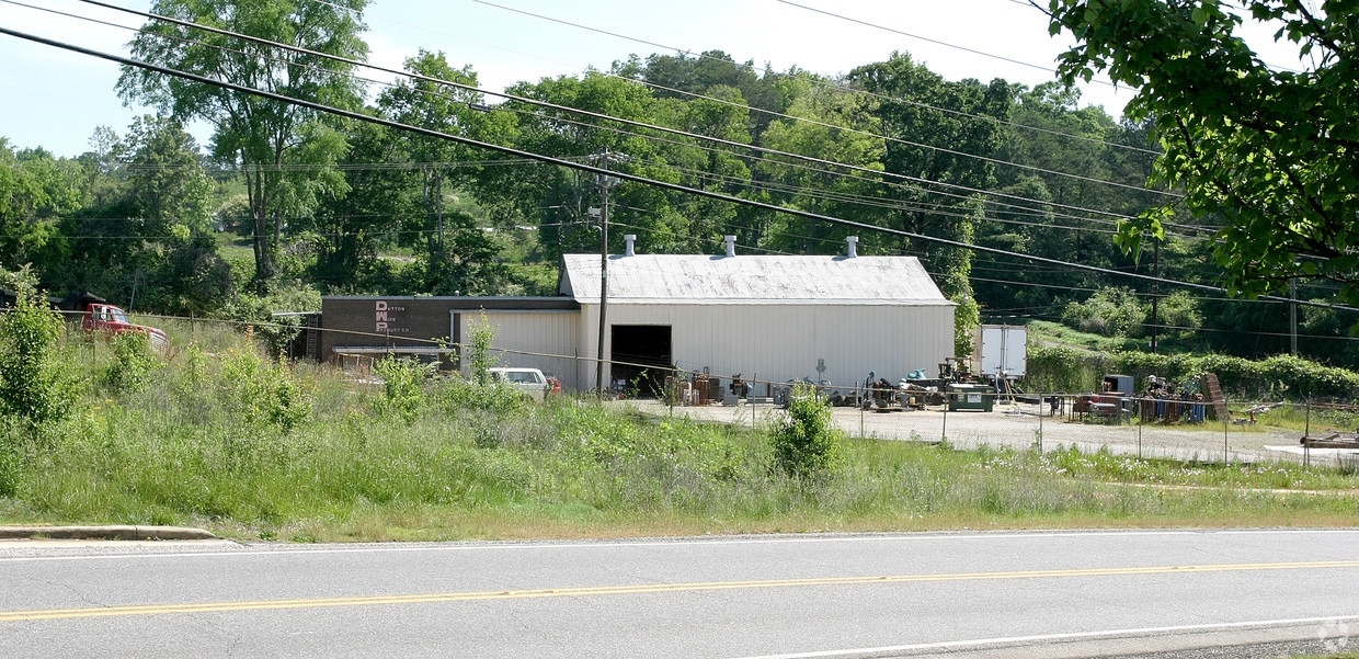
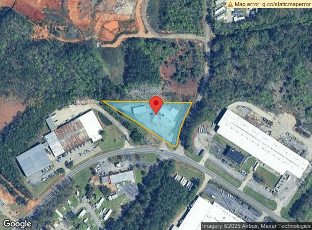
225 Carson Rd N
13-00-11-2-000-004.000
POB NW INTER CARSON RD & ELFRETH JOHNSON RD TH NW 543 FT ALG JOHNSON DR TH E 550 FT TO ELFRETH JOHNSON RD TH SLY 272 FT S ALG R/W TO P O B LYING IN SE 1/4 OF NW 1/4 SEC 11 T 16 S R 2 W SECT 11 TWSP 16S RANGE 2W
Commercialnec
Jefferson
X
Alabama
01073C0237H
1.80 AC
2023
Fultondale
2024
Birmingham
0112102024
Birmingham-Hoover, AL
8,989 SF
DEMOGRAPHICS near 225 Carson Rd N
1 Mile
3 Mile
5 Mile
2024 Total Population
2,298
28,008
74,638
2029 Population
2,301
27,476
73,116
Pop Growth 2024-2029
+ 0.13%
(1.90%)
(2.04%)
Average Age
37
36
37
2024 Total Households
841
10,412
28,137
HH Growth 2024-2029
0.00%
(1.96%)
(2.09%)
Median Household Inc
$36,792
$43,881
$49,811
Avg Household Size
2.60
2.60
2.60
2024 Avg HH Vehicles
2.00
2.00
2.00
Median Home Value
$162,361
$145,959
$149,374
Median Year Built
1978
1975
1976
Nearby Places
- Restaurants
- Banks
- Shops
- Fitness
- Groceries
PUBLIC TRANSPORTATION
AIRPORT
Birmingham-Shuttlesworth International
DRIVE
WALK
Distance
Birmingham-Shuttlesworth International
21 min
12.5 mi
Freight Ports
Port of Mobile
DRIVE
WALK
Distance
Port of Mobile
299 min
269.0 mi
SALE & LEASE HISTORY
LISTING DATE
SALE/LEASE

Sep 23, 2016
For Sale
Jul 19, 2017
For Sale
Aug 25, 2017
For Sale
Aug 18, 2017
For Sale
Apr 10, 2017
For Sale
Nearby Properties
Address
Land Use
TOTAL SIZE
Lot Size
Zoning
Address
Land Use
TOTAL SIZE
Lot Size
Zoning
725,840 SF
89 AC
CM2
Address
Land Use
TOTAL SIZE
Lot Size
Zoning
623,200 SF
50 AC
CM2
Address
Land Use
TOTAL SIZE
Lot Size
Zoning
218,922 SF
21 AC
CR5
Address
Land Use
TOTAL SIZE
Lot Size
Zoning
412,320 SF
16.50 AC
I2
Address
Land Use
TOTAL SIZE
Lot Size
Zoning
192,596 SF
13.79 AC
CR5
Address
Land Use
TOTAL SIZE
Lot Size
Zoning
147,200 SF
7.93 AC
CR5
Address
Land Use
TOTAL SIZE
Lot Size
Zoning
118,522 SF
7.80 AC
I4
Address
Land Use
TOTAL SIZE
Lot Size
Zoning
531,808 SF
23.96 AC
I4&A
Address
Land Use
TOTAL SIZE
Lot Size
Zoning
92,560 SF
15.36 AC
I4
Address
Land Use
TOTAL SIZE
Lot Size
Zoning
502,302 SF
24.61 AC
I4&A
Address
Land Use
TOTAL SIZE
Lot Size
Zoning
125,252 SF
8.07 AC
R4
Address
Land Use
TOTAL SIZE
Lot Size
Zoning
163,790 SF
18 AC
I-4
Address
Land Use
TOTAL SIZE
Lot Size
Zoning
179,464 SF
17.70 AC
M3
Address
Land Use
TOTAL SIZE
Lot Size
Zoning
80,834 SF
7.13 AC
CR5
Address
Land Use
TOTAL SIZE
Lot Size
Zoning
340,000 SF
29 AC
I4
Address
Land Use
TOTAL SIZE
Lot Size
Zoning
109,878 SF
10 AC
C1
Address
Land Use
TOTAL SIZE
Lot Size
Zoning
74,159 SF
2.50 AC
INST
Address
Land Use
TOTAL SIZE
Lot Size
Zoning
26,169 SF
71 AC
R2
Address
Land Use
TOTAL SIZE
Lot Size
Zoning
257,988 SF
CM2
Address
Land Use
TOTAL SIZE
Lot Size
Zoning
63,736 SF
11 AC
I
Address
Land Use
TOTAL SIZE
Lot Size
Zoning
84,602 SF
11.20 AC
B2
Address
Land Use
TOTAL SIZE
Lot Size
Zoning
118,041 SF
5.10 AC
C1
Address
Land Use
TOTAL SIZE
Lot Size
Zoning
113,175 SF
21.85 AC
I2
Address
Land Use
TOTAL SIZE
Lot Size
Zoning
100,788 SF
17 AC
I2
Address
Land Use
TOTAL SIZE
Lot Size
Zoning
182,751 SF
8.10 AC
I4
Address
Land Use
TOTAL SIZE
Lot Size
Zoning
86,240 SF
104 AC
CM2
Address
Land Use
TOTAL SIZE
Lot Size
Zoning
61,472 SF
18.84 AC
INT-
Address
Land Use
TOTAL SIZE
Lot Size
Zoning
158,835 SF
9.50 AC
I-4
Address
Land Use
TOTAL SIZE
Lot Size
Zoning
244,800 SF
CM2
The World's #1 Commercial Real Estate Marketplace
Connect with us
© 2025 CoStar Group
The information above has been obtained from sources believed reliable. While we do not doubt its accuracy we have not verified it and make no guarantee, warranty or representation about it. It is your responsibility to independently confirm its accuracy and completeness. Any projections, opinions, assumptions, or estimates used are for example only and do not represent the current or future performance of the property. The value of this transaction to you depends on tax and other factors which should be evaluated by your tax, financial, and legal advisors. You and your advisors should conduct a careful, independent investigation of the property to determine to your satisfaction the suitability of the property for your needs.