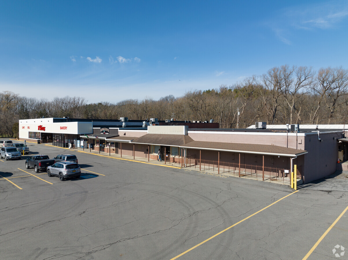
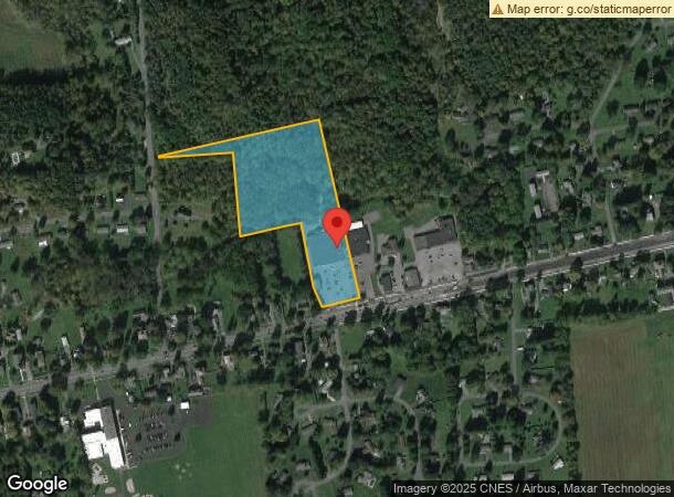
Property Record
227 E Main St, Elbridge, NY 13060

NEARBY LISTINGS FOR SALE OR LEASE
-
-
View all Elbridge listings for lease on LoopNet.com
Property Detail
227 E Main St
312801-014-000-0001-022-000-0000
Onondaga
Supermarket
New York
X
22.000
36067C0162F
8.31 AC
2024
W Outer Onondaga County
2023
Syracuse
012000
Syracuse, NY
25,831 SF
DEMOGRAPHICS near 227 E Main St
1 Mile
3 Mile
5 Mile
2024 Total Population
1,368
4,851
9,796
2029 Population
1,323
4,717
9,546
Pop Growth 2024-2029
(3.29%)
(2.76%)
(2.55%)
Average Age
45
45
45
2024 Total Households
576
2,033
4,095
HH Growth 2024-2029
(3.47%)
(3.10%)
(2.81%)
Median Household Inc
$54,567
$57,185
$68,386
Avg Household Size
2.30
2.30
2.30
2024 Avg HH Vehicles
2.00
2.00
2.00
Median Home Value
$185,087
$162,930
$180,999
Median Year Built
1973
1970
1969
Nearby Places
- Restaurants
- Banks
- Shops
- Fitness
- Groceries
PUBLIC TRANSPORTATION
AIRPORT
Syracuse Hancock International
DRIVE
WALK
Distance
Syracuse Hancock International
31 min
22.3 mi
Freight Ports
Albany, NY Port
DRIVE
WALK
Distance
Albany, NY Port
195 min
161.6 mi
SALE & LEASE HISTORY
LISTING DATE
SALE/LEASE

Sep 23, 2016
For Sale
May 24, 2017
For Sale
May 06, 2019
For Sale
Apr 28, 2020
For Lease
Nearby Properties
Address
Land Use
TOTAL SIZE
Lot Size
Zoning
Address
Land Use
TOTAL SIZE
Lot Size
Zoning
305,558 SF
28.34 AC
9
Address
Land Use
TOTAL SIZE
Lot Size
Zoning
4,200 SF
51.92 AC
06 - INDUS
Address
Land Use
TOTAL SIZE
Lot Size
Zoning
107,558 SF
57.12 AC
08 - GOVER
Address
Land Use
TOTAL SIZE
Lot Size
Zoning
185,026 SF
16.72 AC
9
Address
Land Use
TOTAL SIZE
Lot Size
Zoning
Address
Land Use
TOTAL SIZE
Lot Size
Zoning
52,922 SF
16.06 AC
07 - MIXED
Address
Land Use
TOTAL SIZE
Lot Size
Zoning
97,390 SF
31.92 AC
9
Address
Land Use
TOTAL SIZE
Lot Size
Zoning
208 SF
46.88 AC
02 - SINGL
Address
Land Use
TOTAL SIZE
Lot Size
Zoning
Address
Land Use
TOTAL SIZE
Lot Size
Zoning
Address
Land Use
TOTAL SIZE
Lot Size
Zoning
60,794 SF
39.61 AC
02 - SINGL
Address
Land Use
TOTAL SIZE
Lot Size
Zoning
5,740 SF
2.36 AC
05 - COMME
Address
Land Use
TOTAL SIZE
Lot Size
Zoning
840 SF
15.65 AC
HDR
Address
Land Use
TOTAL SIZE
Lot Size
Zoning
924 SF
11.39 AC
05 - COMME
Address
Land Use
TOTAL SIZE
Lot Size
Zoning
Address
Land Use
TOTAL SIZE
Lot Size
Zoning
1,200 SF
12.70 AC
HDR
Address
Land Use
TOTAL SIZE
Lot Size
Zoning
910 SF
9.89 AC
HDR
Address
Land Use
TOTAL SIZE
Lot Size
Zoning
5,440 SF
10.45 AC
06 - INDUS
Address
Land Use
TOTAL SIZE
Lot Size
Zoning
3,960 SF
21.70 AC
14
Address
Land Use
TOTAL SIZE
Lot Size
Zoning
4,668 SF
157.53 AC
04 - FARM
Address
Land Use
TOTAL SIZE
Lot Size
Zoning
21,622 SF
5 AC
05 - COMME
Address
Land Use
TOTAL SIZE
Lot Size
Zoning
10,976 SF
2.14 AC
05 - COMME
Address
Land Use
TOTAL SIZE
Lot Size
Zoning
26,298 SF
1.31 AC
15
Address
Land Use
TOTAL SIZE
Lot Size
Zoning
Address
Land Use
TOTAL SIZE
Lot Size
Zoning
Address
Land Use
TOTAL SIZE
Lot Size
Zoning
11,295 SF
4.46 AC
04 - FARM
Address
Land Use
TOTAL SIZE
Lot Size
Zoning
02 - SINGL
Address
Land Use
TOTAL SIZE
Lot Size
Zoning
15,648 SF
20.60 AC
06 - INDUS
Address
Land Use
TOTAL SIZE
Lot Size
Zoning
123,710 SF
6.56 AC
06 - INDUS
Address
Land Use
TOTAL SIZE
Lot Size
Zoning
12.84 AC
02 - SINGL
The World's #1 Commercial Real Estate Marketplace
Connect with us
© 2025 CoStar Group
The information above has been obtained from sources believed reliable. While we do not doubt its accuracy we have not verified it and make no guarantee, warranty or representation about it. It is your responsibility to independently confirm its accuracy and completeness. Any projections, opinions, assumptions, or estimates used are for example only and do not represent the current or future performance of the property. The value of this transaction to you depends on tax and other factors which should be evaluated by your tax, financial, and legal advisors. You and your advisors should conduct a careful, independent investigation of the property to determine to your satisfaction the suitability of the property for your needs.