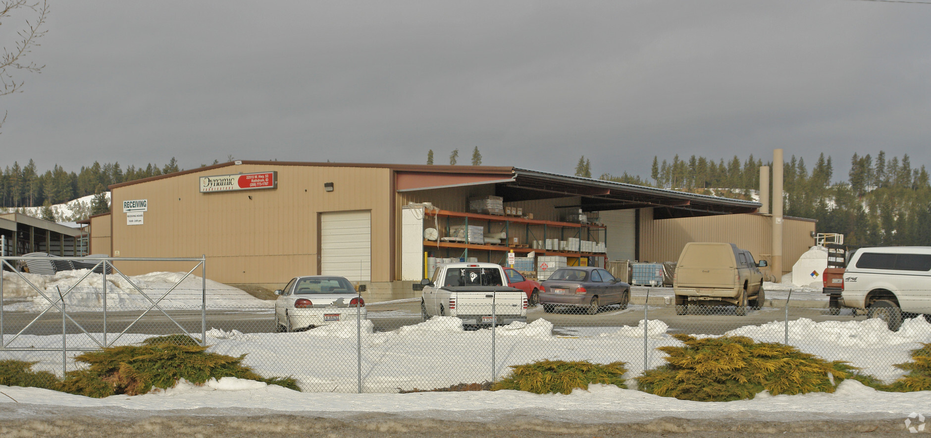
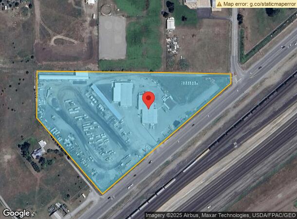
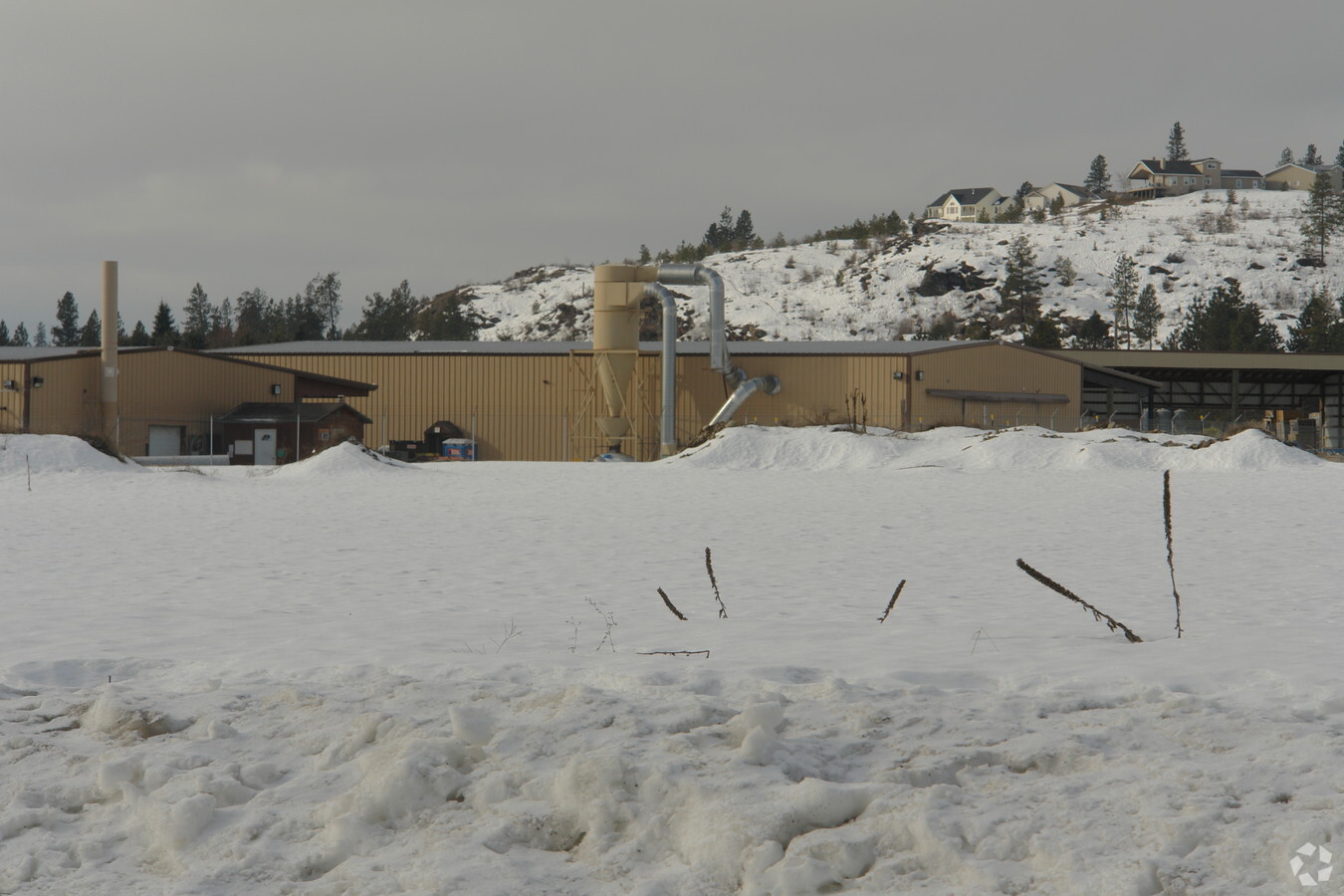
Property Record
22515 W Highway 53, Rathdrum, ID 83858
NEARBY LISTINGS FOR SALE OR LEASE
Property Detail
22515 W Highway 53
51N05W164200
TAX#13542 EX RW 1651N05W
Industrialgeneral
Kootenai
X
Idaho
16055C0225E
9.44 AC
2024
Post Falls
2023
Coeur D'Alene
000301
Coeur d'Alene, ID
20,325 SF
DEMOGRAPHICS near 22515 W Highway 53
1 Mile
3 Mile
5 Mile
2024 Total Population
606
13,321
54,971
2029 Population
721
15,916
65,587
Pop Growth 2024-2029
+ 18.98%
+ 19.48%
+ 19.31%
Average Age
42
39
38
2024 Total Households
219
4,825
20,571
HH Growth 2024-2029
+ 18.72%
+ 19.07%
+ 18.94%
Median Household Inc
$87,500
$83,919
$70,518
Avg Household Size
2.70
2.70
2.60
2024 Avg HH Vehicles
3.00
2.00
2.00
Median Home Value
$443,571
$437,435
$406,828
Median Year Built
1994
2005
2004
Nearby Places
- Restaurants
- Banks
- Shops
- Fitness
- Groceries
PUBLIC TRANSPORTATION
AIRPORT
Spokane International
DRIVE
WALK
Distance
Spokane International
42 min
31.8 mi
Freight Ports
Port of Everett
DRIVE
WALK
Distance
Port of Everett
370 min
327.4 mi
Nearby Properties
Address
Land Use
TOTAL SIZE
Lot Size
Zoning
Address
Land Use
TOTAL SIZE
Lot Size
Zoning
94,960 SF
7.45 AC
Address
Land Use
TOTAL SIZE
Lot Size
Zoning
12,600 SF
29.04 AC
Address
Land Use
TOTAL SIZE
Lot Size
Zoning
112,154 SF
4.61 AC
Address
Land Use
TOTAL SIZE
Lot Size
Zoning
104,852 SF
5.70 AC
Address
Land Use
TOTAL SIZE
Lot Size
Zoning
41,410 SF
64.25 AC
IND
Address
Land Use
TOTAL SIZE
Lot Size
Zoning
79,232 SF
6.06 AC
Address
Land Use
TOTAL SIZE
Lot Size
Zoning
48,618 SF
32.41 AC
IND
Address
Land Use
TOTAL SIZE
Lot Size
Zoning
40,016 SF
5.50 AC
Address
Land Use
TOTAL SIZE
Lot Size
Zoning
50,940 SF
4.78 AC
Address
Land Use
TOTAL SIZE
Lot Size
Zoning
35,000 SF
10 AC
IND
Address
Land Use
TOTAL SIZE
Lot Size
Zoning
7,741 SF
111.48 AC
IND
Address
Land Use
TOTAL SIZE
Lot Size
Zoning
36,180 SF
4.77 AC
Address
Land Use
TOTAL SIZE
Lot Size
Zoning
15,000 SF
4.80 AC
Address
Land Use
TOTAL SIZE
Lot Size
Zoning
16,800 SF
5 AC
IND
Address
Land Use
TOTAL SIZE
Lot Size
Zoning
25,467 SF
4.78 AC
Address
Land Use
TOTAL SIZE
Lot Size
Zoning
44,164 SF
19.14 AC
IND
Address
Land Use
TOTAL SIZE
Lot Size
Zoning
17,920 SF
200 AC
MIN
Address
Land Use
TOTAL SIZE
Lot Size
Zoning
600 SF
21.24 AC
AGSUB
Address
Land Use
TOTAL SIZE
Lot Size
Zoning
50,810 SF
13.59 AC
IND
Address
Land Use
TOTAL SIZE
Lot Size
Zoning
45,118 SF
4.61 AC
Address
Land Use
TOTAL SIZE
Lot Size
Zoning
13,900 SF
4.79 AC
Address
Land Use
TOTAL SIZE
Lot Size
Zoning
7,792 SF
4.50 AC
RUR
Address
Land Use
TOTAL SIZE
Lot Size
Zoning
13,432 SF
4.54 AC
LTIND
Address
Land Use
TOTAL SIZE
Lot Size
Zoning
6,224 SF
77.29 AC
MINDEV
Address
Land Use
TOTAL SIZE
Lot Size
Zoning
14,362 SF
4.78 AC
Address
Land Use
TOTAL SIZE
Lot Size
Zoning
14,362 SF
4.78 AC
Address
Land Use
TOTAL SIZE
Lot Size
Zoning
8,240 SF
4.54 AC
LTIND
Address
Land Use
TOTAL SIZE
Lot Size
Zoning
3,499 SF
2.04 AC
Address
Land Use
TOTAL SIZE
Lot Size
Zoning
1,272 SF
9 AC
The World's #1 Commercial Real Estate Marketplace
Connect with us
© 2025 CoStar Group
The information above has been obtained from sources believed reliable. While we do not doubt its accuracy we have not verified it and make no guarantee, warranty or representation about it. It is your responsibility to independently confirm its accuracy and completeness. Any projections, opinions, assumptions, or estimates used are for example only and do not represent the current or future performance of the property. The value of this transaction to you depends on tax and other factors which should be evaluated by your tax, financial, and legal advisors. You and your advisors should conduct a careful, independent investigation of the property to determine to your satisfaction the suitability of the property for your needs.