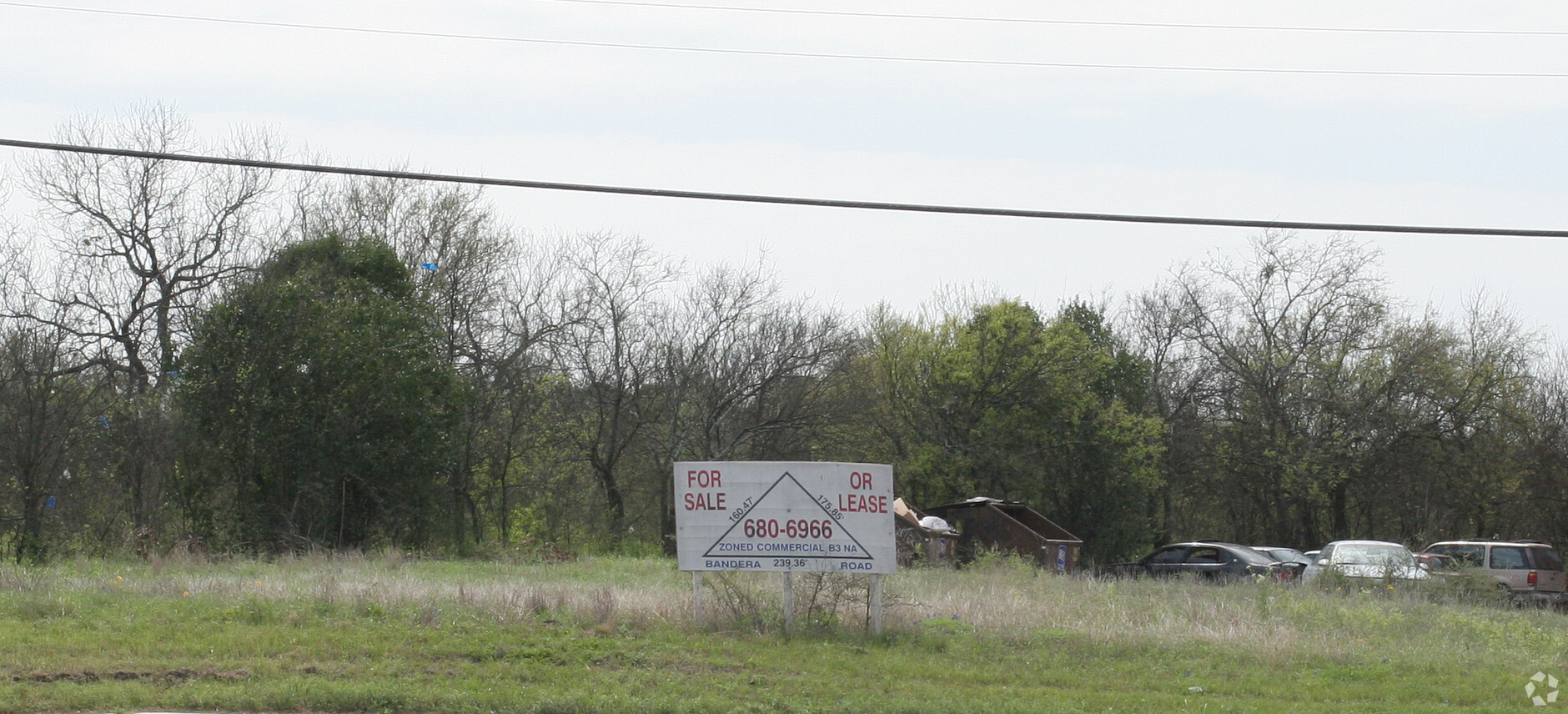
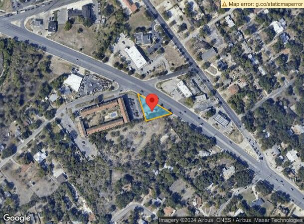
Property Record
2265 Bandera Rd, San Antonio, TX 78228
NEARBY LISTINGS FOR SALE OR LEASE
-
-
No Photo
-
-
-
-
-
-
-
-
-
View all San Antonio listings for sale on LoopNet.com
Property Detail
2265 Bandera Rd
San Antonio-New Braunfels, TX
Conv A/S Code
11538-001-0080
NCB 11538 BLK E LOT 77B
Commercialnec
Bexar
X
Texas
48029C0380G
8
2023
0.29 AC
2023
Northwest
180501
San Antonio
DEMOGRAPHICS near 2265 Bandera Rd
1 Mile
3 Mile
5 Mile
2024 Total Population
11,665
132,777
369,342
2029 Population
12,302
140,866
391,008
Pop Growth 2024-2029
+ 5.46%
+ 6.09%
+ 5.87%
Average Age
39
38
37
2024 Total Households
4,551
53,764
143,473
HH Growth 2024-2029
+ 5.78%
+ 6.40%
+ 6.14%
Median Household Inc
$43,720
$44,443
$46,957
Avg Household Size
2.50
2.40
2.50
2024 Avg HH Vehicles
2.00
2.00
2.00
Median Home Value
$165,701
$161,498
$165,440
Median Year Built
1972
1977
1976
Nearby Places
- Restaurants
- Banks
- Shops
- Fitness
- Groceries
PUBLIC TRANSPORTATION
COMMUTER RAIL
San Antonio Amtrak Station (Sunset Limited - Amtrak, Texas Eagle - Amtrak)
Drive
Walk
Distance
San Antonio Amtrak Station (Sunset Limited - Amtrak, Texas Eagle - Amtrak)
15 min
8.4 mi
AIRPORT
San Antonio International
Drive
Walk
Distance
San Antonio International
12 min
8.5 mi
Freight Ports
Calhoun Port
Drive
Walk
Distance
Calhoun Port
191 min
155.8 mi
Nearby Properties
Address
Land Use
TOTAL SIZE
Lot Size
Zoning
Address
Land Use
TOTAL SIZE
Lot Size
Zoning
429561
25.70 AC
Address
Land Use
TOTAL SIZE
Lot Size
Zoning
541776
22.15 AC
Address
Land Use
TOTAL SIZE
Lot Size
Zoning
284359
21.53 AC
Address
Land Use
TOTAL SIZE
Lot Size
Zoning
97.47 AC
Address
Land Use
TOTAL SIZE
Lot Size
Zoning
495484
5.81 AC
Address
Land Use
TOTAL SIZE
Lot Size
Zoning
227744
3.99 AC
Address
Land Use
TOTAL SIZE
Lot Size
Zoning
253862
14.78 AC
Address
Land Use
TOTAL SIZE
Lot Size
Zoning
264676
11.91 AC
Address
Land Use
TOTAL SIZE
Lot Size
Zoning
326820
12.57 AC
Address
Land Use
TOTAL SIZE
Lot Size
Zoning
536162
25.11 AC
Address
Land Use
TOTAL SIZE
Lot Size
Zoning
232398
12.66 AC
Address
Land Use
TOTAL SIZE
Lot Size
Zoning
285150
13.62 AC
Address
Land Use
TOTAL SIZE
Lot Size
Zoning
299088
15.66 AC
Address
Land Use
TOTAL SIZE
Lot Size
Zoning
252361
14.35 AC
Address
Land Use
TOTAL SIZE
Lot Size
Zoning
340653
19.27 AC
Address
Land Use
TOTAL SIZE
Lot Size
Zoning
388553
29 AC
Address
Land Use
TOTAL SIZE
Lot Size
Zoning
291385
16.19 AC
Address
Land Use
TOTAL SIZE
Lot Size
Zoning
356368
18.58 AC
Address
Land Use
TOTAL SIZE
Lot Size
Zoning
63.25 AC
Address
Land Use
TOTAL SIZE
Lot Size
Zoning
256678
4.42 AC
Address
Land Use
TOTAL SIZE
Lot Size
Zoning
61.64 AC
Address
Land Use
TOTAL SIZE
Lot Size
Zoning
137036
4.73 AC
Address
Land Use
TOTAL SIZE
Lot Size
Zoning
138674
11.14 AC
Address
Land Use
TOTAL SIZE
Lot Size
Zoning
207445
9.55 AC
Address
Land Use
TOTAL SIZE
Lot Size
Zoning
237245
11.74 AC
Address
Land Use
TOTAL SIZE
Lot Size
Zoning
302836
15.96 AC
Address
Land Use
TOTAL SIZE
Lot Size
Zoning
219292
6.85 AC
Address
Land Use
TOTAL SIZE
Lot Size
Zoning
122292
12.82 AC
Address
Land Use
TOTAL SIZE
Lot Size
Zoning
213968
21.30 AC
Address
Land Use
TOTAL SIZE
Lot Size
Zoning
206623
2.70 AC
Start a new search to find other properties for sale or lease
Connect with us
© 2024 CoStar Group
The information above has been obtained from sources believed reliable. While we do not doubt its accuracy we have not verified it and make no guarantee, warranty or representation about it. It is your responsibility to independently confirm its accuracy and completeness. Any projections, opinions, assumptions, or estimates used are for example only and do not represent the current or future performance of the property. The value of this transaction to you depends on tax and other factors which should be evaluated by your tax, financial, and legal advisors. You and your advisors should conduct a careful, independent investigation of the property to determine to your satisfaction the suitability of the property for your needs.