Property Record
22737 Rockside Rd, Bedford, OH 44146


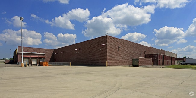

Property Detail
22737 Rockside Rd
811-25-001
PCL 1 VOL 350 PG 45 AC 22.0587 OL 26 ADDITIONAL PARCELS 81126001 & 81127003 2008 S/R
Departmentstore
CUYAHOGA
B3
Ohio
B and X Area of moderate flood hazard, usually the area between the limits of the 100-year and 500-year floods.
1
2025
22.06 AC
2025
Bedford/Walton Hills
132100
Cleveland
192,371 SF
Cleveland-Elyria, OH
NEARBY LISTINGS FOR SALE OR LEASE
DEMOGRAPHICS near 22737 Rockside Rd
1 mile
3 mile
5 mile
2025 Total Population
11,831
72,033
172,713
2030 Population
11,736
71,758
171,398
Pop Growth 2025-2030
(0.80%)
(0.38%)
(0.76%)
Average Age
42
42
42
2025 Total Households
5,455
32,554
74,629
HH Growth 2025-2030
(0.93%)
(0.49%)
(0.88%)
Median Household Inc
$59,966
$53,415
$59,649
Avg Household Size
2.10
2.10
2.20
2025 Avg HH Vehicles
1.00
1.00
2.00
Median Home Value
$123,070
$126,090
$151,269
Median Year Built
1955
1958
1956
Nearby Places
Map Layers
Map Styles
 Street
 Aerial
Layers
 Traffic
 Biking
Places
Listings with unknown addresses are not visible on the map
- Restaurants
- Banks
- Shops
- Fitness
- Groceries
PUBLIC TRANSPORTATION
COMMUTER RAIL
Drive
Walk
Distance
15 min
5.9 mi
Drive
Walk
Distance
15 min
6.2 mi
AIRPORT
Cleveland-Hopkins International
Drive
Walk
Distance
Cleveland-Hopkins International
33 min
18.8 mi
Akron-Canton Regional
Drive
Walk
Distance
Akron-Canton Regional
53 min
39.0 mi
SALE & LEASE HISTORY
LISTING DATE
SALE/LEASE

Sep 23, 2016
For Sale
Jul 29, 2020
For Sale
Nearby Properties
Address
Land Use
TOTAL SIZE
Lot Size
Zoning
Address
Land Use
TOTAL SIZE
Lot Size
Zoning
682,144 SF
99.58 AC
C-2
Address
Land Use
TOTAL SIZE
Lot Size
Zoning
68.97 AC
C-1
Address
Land Use
TOTAL SIZE
Lot Size
Zoning
323,733 SF
106.35 AC
MRC2
Address
Land Use
TOTAL SIZE
Lot Size
Zoning
233,767 SF
36.30 AC
U-1A1
Address
Land Use
TOTAL SIZE
Lot Size
Zoning
333,582 SF
3.67 AC
U-1A1
Address
Land Use
TOTAL SIZE
Lot Size
Zoning
289,009 SF
25.27 AC
I/O
Address
Land Use
TOTAL SIZE
Lot Size
Zoning
11,808 SF
900.50 AC
1F-2
Address
Land Use
TOTAL SIZE
Lot Size
Zoning
99,919 SF
17.91 AC
U-1A1
Address
Land Use
TOTAL SIZE
Lot Size
Zoning
18.38 AC
R2
Address
Land Use
TOTAL SIZE
Lot Size
Zoning
120,722 SF
20.55 AC
I/O
Address
Land Use
TOTAL SIZE
Lot Size
Zoning
14.95 AC
I-1
Address
Land Use
TOTAL SIZE
Lot Size
Zoning
838,521 SF
5.70 AC
I
Address
Land Use
TOTAL SIZE
Lot Size
Zoning
105,215 SF
5.42 AC
PF
Address
Land Use
TOTAL SIZE
Lot Size
Zoning
137,795 SF
37.09 AC
R-4
Address
Land Use
TOTAL SIZE
Lot Size
Zoning
324,644 SF
15.13 AC
I
Address
Land Use
TOTAL SIZE
Lot Size
Zoning
347,218 SF
0.23 AC
O/I
Address
Land Use
TOTAL SIZE
Lot Size
Zoning
65,108 SF
24.93 AC
I/O
Address
Land Use
TOTAL SIZE
Lot Size
Zoning
69,033 SF
8.85 AC
R-3
Address
Land Use
TOTAL SIZE
Lot Size
Zoning
164,109 SF
8.89 AC
U-1A1
Address
Land Use
TOTAL SIZE
Lot Size
Zoning
15,154 SF
9.24 AC
SI
Address
Land Use
TOTAL SIZE
Lot Size
Zoning
350,592 SF
25.29 AC
O/I
Address
Land Use
TOTAL SIZE
Lot Size
Zoning
146,006 SF
8.38 AC
R-1
Address
Land Use
TOTAL SIZE
Lot Size
Zoning
15.46 AC
Address
Land Use
TOTAL SIZE
Lot Size
Zoning
164,157 SF
6.29 AC
BP
Address
Land Use
TOTAL SIZE
Lot Size
Zoning
268,672 SF
25.07 AC
R-3
Address
Land Use
TOTAL SIZE
Lot Size
Zoning
4,160 SF
1.84 AC
U-6
Address
Land Use
TOTAL SIZE
Lot Size
Zoning
155,974 SF
5.33 AC
R-3
Address
Land Use
TOTAL SIZE
Lot Size
Zoning
163,018 SF
12.62 AC
MPUD
Address
Land Use
TOTAL SIZE
Lot Size
Zoning
373,099 SF
6.83 AC
R-3
The World's #1 Commercial Real Estate Marketplace
Connect with us
© 2026 CoStar Group
The information above has been obtained from sources believed reliable. While we do not doubt its accuracy we have not verified it and make no guarantee, warranty or representation about it. It is your responsibility to independently confirm its accuracy and completeness. Any projections, opinions, assumptions, or estimates used are for example only and do not represent the current or future performance of the property. The value of this transaction to you depends on tax and other factors which should be evaluated by your tax, financial, and legal advisors. You and your advisors should conduct a careful, independent investigation of the property to determine to your satisfaction the suitability of the property for your needs.