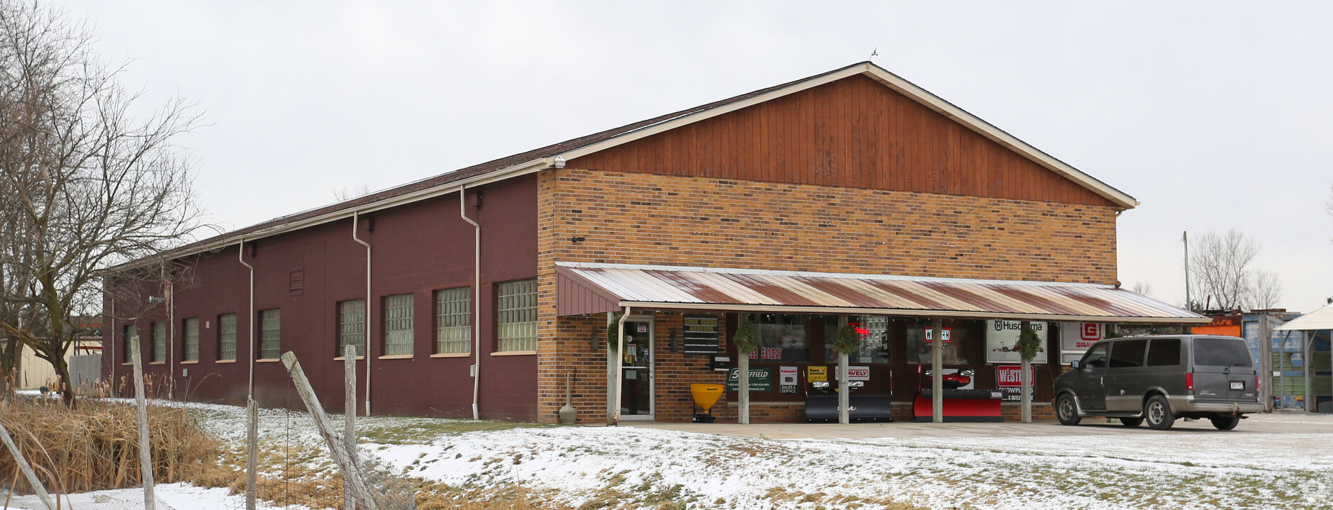
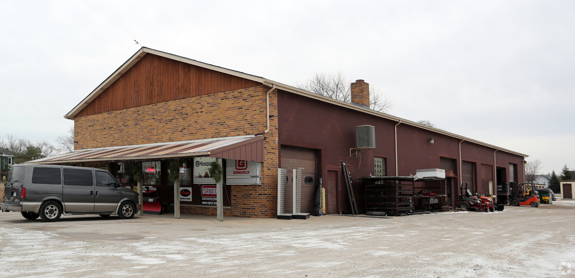
Property Record
22841 Durand Ave, Kansasville, WI 53139
NEARBY LISTINGS FOR SALE OR LEASE
-
-
View all Kansasville listings for sale on LoopNet.com
Property Detail
22841 Durand Ave
006-032026023000
PT SW1/4 COM SW COR N724 TO POB N75 E272 N198 SE226 S272 E269 S211 W487 N243 W272 TO POB EXC STH 75 EXC LAND IN SAN DIST EXC
Commercialnec
Racine
X
Wisconsin
55059C0036D
1.84 AC
2024
Racine West
2024
Milwaukee/Madison
002100
Racine, WI
DEMOGRAPHICS near 22841 Durand Ave
1 Mile
3 Mile
5 Mile
2024 Total Population
1,382
5,941
10,779
2029 Population
1,381
5,936
10,774
Pop Growth 2024-2029
(0.07%)
(0.08%)
(0.05%)
Average Age
46
43
42
2024 Total Households
243
2,117
3,999
HH Growth 2024-2029
0.00%
(0.14%)
(0.03%)
Median Household Inc
$96,621
$87,129
$91,450
Avg Household Size
2.50
2.40
2.50
2024 Avg HH Vehicles
2.00
2.00
2.00
Median Home Value
$320,513
$322,422
$313,534
Median Year Built
1976
1971
1973
Nearby Places
- Restaurants
- Banks
- Shops
- Fitness
- Groceries
PUBLIC TRANSPORTATION
AIRPORT
General Mitchell International
DRIVE
WALK
Distance
General Mitchell International
36 min
27.7 mi
Freight Ports
Port Milwaukee
DRIVE
WALK
Distance
Port Milwaukee
41 min
31.6 mi
Nearby Properties
Address
Land Use
TOTAL SIZE
Lot Size
Zoning
Address
Land Use
TOTAL SIZE
Lot Size
Zoning
0.05 AC
RM
Address
Land Use
TOTAL SIZE
Lot Size
Zoning
6.23 AC
I2
Address
Land Use
TOTAL SIZE
Lot Size
Zoning
4.63 AC
C1
Address
Land Use
TOTAL SIZE
Lot Size
Zoning
5.03 AC
P1
Address
Land Use
TOTAL SIZE
Lot Size
Zoning
0.80 AC
Address
Land Use
TOTAL SIZE
Lot Size
Zoning
4.55 AC
Address
Land Use
TOTAL SIZE
Lot Size
Zoning
4.61 AC
I2
Address
Land Use
TOTAL SIZE
Lot Size
Zoning
2.73 AC
C2
Address
Land Use
TOTAL SIZE
Lot Size
Zoning
30.53 AC
Address
Land Use
TOTAL SIZE
Lot Size
Zoning
151.16 AC
Address
Land Use
TOTAL SIZE
Lot Size
Zoning
0.07 AC
RM
Address
Land Use
TOTAL SIZE
Lot Size
Zoning
4.33 AC
I2
Address
Land Use
TOTAL SIZE
Lot Size
Zoning
0.98 AC
Address
Land Use
TOTAL SIZE
Lot Size
Zoning
4.65 AC
MH
Address
Land Use
TOTAL SIZE
Lot Size
Zoning
0.29 AC
C1
Address
Land Use
TOTAL SIZE
Lot Size
Zoning
2.32 AC
Address
Land Use
TOTAL SIZE
Lot Size
Zoning
3.91 AC
Address
Land Use
TOTAL SIZE
Lot Size
Zoning
151.97 AC
Address
Land Use
TOTAL SIZE
Lot Size
Zoning
Address
Land Use
TOTAL SIZE
Lot Size
Zoning
4.12 AC
I2
Address
Land Use
TOTAL SIZE
Lot Size
Zoning
Address
Land Use
TOTAL SIZE
Lot Size
Zoning
1.59 AC
I2
Address
Land Use
TOTAL SIZE
Lot Size
Zoning
0.20 AC
C3
Address
Land Use
TOTAL SIZE
Lot Size
Zoning
7.38 AC
Address
Land Use
TOTAL SIZE
Lot Size
Zoning
Address
Land Use
TOTAL SIZE
Lot Size
Zoning
2.92 AC
Address
Land Use
TOTAL SIZE
Lot Size
Zoning
Address
Land Use
TOTAL SIZE
Lot Size
Zoning
4.71 AC
Address
Land Use
TOTAL SIZE
Lot Size
Zoning
2.63 AC
Address
Land Use
TOTAL SIZE
Lot Size
Zoning
0.14 AC
MH
The World's #1 Commercial Real Estate Marketplace
Connect with us
© 2025 CoStar Group
The information above has been obtained from sources believed reliable. While we do not doubt its accuracy we have not verified it and make no guarantee, warranty or representation about it. It is your responsibility to independently confirm its accuracy and completeness. Any projections, opinions, assumptions, or estimates used are for example only and do not represent the current or future performance of the property. The value of this transaction to you depends on tax and other factors which should be evaluated by your tax, financial, and legal advisors. You and your advisors should conduct a careful, independent investigation of the property to determine to your satisfaction the suitability of the property for your needs.