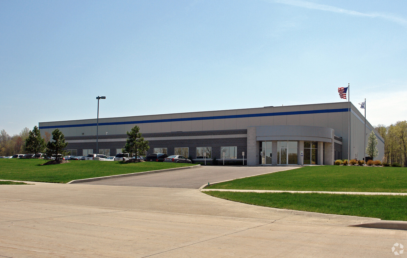
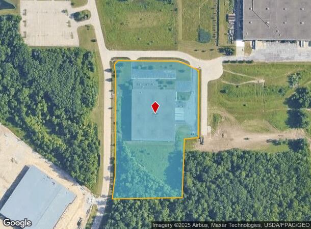
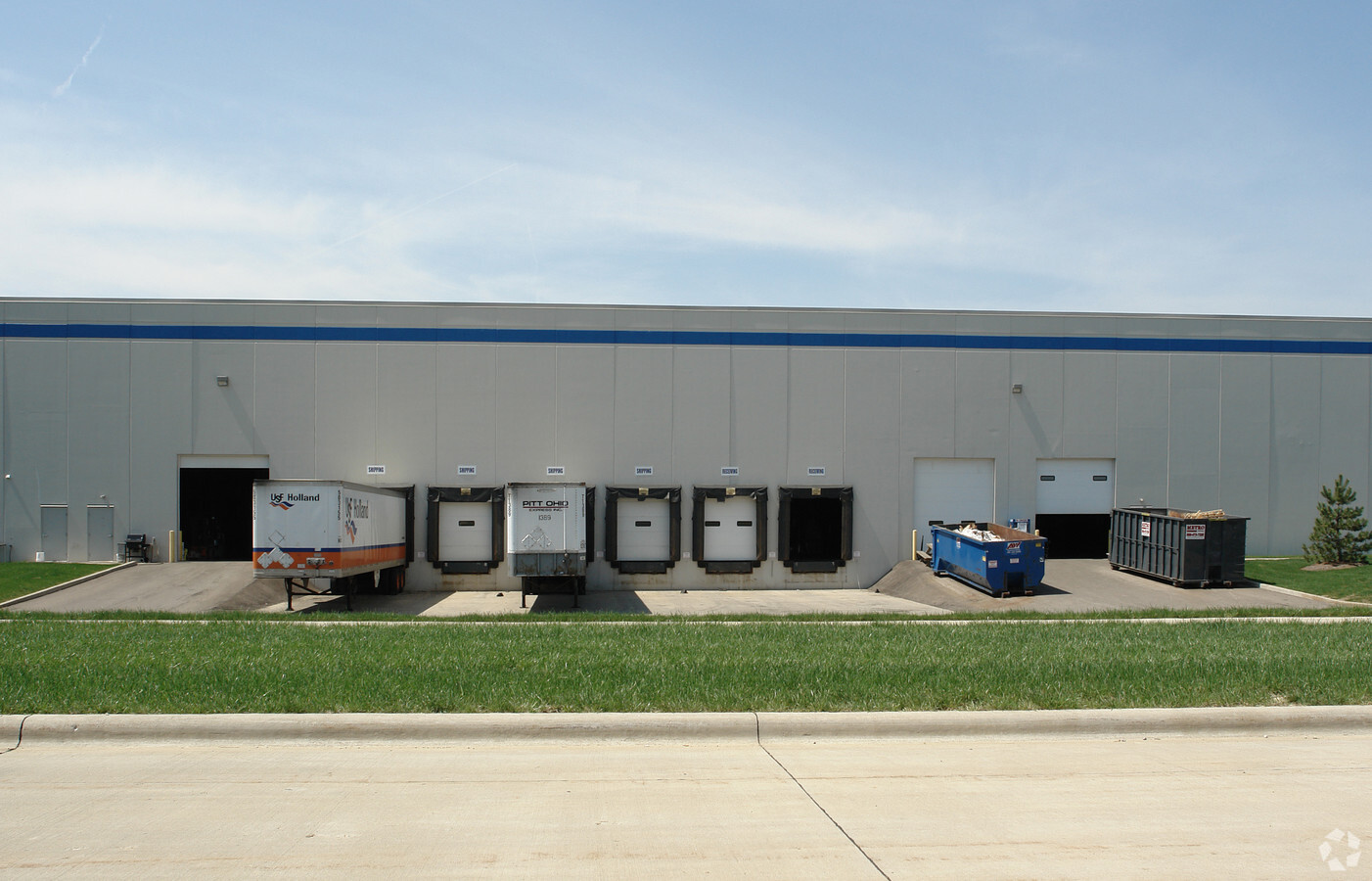
Property Record
22979 Stelfast Pky, Strongsville, OH 44149
NEARBY LISTINGS FOR SALE OR LEASE
Property Detail
22979 Stelfast Pky
Cleveland-Elyria, OH
Strongsville
394-10-001
S/L 4 VOL 333 PG 38 FF 490.52 D 712.40 AC 7.97 OL 82 & 99 SUBDIVISION PLAT FOR STRONGSVILLE BUSINESS PARK S/R 2005
Lightindustrial
Cuyahoga
X
Ohio
39035C0286E
4
2024
7.97 AC
2024
Strongsville/N Rylton
186206
Cleveland
80,730 SF
DEMOGRAPHICS near 22979 Stelfast Pky
1 Mile
3 Mile
5 Mile
2024 Total Population
2,117
39,931
100,469
2029 Population
2,052
39,549
100,040
Pop Growth 2024-2029
(3.07%)
(0.96%)
(0.43%)
Average Age
42
43
43
2024 Total Households
737
15,302
40,212
HH Growth 2024-2029
(3.26%)
(1.06%)
(0.63%)
Median Household Inc
$122,058
$99,818
$89,110
Avg Household Size
2.80
2.50
2.40
2024 Avg HH Vehicles
3.00
2.00
2.00
Median Home Value
$322,170
$253,758
$239,311
Median Year Built
1990
1984
1980
Nearby Places
- Restaurants
- Banks
- Shops
- Fitness
- Groceries
PUBLIC TRANSPORTATION
AIRPORT
Cleveland-Hopkins International
DRIVE
WALK
Distance
Cleveland-Hopkins International
27 min
12.1 mi
Freight Ports
Port of Toledo
DRIVE
WALK
Distance
Port of Toledo
130 min
106.0 mi
Nearby Properties
Address
Land Use
TOTAL SIZE
Lot Size
Zoning
Address
Land Use
TOTAL SIZE
Lot Size
Zoning
830,541 SF
51.19 AC
SC
Address
Land Use
TOTAL SIZE
Lot Size
Zoning
184,998 SF
20.43 AC
PF
Address
Land Use
TOTAL SIZE
Lot Size
Zoning
345,524 SF
107.02 AC
PF
Address
Land Use
TOTAL SIZE
Lot Size
Zoning
62,681 SF
5.48 AC
OB
Address
Land Use
TOTAL SIZE
Lot Size
Zoning
288,114 SF
27.52 AC
GB
Address
Land Use
TOTAL SIZE
Lot Size
Zoning
53,653 SF
30.83 AC
Address
Land Use
TOTAL SIZE
Lot Size
Zoning
230,291 SF
17.35 AC
Address
Land Use
TOTAL SIZE
Lot Size
Zoning
437,700 SF
36.08 AC
GI
Address
Land Use
TOTAL SIZE
Lot Size
Zoning
124,195 SF
54.96 AC
PF
Address
Land Use
TOTAL SIZE
Lot Size
Zoning
310,080 SF
28.30 AC
GI
Address
Land Use
TOTAL SIZE
Lot Size
Zoning
381,528 SF
42.50 AC
GI
Address
Land Use
TOTAL SIZE
Lot Size
Zoning
120,478 SF
17.45 AC
Address
Land Use
TOTAL SIZE
Lot Size
Zoning
167,946 SF
33.22 AC
Address
Land Use
TOTAL SIZE
Lot Size
Zoning
180,606 SF
10.99 AC
Address
Land Use
TOTAL SIZE
Lot Size
Zoning
149,184 SF
14.09 AC
PDA-2
Address
Land Use
TOTAL SIZE
Lot Size
Zoning
185,284 SF
10.84 AC
Address
Land Use
TOTAL SIZE
Lot Size
Zoning
83,961 SF
6.58 AC
GB
Address
Land Use
TOTAL SIZE
Lot Size
Zoning
156,667 SF
21.18 AC
Address
Land Use
TOTAL SIZE
Lot Size
Zoning
96,685 SF
16.21 AC
R-RS
Address
Land Use
TOTAL SIZE
Lot Size
Zoning
8,316 SF
14.90 AC
Address
Land Use
TOTAL SIZE
Lot Size
Zoning
62,070 SF
18.43 AC
GB
Address
Land Use
TOTAL SIZE
Lot Size
Zoning
95,159 SF
10.97 AC
PF
Address
Land Use
TOTAL SIZE
Lot Size
Zoning
72,949 SF
10.07 AC
SC
Address
Land Use
TOTAL SIZE
Lot Size
Zoning
119,880 SF
11.61 AC
GI
Address
Land Use
TOTAL SIZE
Lot Size
Zoning
247,299 SF
23.38 AC
GI
Address
Land Use
TOTAL SIZE
Lot Size
Zoning
271,272 SF
25.13 AC
GI
Address
Land Use
TOTAL SIZE
Lot Size
Zoning
111,553 SF
17.78 AC
SC
Address
Land Use
TOTAL SIZE
Lot Size
Zoning
175,308 SF
51.03 AC
GI
Address
Land Use
TOTAL SIZE
Lot Size
Zoning
30,000 SF
13.96 AC
Address
Land Use
TOTAL SIZE
Lot Size
Zoning
173,390 SF
11.56 AC
GI
The World's #1 Commercial Real Estate Marketplace
Connect with us
© 2025 CoStar Group
The information above has been obtained from sources believed reliable. While we do not doubt its accuracy we have not verified it and make no guarantee, warranty or representation about it. It is your responsibility to independently confirm its accuracy and completeness. Any projections, opinions, assumptions, or estimates used are for example only and do not represent the current or future performance of the property. The value of this transaction to you depends on tax and other factors which should be evaluated by your tax, financial, and legal advisors. You and your advisors should conduct a careful, independent investigation of the property to determine to your satisfaction the suitability of the property for your needs.