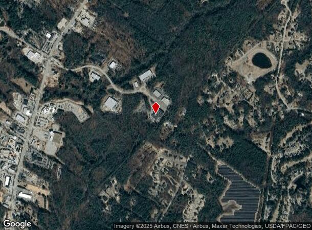
Property Record
23 Mill Brook Rd, Saco, ME 04072
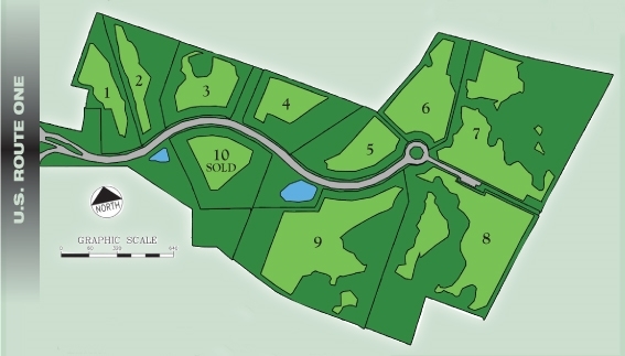
NEARBY LISTINGS FOR SALE OR LEASE
Property Detail
23 Mill Brook Rd
SACO-000045-000019-000003-000008
York
Commercialnec
Maine
X
19
2301550043D
12.58 AC
2024
York County
2024
Portland/South Portland
005200
Portland-South Portland, ME
52,582 SF
DEMOGRAPHICS near 23 Mill Brook Rd
1 Mile
3 Mile
5 Mile
2024 Total Population
1,778
29,439
57,868
2029 Population
1,893
31,542
61,433
Pop Growth 2024-2029
+ 6.47%
+ 7.14%
+ 6.16%
Average Age
48
45
43
2024 Total Households
852
13,767
25,932
HH Growth 2024-2029
+ 6.34%
+ 7.30%
+ 6.38%
Median Household Inc
$62,604
$67,950
$67,865
Avg Household Size
2.00
2.10
2.10
2024 Avg HH Vehicles
2.00
2.00
2.00
Median Home Value
$307,716
$322,061
$341,514
Median Year Built
1990
1982
1978
Nearby Places
- Restaurants
- Banks
- Shops
- Fitness
- Groceries
PUBLIC TRANSPORTATION
COMMUTER RAIL
Saco Amtrak Station (Downeaster - Amtrak)
DRIVE
WALK
Distance
Saco Amtrak Station (Downeaster - Amtrak)
10 min
3.7 mi
Old Orchard Beach Amtrak (Downeaster - Amtrak)
DRIVE
WALK
Distance
Old Orchard Beach Amtrak (Downeaster - Amtrak)
10 min
4.8 mi
AIRPORT
Portland International Jetport
DRIVE
WALK
Distance
Portland International Jetport
25 min
12.3 mi
Freight Ports
Portland, ME
DRIVE
WALK
Distance
Portland, ME
26 min
14.9 mi
Nearby Properties
Address
Land Use
TOTAL SIZE
Lot Size
Zoning
Address
Land Use
TOTAL SIZE
Lot Size
Zoning
10 AC
B-4
Address
Land Use
TOTAL SIZE
Lot Size
Zoning
141.57 AC
I-1
Address
Land Use
TOTAL SIZE
Lot Size
Zoning
Address
Land Use
TOTAL SIZE
Lot Size
Zoning
224,607 SF
5.07 AC
B-4
Address
Land Use
TOTAL SIZE
Lot Size
Zoning
27.50 AC
R-1B
Address
Land Use
TOTAL SIZE
Lot Size
Zoning
2,295.68 AC
B-6
Address
Land Use
TOTAL SIZE
Lot Size
Zoning
7.86 AC
B2A
Address
Land Use
TOTAL SIZE
Lot Size
Zoning
Address
Land Use
TOTAL SIZE
Lot Size
Zoning
2,664 SF
81.33 AC
MZ
Address
Land Use
TOTAL SIZE
Lot Size
Zoning
Address
Land Use
TOTAL SIZE
Lot Size
Zoning
2.50 AC
R-1
Address
Land Use
TOTAL SIZE
Lot Size
Zoning
11.40 AC
B-1
Address
Land Use
TOTAL SIZE
Lot Size
Zoning
62,610 SF
2.61 AC
R-1A
Address
Land Use
TOTAL SIZE
Lot Size
Zoning
110 AC
R-1D
Address
Land Use
TOTAL SIZE
Lot Size
Zoning
708 SF
52.01 AC
R-4
Address
Land Use
TOTAL SIZE
Lot Size
Zoning
49,518 SF
5.60 AC
R-1A
Address
Land Use
TOTAL SIZE
Lot Size
Zoning
3,033 SF
55.01 AC
RD
Address
Land Use
TOTAL SIZE
Lot Size
Zoning
35,714 SF
39.79 AC
MU3
Address
Land Use
TOTAL SIZE
Lot Size
Zoning
63,300 SF
11.76 AC
B-2D
Address
Land Use
TOTAL SIZE
Lot Size
Zoning
124,800 SF
30.53 AC
Address
Land Use
TOTAL SIZE
Lot Size
Zoning
104.72 AC
B-6
Address
Land Use
TOTAL SIZE
Lot Size
Zoning
127,292 SF
12.55 AC
I-1
Address
Land Use
TOTAL SIZE
Lot Size
Zoning
47,532 SF
4.76 AC
MZ
Address
Land Use
TOTAL SIZE
Lot Size
Zoning
75,288 SF
6.27 AC
Address
Land Use
TOTAL SIZE
Lot Size
Zoning
4,296 SF
27.94 AC
MZ
Address
Land Use
TOTAL SIZE
Lot Size
Zoning
7,216 SF
10.40 AC
MZ
Address
Land Use
TOTAL SIZE
Lot Size
Zoning
80,064 SF
9.80 AC
R-1B
Address
Land Use
TOTAL SIZE
Lot Size
Zoning
41,036 SF
0.68 AC
B-3
Address
Land Use
TOTAL SIZE
Lot Size
Zoning
39,552 SF
56.22 AC
B-6
The World's #1 Commercial Real Estate Marketplace
Connect with us
© 2025 CoStar Group
The information above has been obtained from sources believed reliable. While we do not doubt its accuracy we have not verified it and make no guarantee, warranty or representation about it. It is your responsibility to independently confirm its accuracy and completeness. Any projections, opinions, assumptions, or estimates used are for example only and do not represent the current or future performance of the property. The value of this transaction to you depends on tax and other factors which should be evaluated by your tax, financial, and legal advisors. You and your advisors should conduct a careful, independent investigation of the property to determine to your satisfaction the suitability of the property for your needs.