Property Record
230 2Nd St, Downers Grove, IL 60515
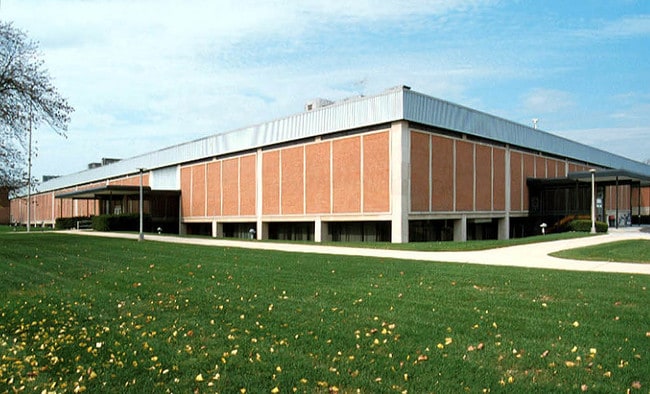
Property Detail
230 2Nd St
09-09-308-002
PEPPERIDGE FARM ASSMT PLAT ALL LOT 1 & W 1/2 VAC CUMNOR RD E & ADJ & E 30FT VAC WILCOX AVE W & ADJ & E 30FT OF PRT LT 1 OF RESUB BLK 2 OF V FREDENHAGEN JRS SUB LYG N OF FREDENHAGEN PL /EX N 15FT/ IN BLK 2
Industrialgeneral
DuPage
N
Illinois
B and X Area of moderate flood hazard, usually the area between the limits of the 100-year and 500-year floods.
1
2024
9.41 AC
2024
West Suburbs
845602
Chicago
207,084 SF
Chicago-Naperville-Elgin, IL-IN
NEARBY LISTINGS FOR SALE OR LEASE
DEMOGRAPHICS near 230 2Nd St
1 mile
3 mile
5 mile
2025 Total Population
16,892
110,630
258,036
2030 Population
17,263
112,689
263,293
Pop Growth 2025-2030
+ 2.20%
+ 1.86%
+ 2.04%
Average Age
41
43
43
2025 Total Households
6,752
44,240
103,929
HH Growth 2025-2030
+ 2.19%
+ 1.84%
+ 2.09%
Median Household Inc
$113,265
$112,256
$108,225
Avg Household Size
2.40
2.40
2.40
2025 Avg HH Vehicles
2.00
2.00
2.00
Median Home Value
$426,781
$459,975
$433,842
Median Year Built
1964
1974
1976
Nearby Places
Map Layers
Map Styles
 Street
 Aerial
Layers
 Traffic
 Biking
Places
Listings with unknown addresses are not visible on the map
- Restaurants
- Banks
- Shops
- Fitness
- Groceries
PUBLIC TRANSPORTATION
COMMUTER RAIL
Downers Grove Fairview Avenue Station (Burlington Northern-Santa Fe Railway Line - Northeast Illinois Regional Commuter Railroad (Metra))
Drive
Walk
Distance
Downers Grove Fairview Avenue Station (Burlington Northern-Santa Fe Railway Line - Northeast Illinois Regional Commuter Railroad (Metra))
1 min
5 min
0.3 mi
Westmont Station (Burlington Northern-Santa Fe Railway Line - Northeast Illinois Regional Commuter Railroad (Metra))
Drive
Walk
Distance
Westmont Station (Burlington Northern-Santa Fe Railway Line - Northeast Illinois Regional Commuter Railroad (Metra))
4 min
19 min
1.0 mi
AIRPORT
Chicago Midway International
Drive
Walk
Distance
Chicago Midway International
24 min
13.6 mi
Chicago O'Hare International
Drive
Walk
Distance
Chicago O'Hare International
32 min
21.4 mi
Freight Ports
Port Milwaukee
Drive
Walk
Distance
Port Milwaukee
113 min
93.2 mi
Nearby Properties
Address
Land Use
TOTAL SIZE
Lot Size
Zoning
Address
Land Use
TOTAL SIZE
Lot Size
Zoning
534,583 SF
16.04 AC
C
Address
Land Use
TOTAL SIZE
Lot Size
Zoning
439,070 SF
38.77 AC
C
Address
Land Use
TOTAL SIZE
Lot Size
Zoning
403,248 SF
24.98 AC
M
Address
Land Use
TOTAL SIZE
Lot Size
Zoning
1.34 AC
Address
Land Use
TOTAL SIZE
Lot Size
Zoning
13.53 AC
M
Address
Land Use
TOTAL SIZE
Lot Size
Zoning
470,838 SF
17.13 AC
M
Address
Land Use
TOTAL SIZE
Lot Size
Zoning
299,435 SF
11.16 AC
C
Address
Land Use
TOTAL SIZE
Lot Size
Zoning
312,210 SF
9.74 AC
C
Address
Land Use
TOTAL SIZE
Lot Size
Zoning
368,233 SF
16.12 AC
Address
Land Use
TOTAL SIZE
Lot Size
Zoning
19.02 AC
M
Address
Land Use
TOTAL SIZE
Lot Size
Zoning
388,561 SF
12.77 AC
Address
Land Use
TOTAL SIZE
Lot Size
Zoning
190,058 SF
11.77 AC
Address
Land Use
TOTAL SIZE
Lot Size
Zoning
291,840 SF
14.34 AC
Address
Land Use
TOTAL SIZE
Lot Size
Zoning
274,406 SF
17.67 AC
M
Address
Land Use
TOTAL SIZE
Lot Size
Zoning
276,953 SF
8.78 AC
C
Address
Land Use
TOTAL SIZE
Lot Size
Zoning
205,315 SF
0.87 AC
Address
Land Use
TOTAL SIZE
Lot Size
Zoning
175,695 SF
1.01 AC
C
Address
Land Use
TOTAL SIZE
Lot Size
Zoning
182,295 SF
21.84 AC
C
Address
Land Use
TOTAL SIZE
Lot Size
Zoning
164,787 SF
8.20 AC
Address
Land Use
TOTAL SIZE
Lot Size
Zoning
230,187 SF
15.38 AC
M
Address
Land Use
TOTAL SIZE
Lot Size
Zoning
225,110 SF
7.66 AC
C
Address
Land Use
TOTAL SIZE
Lot Size
Zoning
25.64 AC
Address
Land Use
TOTAL SIZE
Lot Size
Zoning
202,562 SF
16.17 AC
M
Address
Land Use
TOTAL SIZE
Lot Size
Zoning
213,460 SF
10.71 AC
Address
Land Use
TOTAL SIZE
Lot Size
Zoning
265,215 SF
18.12 AC
C
Address
Land Use
TOTAL SIZE
Lot Size
Zoning
241,164 SF
6.30 AC
C
Address
Land Use
TOTAL SIZE
Lot Size
Zoning
227,600 SF
6.12 AC
C
Address
Land Use
TOTAL SIZE
Lot Size
Zoning
235,595 SF
5.48 AC
C
Address
Land Use
TOTAL SIZE
Lot Size
Zoning
126,165 SF
20.34 AC
Address
Land Use
TOTAL SIZE
Lot Size
Zoning
108,021 SF
0.89 AC
The World's #1 Commercial Real Estate Marketplace
Connect with us
© 2026 CoStar Group
The information above has been obtained from sources believed reliable. While we do not doubt its accuracy we have not verified it and make no guarantee, warranty or representation about it. It is your responsibility to independently confirm its accuracy and completeness. Any projections, opinions, assumptions, or estimates used are for example only and do not represent the current or future performance of the property. The value of this transaction to you depends on tax and other factors which should be evaluated by your tax, financial, and legal advisors. You and your advisors should conduct a careful, independent investigation of the property to determine to your satisfaction the suitability of the property for your needs.