Property Record
230 Lee Burbank Hwy, Revere, MA 02151

NEARBY LISTINGS FOR SALE OR LEASE
-
-
View all Revere listings for sale on LoopNet.com
Property Detail
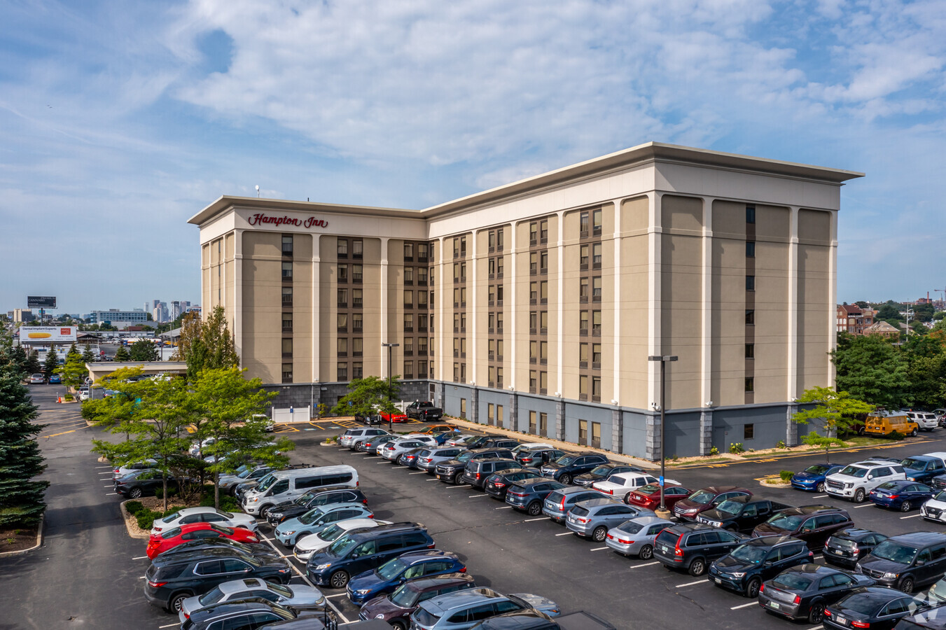
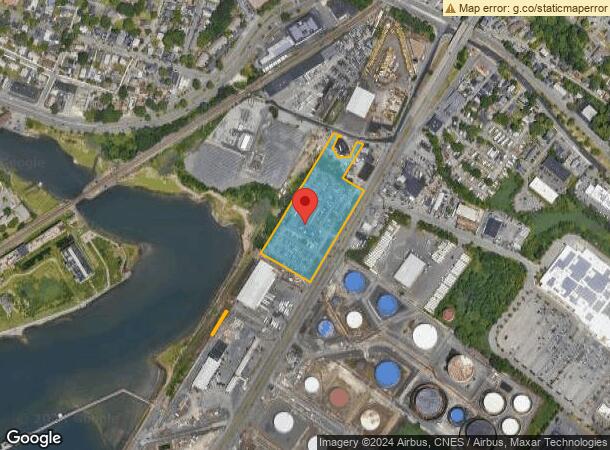
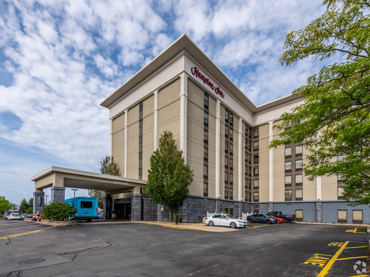
230 Lee Burbank Hwy
REVE-000006-001201A-000009A
Suffolk
Hotel
Massachusetts
AE
9a
25025C0019J
5.34 AC
2024
Boston CBD/Airport
2024
Boston
981502
Boston-Cambridge-Newton, MA-NH
131,972 SF
DEMOGRAPHICS near 230 Lee Burbank Hwy
1 Mile
3 Mile
5 Mile
2024 Total Population
31,640
204,677
500,350
2029 Population
29,543
193,660
482,774
Pop Growth 2024-2029
(6.63%)
(5.38%)
(3.51%)
Average Age
39
38
39
2024 Total Households
11,109
75,834
207,414
HH Growth 2024-2029
(7.00%)
(5.65%)
(3.56%)
Median Household Inc
$63,392
$72,332
$91,812
Avg Household Size
2.70
2.60
2.30
2024 Avg HH Vehicles
1.00
1.00
1.00
Median Home Value
$525,614
$554,765
$670,793
Median Year Built
1953
1949
1953
Nearby Places
- Restaurants
- Banks
- Shops
- Fitness
- Groceries
PUBLIC TRANSPORTATION
TRANSIT/SUBWAY
Beachmont Station (Blue Line - Massachusetts Bay Transportation Authority Subway (The T))
Drive
Walk
Distance
Beachmont Station (Blue Line - Massachusetts Bay Transportation Authority Subway (The T))
4 min
16 min
0.9 mi
COMMUTER RAIL
Chelsea (Newburyport/Rockport Line - MBTA)
Drive
Walk
Distance
Chelsea (Newburyport/Rockport Line - MBTA)
9 min
3.9 mi
North Station (Fitchburg/South Acton Line - Massachusetts Bay Transportation Authority Commuter Rail (Purple Line), Haverhill Line - Massachusetts Bay Transportation Authority Commuter Rail (Purple Line), Lowell Line - Massachusetts Bay Transportation Authority Commuter Rail (Purple Line), Newburyport/Rockport Line - Massachusetts Bay Transportation Authority Commuter Rail (Purple Line))
Drive
Walk
Distance
North Station (Fitchburg/South Acton Line - Massachusetts Bay Transportation Authority Commuter Rail (Purple Line), Haverhill Line - Massachusetts Bay Transportation Authority Commuter Rail (Purple Line), Lowell Line - Massachusetts Bay Transportation Authority Commuter Rail (Purple Line), Newburyport/Rockport Line - Massachusetts Bay Transportation Authority Commuter Rail (Purple Line))
9 min
4.5 mi
AIRPORT
General Edward Lawrence Logan International
Drive
Walk
Distance
General Edward Lawrence Logan International
7 min
3.4 mi
Freight Ports
Port of Boston
Drive
Walk
Distance
Port of Boston
13 min
6.1 mi
Nearby Properties
Address
Land Use
TOTAL SIZE
Lot Size
Zoning
Address
Land Use
TOTAL SIZE
Lot Size
Zoning
171791
166.88 AC
E
Address
Land Use
TOTAL SIZE
Lot Size
Zoning
435381
4.22 AC
LB-R
Address
Land Use
TOTAL SIZE
Lot Size
Zoning
8 AC
HB
Address
Land Use
TOTAL SIZE
Lot Size
Zoning
526171
8.39 AC
A
Address
Land Use
TOTAL SIZE
Lot Size
Zoning
164959
96.81 AC
E
Address
Land Use
TOTAL SIZE
Lot Size
Zoning
234450
3.49 AC
I
Address
Land Use
TOTAL SIZE
Lot Size
Zoning
6.73 AC
HB
Address
Land Use
TOTAL SIZE
Lot Size
Zoning
302840
5.83 AC
E
Address
Land Use
TOTAL SIZE
Lot Size
Zoning
211294
1.66 AC
RC2
Address
Land Use
TOTAL SIZE
Lot Size
Zoning
224840
2.18 AC
RC1
Address
Land Use
TOTAL SIZE
Lot Size
Zoning
129898
43.82 AC
ID
Address
Land Use
TOTAL SIZE
Lot Size
Zoning
247013
1.13 AC
RC2
Address
Land Use
TOTAL SIZE
Lot Size
Zoning
1.65 AC
RC2
Address
Land Use
TOTAL SIZE
Lot Size
Zoning
359892
9.06 AC
Address
Land Use
TOTAL SIZE
Lot Size
Zoning
297396
2.79 AC
CTED
Address
Land Use
TOTAL SIZE
Lot Size
Zoning
237393
7.15 AC
A
Address
Land Use
TOTAL SIZE
Lot Size
Zoning
6.02 AC
TED
Address
Land Use
TOTAL SIZE
Lot Size
Zoning
230000
2.01 AC
E
Address
Land Use
TOTAL SIZE
Lot Size
Zoning
172043
1.13 AC
RC1
Address
Land Use
TOTAL SIZE
Lot Size
Zoning
5668
20.05 AC
A
Address
Land Use
TOTAL SIZE
Lot Size
Zoning
391884
108.79 AC
C
Address
Land Use
TOTAL SIZE
Lot Size
Zoning
422028
16.10 AC
RB
Address
Land Use
TOTAL SIZE
Lot Size
Zoning
379857
7.16 AC
R2
Address
Land Use
TOTAL SIZE
Lot Size
Zoning
362970
8.36 AC
BH
Address
Land Use
TOTAL SIZE
Lot Size
Zoning
191523
2.70 AC
Address
Land Use
TOTAL SIZE
Lot Size
Zoning
404724
3.10 AC
PDD1
Address
Land Use
TOTAL SIZE
Lot Size
Zoning
227673
1.75 AC
R3
Address
Land Use
TOTAL SIZE
Lot Size
Zoning
208663
2.56 AC
DD
Address
Land Use
TOTAL SIZE
Lot Size
Zoning
221856
17.82 AC
ID
Address
Land Use
TOTAL SIZE
Lot Size
Zoning
214895
3.30 AC
A
Start a new search to find other properties for sale or lease
Connect with us
© 2024 CoStar Group
The information above has been obtained from sources believed reliable. While we do not doubt its accuracy we have not verified it and make no guarantee, warranty or representation about it. It is your responsibility to independently confirm its accuracy and completeness. Any projections, opinions, assumptions, or estimates used are for example only and do not represent the current or future performance of the property. The value of this transaction to you depends on tax and other factors which should be evaluated by your tax, financial, and legal advisors. You and your advisors should conduct a careful, independent investigation of the property to determine to your satisfaction the suitability of the property for your needs.